- Start or End: I started at a bus stop at the corner of Bukit Timah Road and Clementi Road (Google Map Directions) and continued onto the Kampong Trail on completion. But now the best start and finish point is probably the Beauty World Train Station on the Downtown Line (Google Map Directions).
- Length: 5.1km (3.2mi) in about 1.5hr
- Grade: Medium. Hilly with paved and muddy tracks. The heat and humidity is the main issue.
- Date Walked: 23rd of October 2013
Lush jungle, the summit of Singapore and a massive lizard. A walk around Bukit Timah Nature Reserve.
Today it is out of the city and into the nature of Singapore. My first point of focus today is Bukit Timah Nature Reserve, Singapore's first nature reserve and the highest point on the island at 163.63 meters. Yes, I know 163.63 meters isn't a very impressive climb, but I'm no mountain climber and the purpose of this metrotrek is to find the more wild side of Singapore. A couple of days ago I did venture out of the city and explore the Southern Ridges, which was really awesome, but much of the forest in that area is secondary forest, that is, regrowth forest after agriculture. Around Bukit Timah much of the forest is untouched and luckily for me is easily accessed by public transport.
It took about 40 minutes on the bus along Bukit Timah Road to get from Little India to Bukit Timah. I didn't catch the bus right to the reserve, but stopped a few kilometres short so I could stop off and have breakfast at McDonalds before my big day of walking. Sure McDonalds is probably not the healthiest breakfast, but to be honest I am sick and tired of having curry or noodles for breakfast. A good sausage and egg McMuffin really hit the spot. From McDonalds it was a walk along the busy Jalan Anak Bukit road to the entrance of the Bukit Timah Nature Reserve.
Click Here To Read More ...
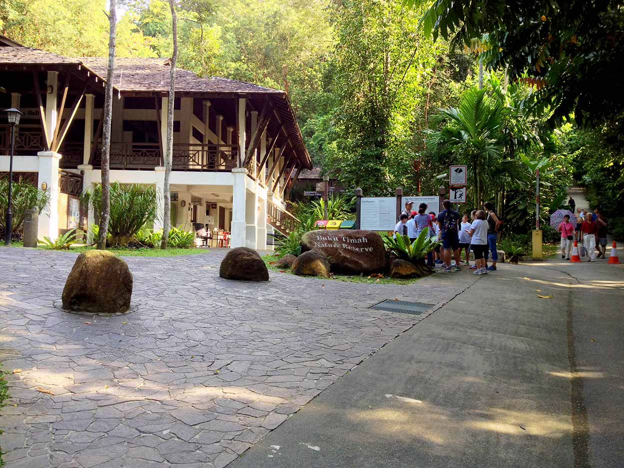
At the start of the reserve is a large building dedicated to the visitors centre. I probably should have a look to see what I am getting myself into, but instead I march on into the wilderness. There are school groups here, so the walk must be relatively easy.
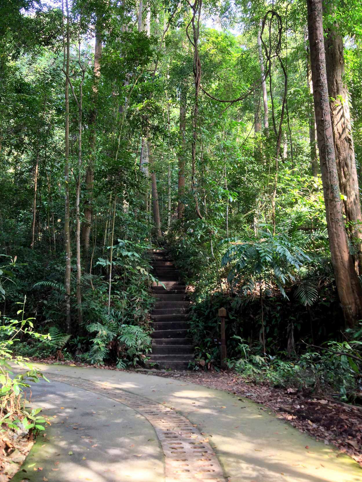
The main path to the Bukit Timah summit is very well serviced with a concrete path that would fit a car. It does get a little steep and appears to be a popular location for Singaporeans to work up a sweat. You can take the main path to summit but I took the staircase, which gets you to the summit quicker, but it is just a bit more hard work.
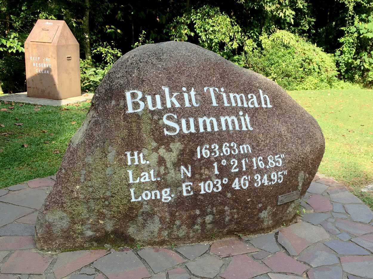
The Bukit Timah summit is marked by a large carved rock indicating the location and height of the summit. Apart from marking the location of the summit the rock also appeared to be popular item for small children to climb on. If the 163.63 meter elevation did not give an indication of the toughness of the climb, the fact that toddlers could make it to the top should give a clear indication. It definitely is not the most arduous journey to the top.
I have quickly reached the summit. Now what? Think I might have a meander around some of the tracks to see what's about. Thick dense jungle, that's what's about, and plenty of it. The tracks range from slightly muddy dirt paths to concrete/stone paths buried in the forest.
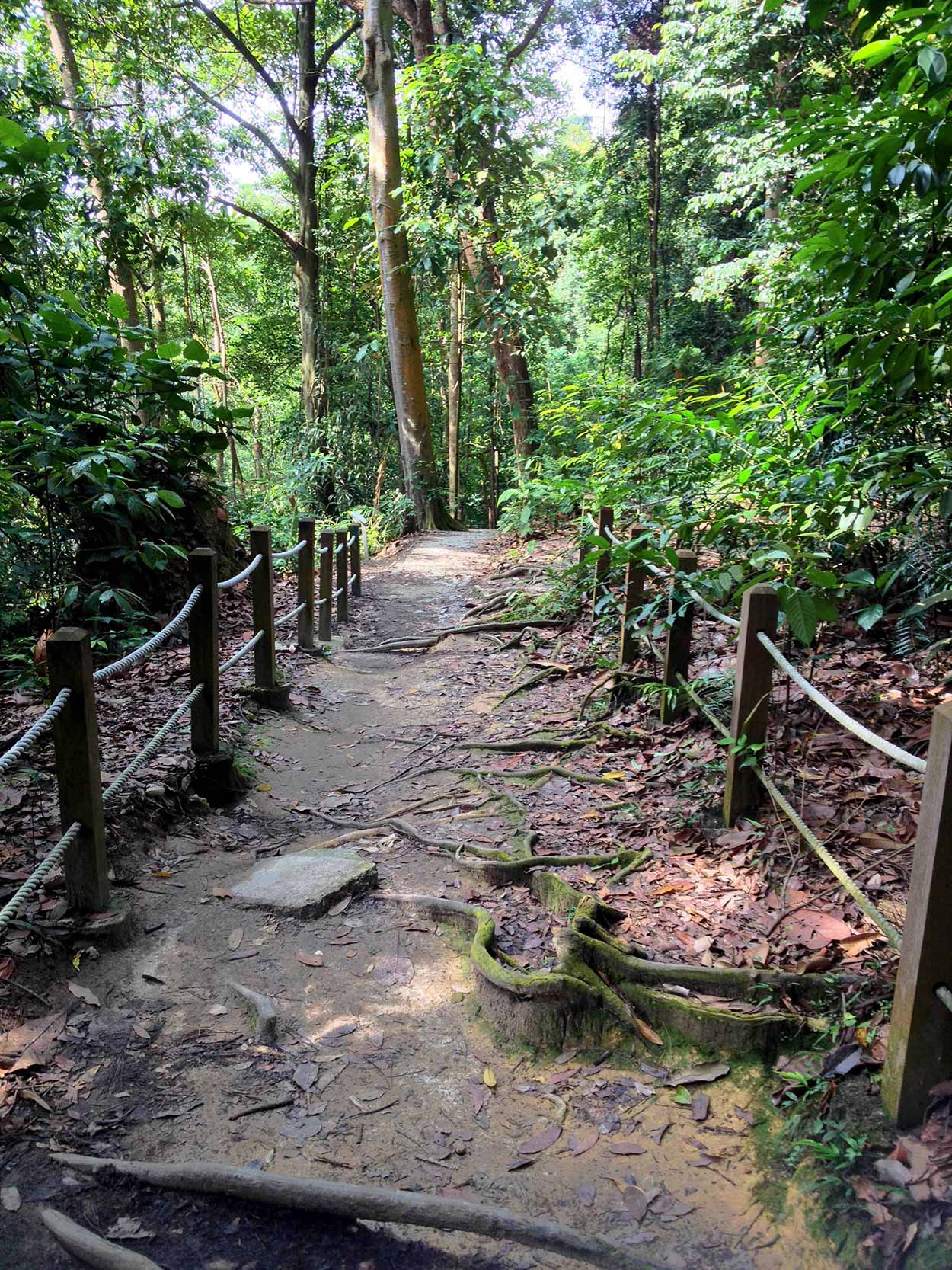

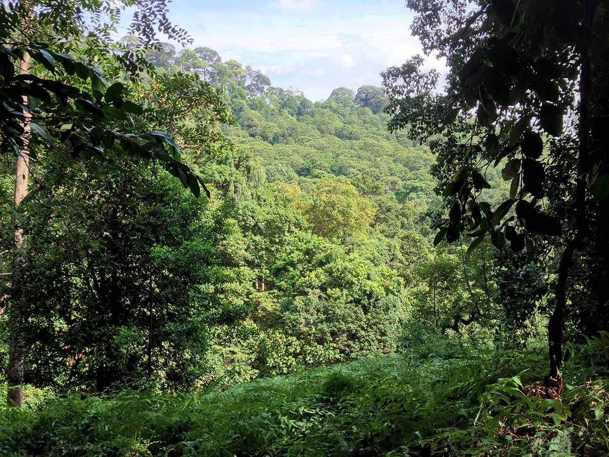
Due to the dense foliage you hardly get a chance to see the sky and great views are few and far between. The photograph below is about the best I could do in terms of expansive views.
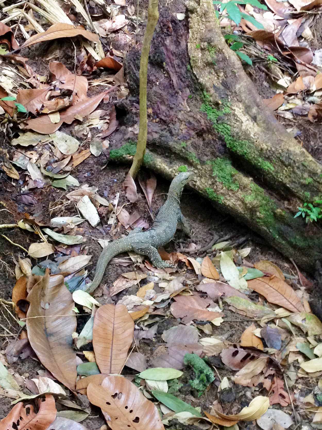
Apart from a great variety of flora there is also a lot of fauna about. You can't see much of the animal life but you can definitely hear it rustling in the bushes and calling out to its friends. I did catch a glimpse of this guy though.
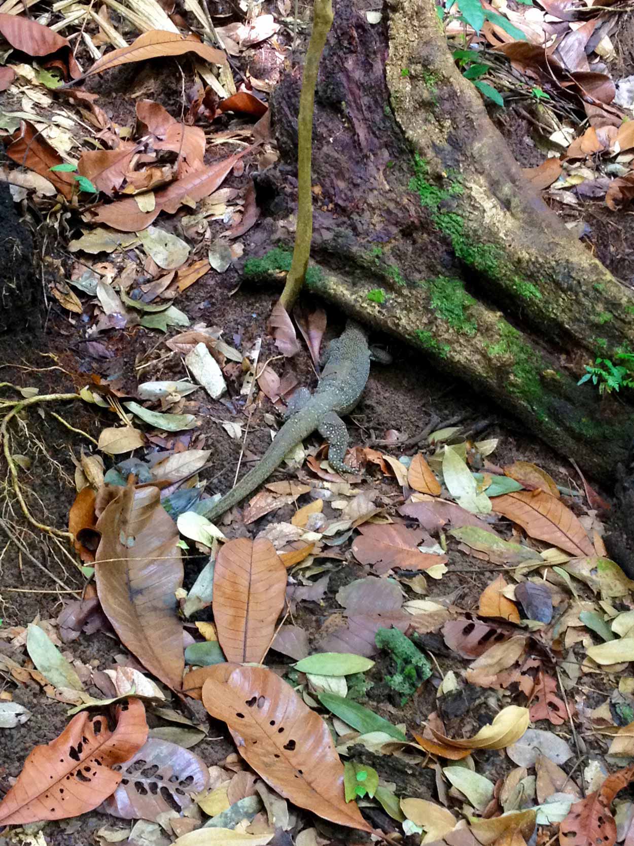
That's a bloody big lizard "hiding" underneath that log. Not the brightest specimen in the world. Must think if it can't see me, I can't see it. He did finally stick his head out to have a look at me and then quickly scampered away.
Like the lizard, I was feeling like scampering away as well. I have't really spent that much time here and there are plenty of paths to be explored, but I have a feeling the paths are all going to be very similar. That is, very jungle-like. Bukit Timah Nature Reserve seems like a lot of jungle with no places of interest, which is to be expected as it is a nature reserve not Disneyland. Nothing wrong with that, I have really enjoyed exploring, but it's not the most exciting walk in the world. Think it is time to head to my next destination of MacRitchie Reservoir, where I know there are some interesting sites, specifically some waterside boardwalks and the TreeTop Walk, a massive jungle canopy suspension bridge.
At the end of the walk I had a rest and a look around that visitors centre building at the entrance to the reserve. The visitor centre has historic and environmental information about the area, but the most interesting display for me was a diorama showing a hiking trail all the way to MacRitchie Reservoir, my next destination. Should I take the bus as originally planned or walk this trail? As this is a blog about walking it should be obvious that I walked all the way to MacRitchie Reservoir, and that story is for the next blog post (it's my biggest walk in Singapore so far by the way).
Click Here To Read More ...
Click Here To Read More ...
Click Here To Read More ...
View Photographs
Hello, I'm Marc and welcome to metrotrekker.
Be it seeing the city sights, exploring parklands and gardens, urban walks or day-hikes in the city outskirts, the metrotrekker website details walking routes and hiking trails accessible by foot and public transport in metropolitan areas.
The metrotrekker website provides you with all the details required for metropolitan exploration:
- a map with geolocation and a selection of map types (street, satellite, topographical)
- navigation formats compatible with common GPS devices, desktop browser/software or mobile apps
- trail length and difficulty
- start and finish options (particularly by public transport)
- photos/videos
- attractions or points of interest along the way
- other walks and hikes nearby
- often a story or detailed description of the trail (I have personally walked every single trail on the website)
- a comments section, so feel free to write about your experiences as well
- and more improvements and resources are continually being added
So let's get outside and explore our great metropolitan areas by foot. Click Here to begin exploring with metrotrekker.
Pleasant Trails,
Marc
Links To Help You Navigate