- Start or End: Start or end at either Harbour Front Train Station (Google Map Directions) or Pasir Panjang Train Station (Google Map Directions).
- Length: 9.8km (6.1mi) in about 3hr
- Grade: Medium. Hilly in sections (especially the climb up Mount Faber) and fully paved.
- Date Walked: 21st of October 2013
Forest, gardens, spectacular views, wave pedestrian bridges and brilliant tree canopy walkways. A walk along Singapore's Southern Ridges.
Today it's out of the hustle and bustle of downtown Singapore and into some greenery. This morning I am going to explore the Southern Ridges. Before arriving I did a bit of research on walks in Singapore and time and time again the Southern Ridges came up. As the name suggests, the Southern Ridges is a series of ridges on the southern side of Singapore. The Southern Ridges path is a 9 km trail that connects a number of green spaces, both natural and landscaped, with a series of pedestrian linkages. The entire path network is relatively new, with the opening occurring in 2008.
The first section of the walk is the Marang Trail, which begins right at Exit D of the Harbourfront MRT Station. Now that's convenience! The Marang Trail, which climbs Mount Faber, is not that convenient. With only a 70 meter elevation the path isn't that much of a strain, but it does get steep in sections. Good to get this part over and done with. What I find on the Marang trail is plenty of greenery and some massive trees towering above the path. I can still hear road noise but there is also plenty of bird and insect songs and the occasional rustling in the bushes from who knows what? There are signs around warning people not to feed the monkeys. Really hope the rustling in the bushes isn't a crazy diseased monkey.
Click Here To Read More ...

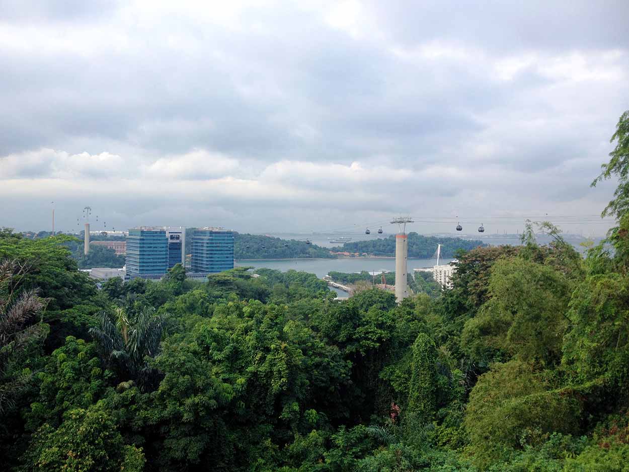
As I reach the top of the Marang Trail the view begins to open up and I catch a glimpse of the cable car that runs from the top of Mount Faber over to Sentosa Island.
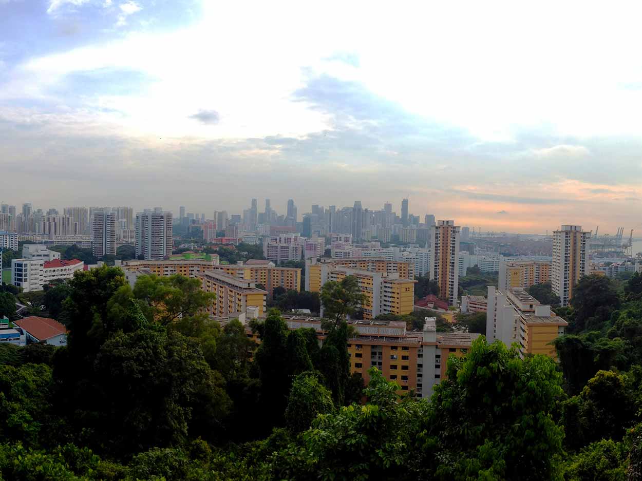
The Marang Trail ends at the top of Mount Faber on Mount Faber Road. It is here that the much flatter Faber Walk begins its journey through Mount Faber Park. I didn't stick to the official walking path, but just meandered in any direction that seemed interesting. The views really open up in Mount Faber Park. To the north you can see the sprawling city while to the south are views of the cable car and islands scattered in Singapore Strait.
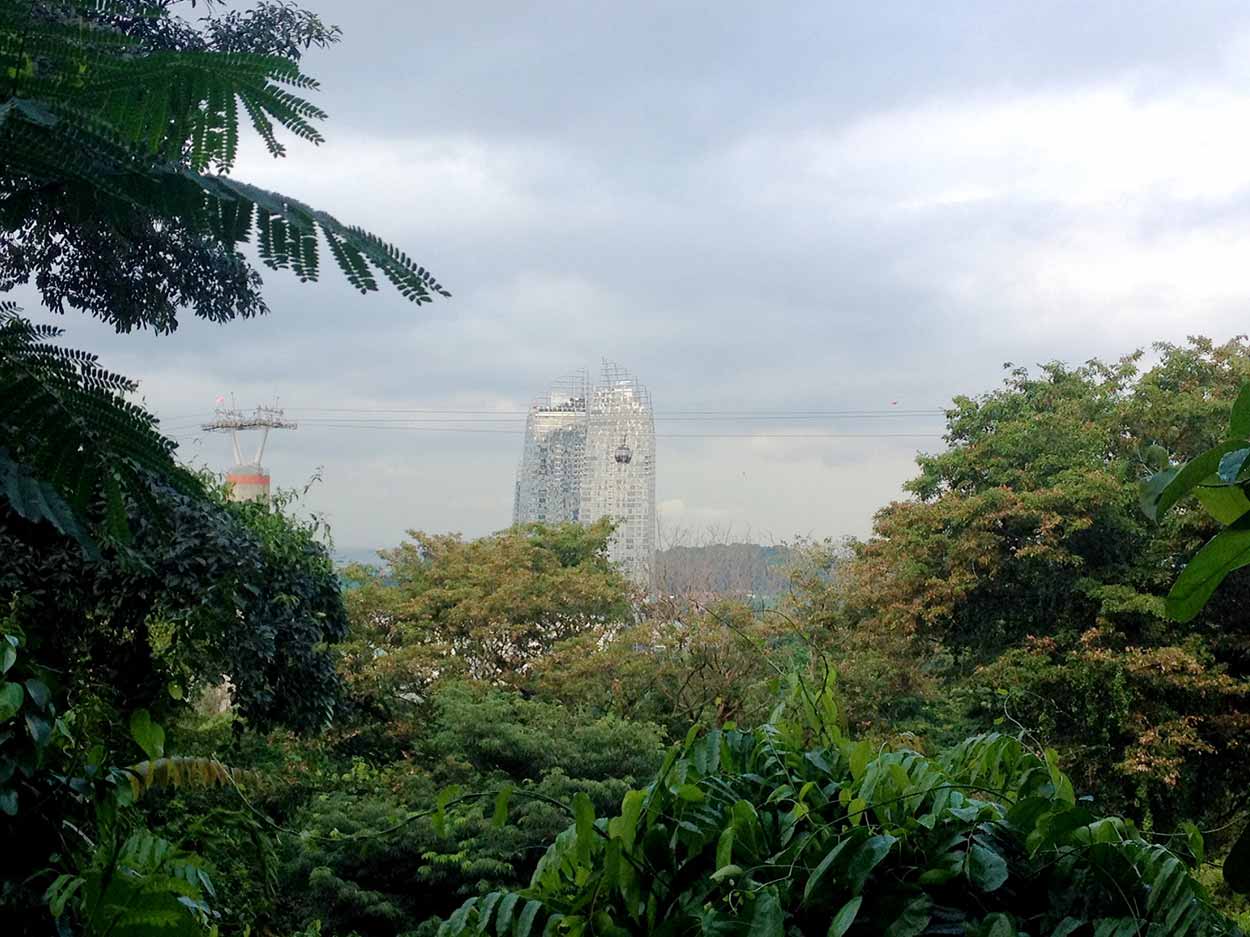
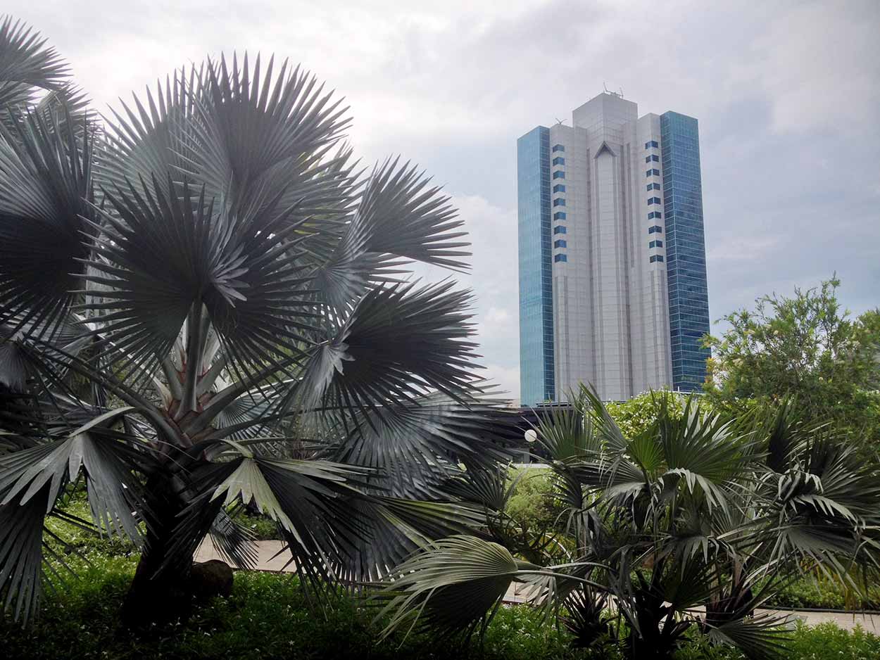
A prominent feature to the south side of the Southern Ridges is the Reflections at Keppel Bay development.
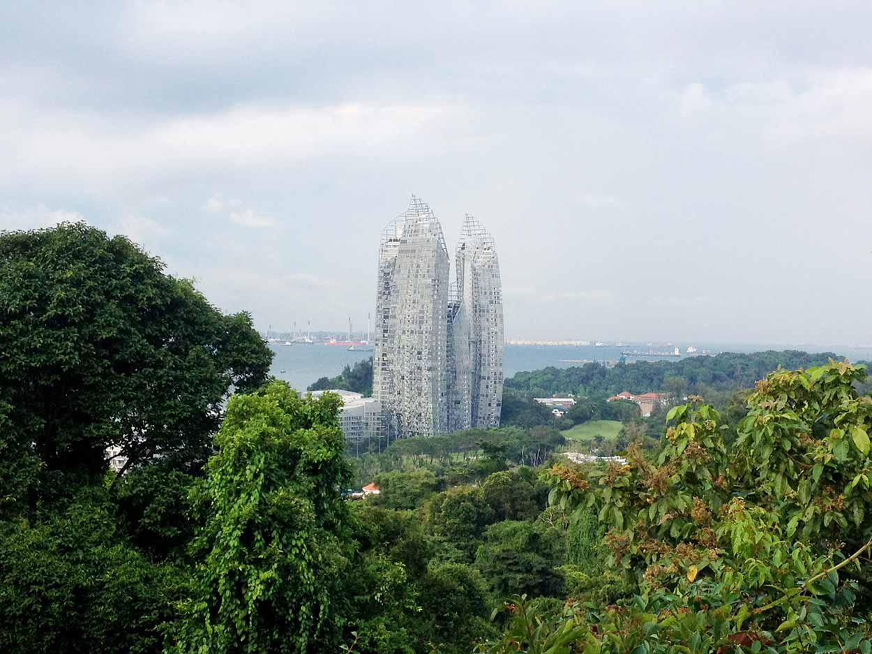
Many of the photographs I took on this walk include the Reflections at Keppel Bay. It is hard to miss and I became a little infatuated with it. It is a really cool looking building and to me looks like a ruin from a post-apocalyptic world. The skeletal framed towers jutting out of the lush vegetation reminds me of those "The World Without Humans" TV shows where the buildings are ripped apart by a nuclear bomb and slowly over time nature starts to take over again. A nuclear holocaust is probably not what the architect envisioned, but that's what it looks like to me.
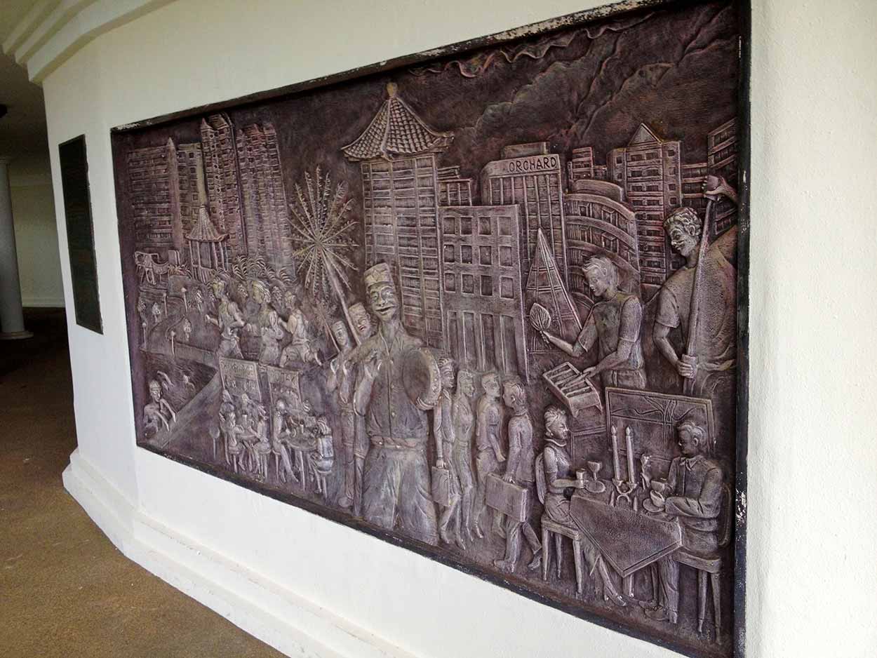
Ok. That's enough of my uneducated critique of architecture. What else did I find in Mount Faber Park? At the highest point of Mount Faber is Faber Point, which consists of a platform where you can take in the views with coin operated binoculars. I am cheap and I don't want to contract Pink Eye, so I just used my regular eyes. Underneath the platform is a circular walk with copper mural panels which depict the history and lifestyle of Singapore.
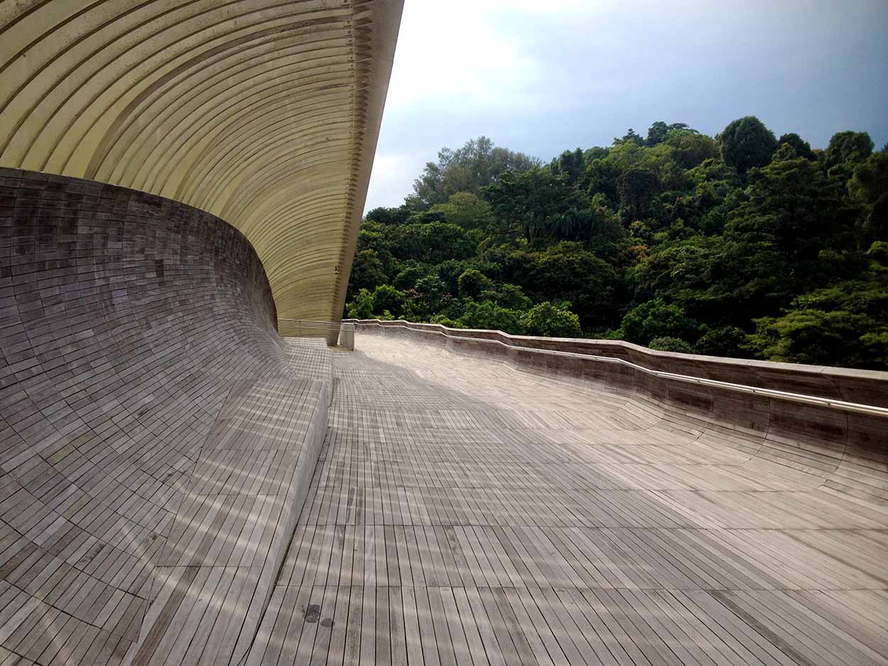
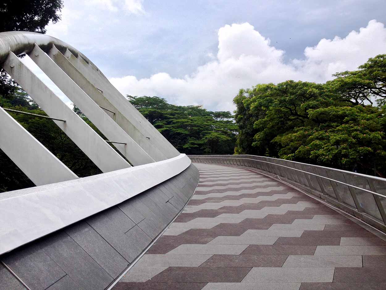
After a wander around Mount Faber Park it was onto Henderson Waves, a 36m high bridge made out of decking wood and shaped like a skate park. The bridge is absolutely amazing, but I am not that comfortable with heights, so I walked along this one really quickly. It's funny when I walk on something like this; I keep my head down, walk quickly and hold onto my possessions tightly. Grasping tightly onto my iPhone I did manage to take it out of my pocket and get a few quick snaps.

On the other side of the Henderson Waves is Telok Blangah Hill Park and the Hilltop Walk. A highlight of the park is the Terrace Garden. Sure there are plenty of stairs, but the outlook from the top is worth it. The stone work on the path, stairs and walls is also a brilliant feature of the garden. I once built garden beds using a truck load of stones and it was an absolute nightmare. Feel sorry for the workers who built this. Beautiful gardens and great views, seems like the perfect spot for a rest.

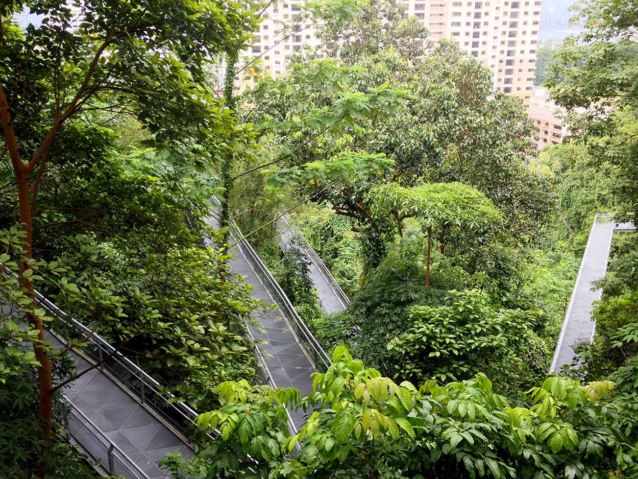
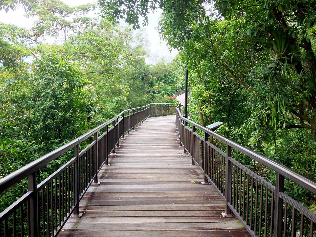
From Telok Blangah Hill Park it is onto the Forest Walk, which is an 800 meter elevated steel walkway amongst the forest. The Forest Walk is without a doubt my favourite part of the entire Southern Ridges walk. Even though the elevation does get quite high, the shear enjoyment of walking amongst the trees pretty much removed by my fear of heights. Hard to explain the walk in words, so I will just let a few pictures say what I cannot.


Directly after the Forest Walk is the Alexandra Arch. The Alexandra Arch is supposed to be a feature of the Southern Ridges walk, but after the excitement of the Forest Walk the Alexandra Arch is a complete let down. Needs a bit of a clean and really not an exciting bridge at all. The architecture is said to represent that of an open leaf. It looks like a leaf alright, a leaf that fell off the tree months ago and has been rotting on the ground since. A little harsh?
The grubbiness soon disappeared when I hit HortPark and the Floral walk. I must be here at the wrong time of year because it wasn't really that floral. I do like the big Bismarck palm trees though.
HortPark is unlike most of the Southern Ridges walk in that the gardens are landscaped and not natural. From my understanding HortPark is a kind of research gardening centre where the local horticultural and landscaping industry create many types of showcase gardens. It was nice to have an amble around the many winding pathways around the gardens. Unfortunately, HortPark is not the most peaceful place to be today. Seems to be a very popular spot for school excursions and hence loud kids. Think it is time to get out of here and onto the final leg of the Southern Ridges walk.
After HortPark it is a short walk to Kent Ridge Park and the Canopy Walk. Like the Forest Walk I raved about earlier, the Canopy walk is also an elevated walk amongst the forest. The main difference to the Forest Walk is that the Canopy Walk is shorter at 280 meters and is a wooden panel path. It is a good tree top walk, but I rate the Forest Walk as better.
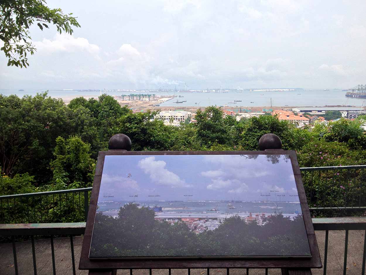
I end the Southern Ridges walk at a lookout in Kent Ridge Park. The lookout provides a vista of the docks and a photograph of how the area used to look. There certainly has been some serious land reclamation occurring here.
That's pretty much it for the Southern Ridges. Brilliant Walk. Now how the hell do I get out of here and to my next destination of Labrador Nature Reserve? Labrador Nature Reserve sits between the Southern Ridges and the sea, and NO, the reserve in not a habitat for Labrador dogs to roam free. Not sure what it is about. But I will soon see.
I make my way downhill to the Keppel Viaduct. I could walk all the way to the Labrador Nature Reserve, however the walk between the docks and the highway with the towering viaduct above is not the most inspirational walk. So I head to Pasir Panjang train station, with a pit stop at a random food centre, and then take the train to Labrador Park train station.
Click Here To Read More ...
Click Here To Read More ...
Click Here To Read More ...
View Photographs
Hello, I'm Marc and welcome to metrotrekker.
Be it seeing the city sights, exploring parklands and gardens, urban walks or day-hikes in the city outskirts, the metrotrekker website details walking routes and hiking trails accessible by foot and public transport in metropolitan areas.
The metrotrekker website provides you with all the details required for metropolitan exploration:
- a map with geolocation and a selection of map types (street, satellite, topographical)
- navigation formats compatible with common GPS devices, desktop browser/software or mobile apps
- trail length and difficulty
- start and finish options (particularly by public transport)
- photos/videos
- attractions or points of interest along the way
- other walks and hikes nearby
- often a story or detailed description of the trail (I have personally walked every single trail on the website)
- a comments section, so feel free to write about your experiences as well
- and more improvements and resources are continually being added
So let's get outside and explore our great metropolitan areas by foot. Click Here to begin exploring with metrotrekker.
Pleasant Trails,
Marc
Links To Help You Navigate