- Start or End: I started and finished at my hotel in Wan Chai, near the corner of Wan Chai Road and Burrows Street (Google Map Directions). You can access the eastern end of the Hong Kong Trail via the bus stop on Stubbs Road (Google Map Directions). To access the western end, you will either need to walk up Peel Rise (like I did) or continue to Section 2 and take the bus from Tin Wan (Google Map Directions).
- Length: 16.4km (10.2mi) in 7hr (I spent some time at Luggard Road taking a time-lapse)
- Grade: Medium. The Hong Kong Trail itself is rather easy as it is flat and about 7km long. Walking up the Wan Chai Green Trail and Peel Rise is a different story though (the path is wide and paved but it is definitely at an incline).
- Date Walked: 11th of December 2015
I decree Section 3 of the Hong Kong Trail to be my least favourite. At least I saw a wild pig, got a sweat-up getting there and stood in awe of the big city lights from Lugard Road.
After a 27 km hike around Lamma Island yesterday, I decided I should take it a little easy today. Might take a walk closer to home (my current "home" being a hotel in Wan Chai). I am yet to try Section 3 of the Hong Kong Trail and it's rather close as the crow flies, but unfortunately, I don't have wings, so I need to get to the top of the mountain somehow. I could take a bus, but where is the fun in that? This is a walking website after all, so I better start walking.
To access the easternmost point of Section 3, I need to make my way to the intersection of Stubbs Road and Peak Road. That is about 230 meters above my hotel. The most direct way there is via the Wan Chai Green Trail, which starts at the corner of Queen's Road East and Wan Chai Gap Road. The trail follows Wan Chai Gap Road.
Click Here To Read More ...

It's mostly just buildings along the path, but it starts to get greener once you cross Kennedy Road (it isn't straight across as the road is barricaded, you need to take a left and walk a short distance to the nearby pedestrian crossing).

As you can tell, the path has a rather steep gradient. It is sweat-inducing, but the increasing amount of plant life provides plenty of shade.

If you need a rest half-way up, I suggest you stop at Bowen Road Park.

After more panting and sweating (I thought I was going to take it easy today!) I reach the intersection of Peak Road and Stubbs Road.

I head along the nearby Mount Cameron Road, which borders Wan Chai Gap Park.

And then take a right along Aberdeen Reservoir Road.


You can continue to follow Aberdeen Reservoir Road to the trailhead of Section 3 or do what I did and take a diversion on Lady Clementi's Ride, a small path which runs parallel to the main road.


Lady Clementi's ride joins up with the Hong Kong Trail at Section 4 (take the sign towards Peel Rise as that is where I am headed).

Follow the path until you join the road again, take a left, go over an old stone bridge and then look for the trailhead of Section 3 on your right.

Time to enjoy some hiking on Section 3 of the Hong Kong Trail!
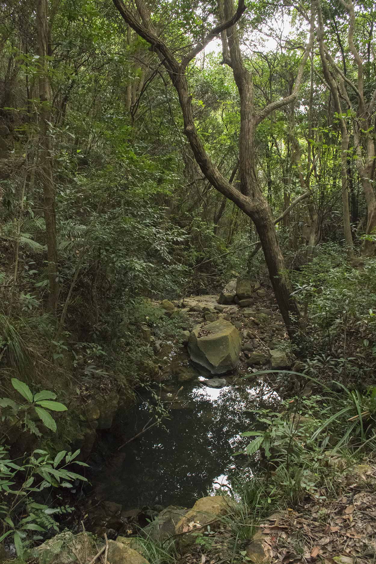


If you are looking for a walk on a rather flat trail with plenty of trees and shade this is the one. You do get the occasional view though.


It is not that exciting, but a nice walk, nonetheless. So far, probably the least exciting section of the Hong Kong Trail I have completed.
When I hit Peel Rise (which is an old road) I have a decision to make.

Do I take a left down Peel Rise and finish off Section 3? Or do I abandon Section 3, take a right and head up Peel Rise to The Peak? The latter sounds much more interesting but much more strenuous. Hmmm, think I will go the exciting option (I also brought the tripod for my camera, so I would like to try some night photography over the Hong Kong skyline from the Lugard Road Lookout).
I take a right.


It is an unexciting, uphill walk, but I am enjoying my time outside. As I make my way up Peel Rise, I hear a sudden scream from further up the road. I am not sure what is going on, but I can just see two people through the trees. As I continue, I hear a woman yelling "get down into the trees and off the road!". What's that all about? I look up the road and there it is ... a dirty great big wild pig.

The woman walks out of the trees and I meet her on the road as she calls out to her husband. We don't hear anything from him. The big pig walks into the vegetation and the husband appears out of the vegetation. The husband is all good and said he got within a few meters of the wild beast. I'm not sure how dangerous it would be, but the woman was very adamant that they have sharp teeth and like to bite. Think I will pass on that.
I didn't expect to see a wild pig so close to The Peak. I am so close to civilisation.


With the piggy excitement out of the way, I continue to The Peak via Peak Road. On the way, there are views of Mount High West and the outlying islands.

Soon enough I am at The Peak Tower.

Time for a rest until the sun starts to set and then I will head along Lugard Road to get some night photography of the Hong Kong skyline. Here is the result.

And here is the time-lapse.
Spectacular isn't it? One of my favourite views in Hong Kong.
I planned to take the bus back to my hotel but the line-up at the bus stop was epic. So, I did what I usually do, walk. I found my way through the affluent streets of The Peak and returned to the top of the Wan Chai Green Trail. I enjoy going downhill and then call it a day back at my hotel in Wan Chai.
Click Here To Read More ...
Click Here To Read More ...
Q: How long is Section 3 of the Hong Kong Trail?
A: 6.5 km long in about 1 hour and 45 minutes.
Q: How do I access Section 3 of the Hong Kong Trail?
A: The start of Section 3 (western trailhead) can be accessed via bus to Tin Wan Estate. From the terminating bus stop, head uphill (opposite direction to which the bus arrived), past Tin Lai house and up the path where you will meet Section 2. Alternatively, take the bus to Aberdeen and walk-up Peel Rise on Aberdeen Reservoir Rd. The end of Section 3 (eastern trailhead) can be accessed via bus to the intersection of Peak Road and Stubbs Road. From there, walk along Mount Cameron Road, take a right on Aberdeen Reservoir Road and follow to the trailhead.
Q: Are there trail markers for Section 3 of the Hong Kong Trail?
A: The entire Hong Kong Trail is well marked. The logo for the Hong Kong Trail is the silhouette of two hikers, one behind the other in full stride. Apart from larger signs indicating the start of sections and access to the trail, there are 100 numbered trail markers about 500m apart along the trail.
Click Here To Read More ...
Q: Is there mobile phone reception along Stage 3 of the Hong Kong Trail?
A: Mobile phone coverage is mostly good, although there are a few dead spots.
Q: Is water available along Section 3 of the Hong Kong Trail?
A: No potable water is available along the trail itself. Water is available at Wan Chai Gap Park near the eastern end of Section 3 (where Section 3 and 4 join). At the western end (where Section 2 and 3 join) you will need to venture back into civilization at Tin Wan or Aberdeen. It is recommended that you bring plenty of your own water from home.
Q: Where is the best location to take night photography of the Hong Kong city skyline?
A: Lugard Road Lookout, Lugard Road, which is near the Peak Tower. It is only pedestrian access to the lookout, and it is about 10 to 15 minutes away from the Peak Tower.
View Photographs
Hello, I'm Marc and welcome to metrotrekker.
Be it seeing the city sights, exploring parklands and gardens, urban walks or day-hikes in the city outskirts, the metrotrekker website details walking routes and hiking trails accessible by foot and public transport in metropolitan areas.
The metrotrekker website provides you with all the details required for metropolitan exploration:
- a map with geolocation and a selection of map types (street, satellite, topographical)
- navigation formats compatible with common GPS devices, desktop browser/software or mobile apps
- trail length and difficulty
- start and finish options (particularly by public transport)
- photos/videos
- attractions or points of interest along the way
- other walks and hikes nearby
- often a story or detailed description of the trail (I have personally walked every single trail on the website)
- a comments section, so feel free to write about your experiences as well
- and more improvements and resources are continually being added
So let's get outside and explore our great metropolitan areas by foot. Click Here to begin exploring with metrotrekker.
Pleasant Trails,
Marc
Links To Help You Navigate