- Start or End: Start or end at either Canning Bridge Train Station (Google Map Directions) or Fremantle Train Station (Google Map Directions).
- Length: 19.0km (11.8mi) in about 4.5hr
- Grade: Medium. A long walk but relatively flat and paved the whole way. Plenty of public transport options along the way if you wish to cut the walk short.
- Date Walked: 16th of June 2013
Tranquil morning river views, defecating marathon runners and boardwalk trespassing.
Off to Perth city today to walk along the Swan River. Last time I walked from Canning Bridge Train Station along the river north towards the CBD, but today I am going to head west from the train station towards the mouth of the Swan River at Fremantle.
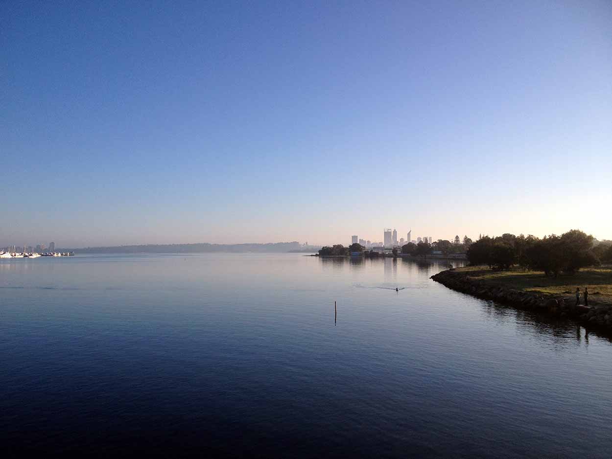
The first point of interest is Canning Bridge which crosses the Canning River, a major feeder to the Swan. The bridge is a great vantage point for uninterrupted views of the river and the skyscrapers of the CBD in the distance.
Click Here To Read More ...
After the Canning Bridgethe concrete path hugs the river bank and is very popular spot for people to walk, run and cycle. The popularity is justified as the path is great quality, the views over the river are spectacular and some of the houses (mansions more like it) along the river are just epic. However, the popularity is a bit more than I expected. There are people everywhere and for some reason there are groups of people lining the path? I soon realise that the Perth Marathon Club is holding a marathon on the very path I am walking. Just my luck that I picked here to walk today, but hey, it's a public path I am sure the marathon runners can share it with me. On the plus side it was nice to get some applause from the locals. Sure, the clapping and words of encouragement were for the runners sprinting past me, but I'll take it anyway.
As a walker I have never understood why people run, especially run in a marathon. It's just painful and from the expression on many of the runners' faces my opinion is justified. Also, is having a marathon runners number on your shirt a licence to publicly urinate and defecate. During this walk I was witness to a number of the male runners taking a leak in the bushes along the path. I even saw a guy run into the wetlands, drop his pants, squat and I am guessing lay a cable (can't be certain of this as I looked away immediately when the pants went down). What is wrong with these people? Ok, better get back to describing the aspects of the walk that didn't give me nightmares.
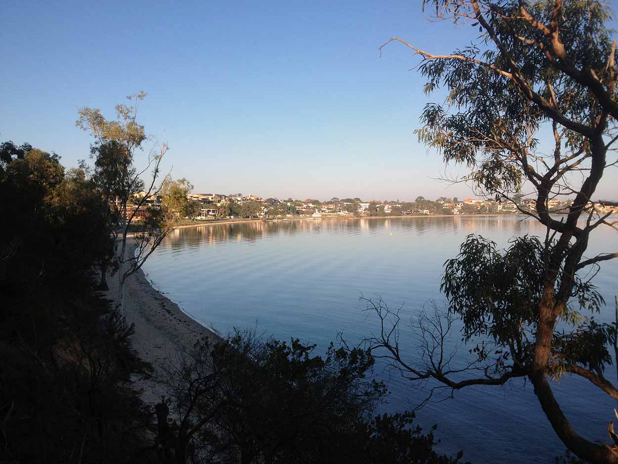
A highlight of the walk was the boardwalk around Point Dundas, just after Jeff Joseph Reserve. The boardwalk is right on the river, providing perfect river views, and lines some really impressive homes. I wasn't really meant to have access to the boardwalk as there was a sign indicating a detour and a pulled down fence, which in hindsight was meant to be blocking the path. But I went on walking anyway. It wasn't until further down the boardwalk that I meet with an intact fence blocking the path. Wish someone had pulled that one down as I had to climb over it. Hopefully the local government fix this up as the boardwalk was one of the best parts of the walk.
The marathon runners and I finally departed ways after Attadale Reserve. From Attadale Reserve to Norm McKenzie Reserve the walk was surprisingly quite, with only a few other walkers around. The silence was most obvious around the Point Walter Reserve, which is a nice little nature walk. Within the reserve are a few dirt tracks that provide access to cliff face lookouts over the river. The perfect place for a rest.
The path is clear until I reach the Bicton Baths, which is a really nice spot, however the path is a little hard to follow. I follow the path to the Bicton Baths but once I hit the East Fremantle Yacht Club there is no obvious way to go. After following a road to nowhere I have to back track and finally navigate around the Yacht club, think I should have turned off before the Baths.
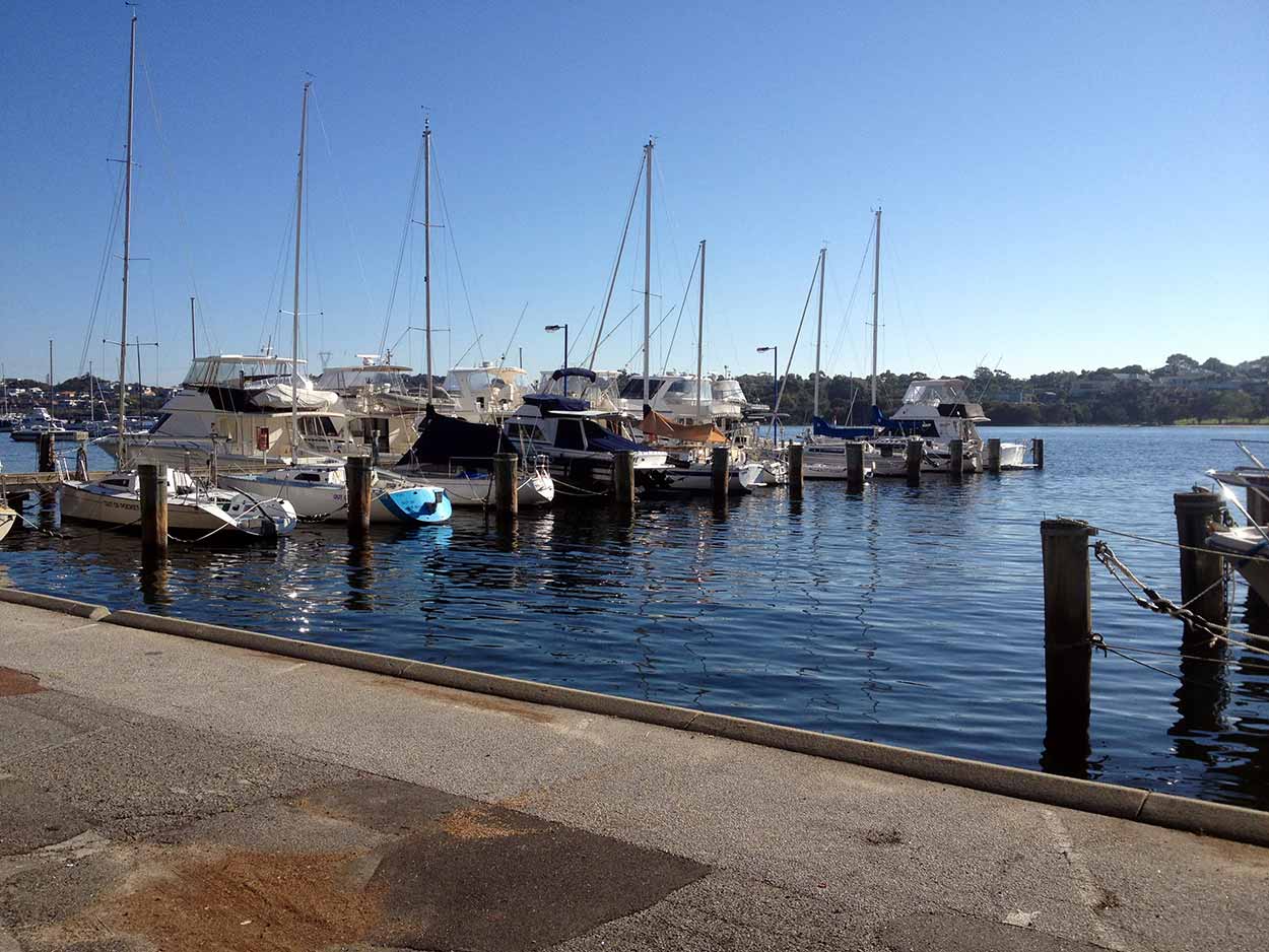
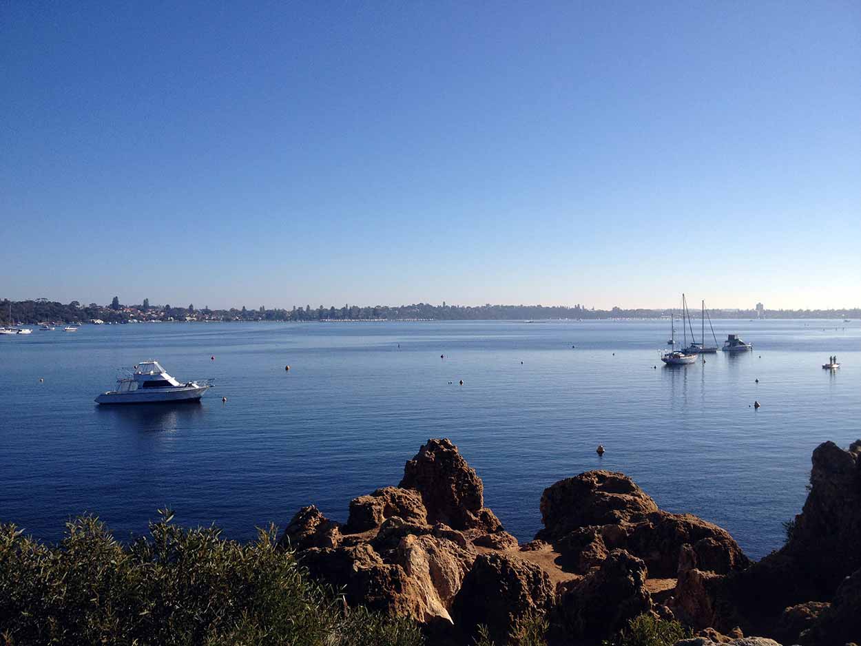
After the Yacht club the walk deviates from the river and follows the road. It doesn't start to get interesting again until I reach the Norm McKenzie Reserve where things get a lot livelier. There are many people picnicking and walking along the path admiring the river views. From the Norm McKenzie Reserve to the Queen Victoria Road Bridge the path straddles the river and as I walk along I admire a number of pleasure craft making their way downstream. The water craft navigate their way through a narrow section under the Queen Victoria Road Bridge. The remainder of the area under the bridge is taken up by a series of boards that link each pylon and allow access for fishermen. The thin boards under the bridge looked a bit rickety to me and there were no hand rails. So instead of exploring under the bridge an taking an unwanted dip in the Swan River I continued my walk.
From the Queen Victoria Road Bridge the path deviates from the river and follows the large shipping ports of Fremantle to the old Fremantle Train Station. It is here that my journey ends, 20.5 kms from my starting point at Canning Bridge Train Station. A great morning walk that I thoroughly recommend.
Click Here To Read More ...
Click Here To Read More ...
Click Here To Read More ...
View Photographs
Hello, I'm Marc and welcome to metrotrekker.
Be it seeing the city sights, exploring parklands and gardens, urban walks or day-hikes in the city outskirts, the metrotrekker website details walking routes and hiking trails accessible by foot and public transport in metropolitan areas.
The metrotrekker website provides you with all the details required for metropolitan exploration:
- a map with geolocation and a selection of map types (street, satellite, topographical)
- navigation formats compatible with common GPS devices, desktop browser/software or mobile apps
- trail length and difficulty
- start and finish options (particularly by public transport)
- photos/videos
- attractions or points of interest along the way
- other walks and hikes nearby
- often a story or detailed description of the trail (I have personally walked every single trail on the website)
- a comments section, so feel free to write about your experiences as well
- and more improvements and resources are continually being added
So let's get outside and explore our great metropolitan areas by foot. Click Here to begin exploring with metrotrekker.
Pleasant Trails,
Marc
Links To Help You Navigate