- Quick Info: Point Peron is home to the remains of an artillery battery constructed in 1942 in response to World War II. The site has decayed, which is a pity. However, the eerie and dark nature of the ruins makes for a great adventure. Apart from war history, Point Peron is a beautiful location with ocean views, rocky shores, beautiful beaches, stunning sunsets, Mushroom Rock, and a cantilevered lookout over the cliffs. Several well-kept paths take you near the cliffs, around WWII gun emplacements and bunkers, and to the WWII Observation Post at the summit of Point Peron.
- Getting There: There are four small car park facilities at Point Peron but limited public transport. The nearest bus stop is near the corner of Safety Bay Road and Parkin Street (Google Map Directions). From the bus stop, you can walk along Point Peron Road or along the shoreline. The walk along Point Peron Road is not scenic and a little dangerous due to traffic on the narrow road, but it is very direct (Google Map Directions). The walk along the shoreline is much more scenic and starts at the corner of Hymus Street and Esplanade (Google Map Directions). You can see the path I took on the map for the Rockingham Coastal Hike. It is possible to walk all the way to the bridge that crosses Cockburn Sound to the Garden Island military base, but if the tide is high, the water can get right up the shoreline (it isn't dangerous, it's just a little annoying). Once you get past the Garden Island bridge entrance, take a right through the large car park near the Rockingham Naval Association and to the Point Peron Boat Launching Facility. From here you can walk along beautiful beaches all the way to Point Peron.
- Opening Hours: 24 hours a day, 365 days a year. The sunsets can be spectacular, but there isn't much to see at night.
- Price: Free
- Facilities: The are toilets near the Point Peron Boat Launching Facility. Bring your own water (a coffee cart is often in the area, though). There are several park benches but no BBQ facilities.
Click Here To Read More ...
Click Here To Read More ...
Point Peron is an enjoyable location for a walk. There are rocky cliffs and small tranquil beaches to discover, eerie and dark World War II ruins to explore, spectacular ocean views, amazing sunsets, and a cantilevered lookout over the cliffs.
There are two good reasons to visit Point Peron (Cape Peron is the official name, but the area is commonly referred to as Point Peron). One, the stunning coastal scenery and two, the remains of an abandoned artillery battery. Let's start with the scenery.
Click Here To Read More ...
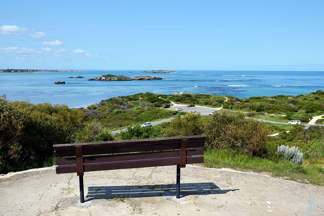
Impressive right? This photo was taken from the highest point of Point Peron, the WWII Observation Post, and is probably the most scenic spot in the area. However, it isn't just coastal panoramas on offer. On the northern side of Point Peron are the blue waters of Cockburn Sound and beaches perfect for a stroll.

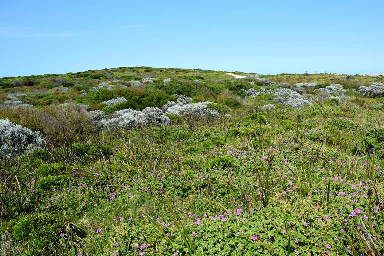
Heading inland are paths through low-lying shrubs and wildflowers.
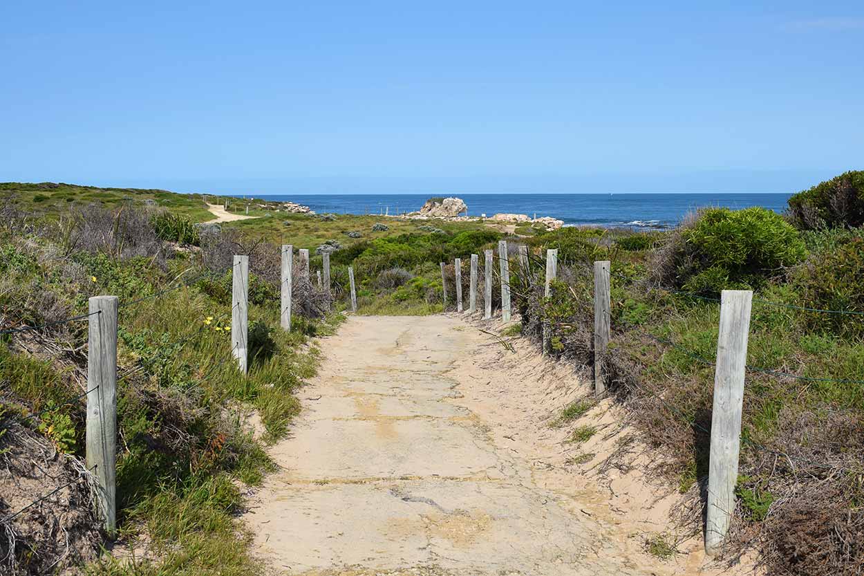
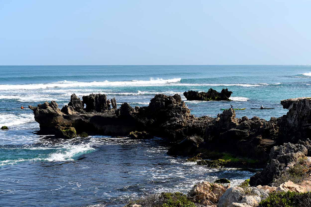
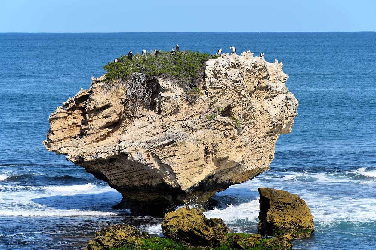
The north-west point of Point Peron is exposed to the Indian Ocean elements resulting in dramatic, craggy limestone cliffs.

Despite the elements, Mushroom Rock stands strong.

The rugged terrain is juxtaposed alongside the smooth sands of secluded beaches.

There a several spots to sit and enjoy the scenery.

You can also hover over the cliffs on the Cantilevered Lookout (located near the most westerly car park).


Point Peron is a brilliant place to visit on a warm sunny day, but as the sun goes down, Point Peron really shines.

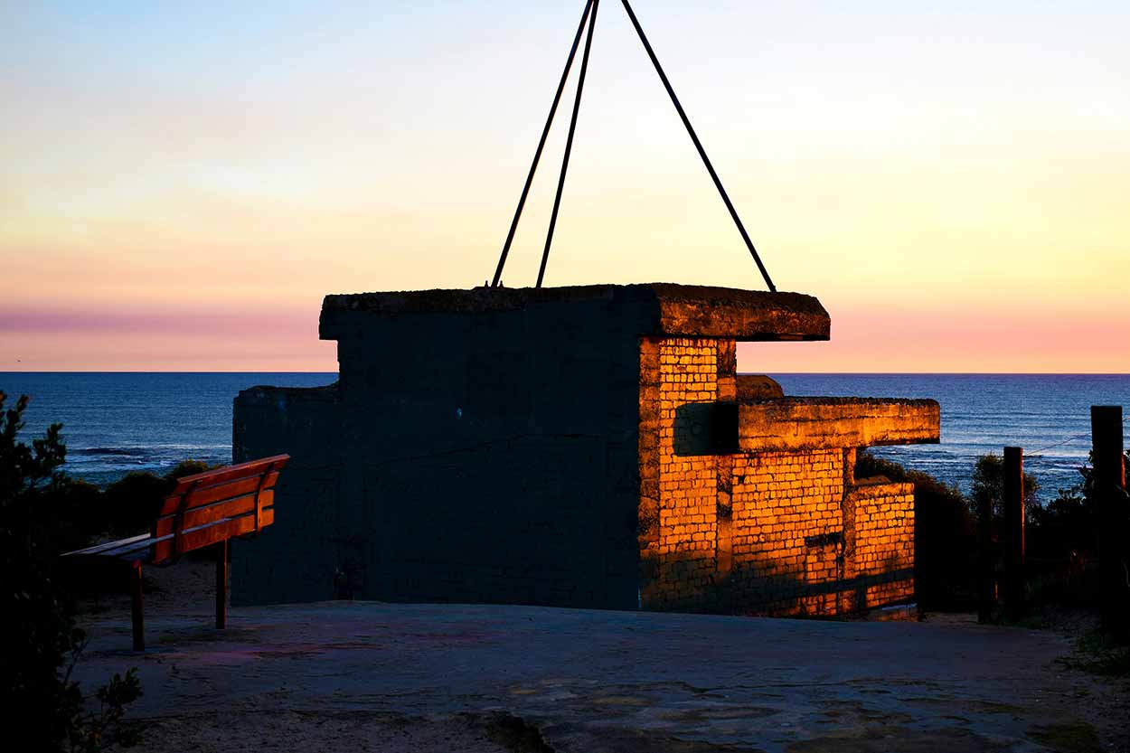
I recommend taking the path or stairs (warning, it is a bit of a climb) to the WWII Observation Post for the best sunset views. While we are here, let me introduce you to the second reason to visit Point Peron, exploring the sometimes eerie and dark World War II ruins. Point Peron is home to the remains of an artillery battery constructed in 1942 as a defence system in response to external threats during World War II. The battery never saw action.

The photograph above is the Observation Post located at the summit of Point Peron. The positioning of the Observation Post is obvious as it provides glorious 360-degree views over the Indian Ocean, Cockburn Sound, Point Peron and Rockingham City. The structure is also in exceptionally good condition. Other structures are in not so good a condition.
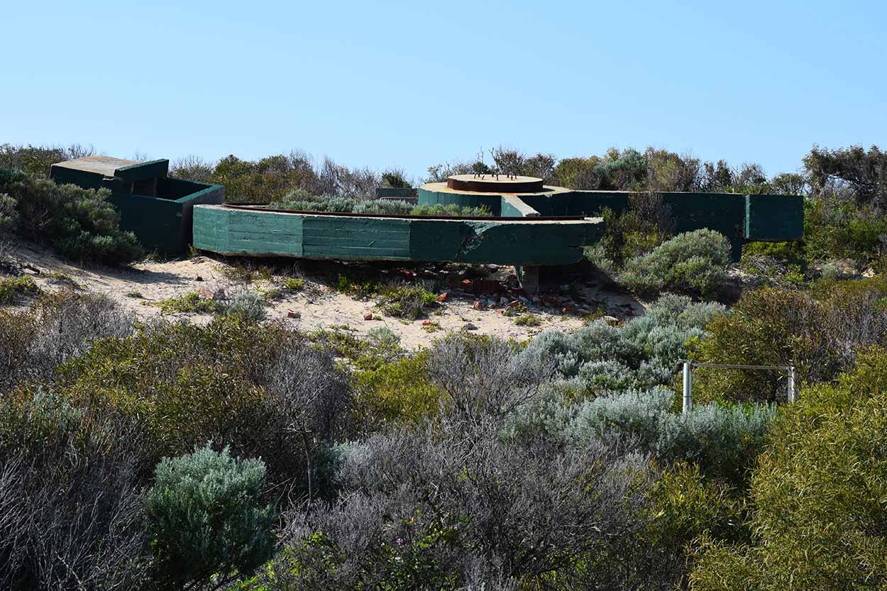

The battery consisted of two gun emplacements (the original guns are now gone), an observation post bunker, an operations bunker, two ammunition bunkers and several ancillary buildings.
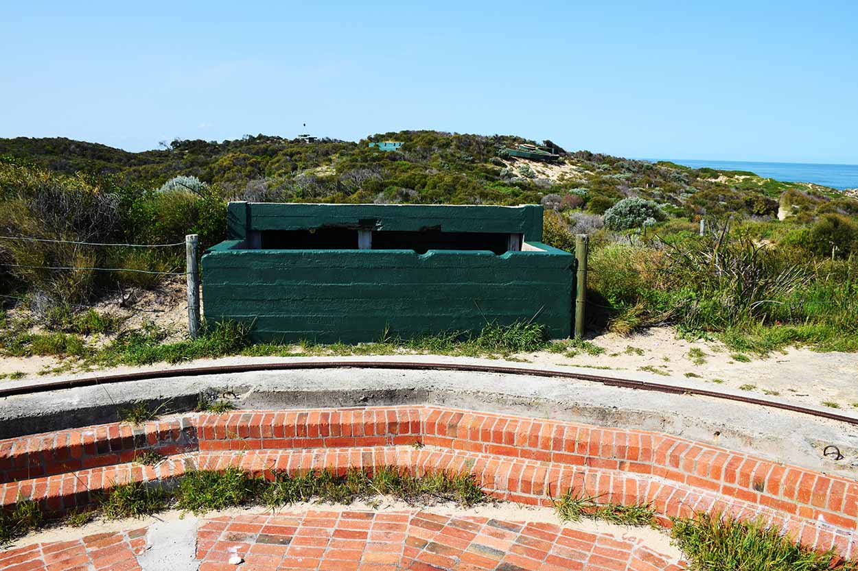
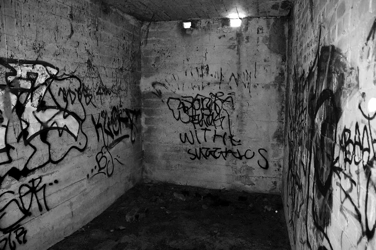
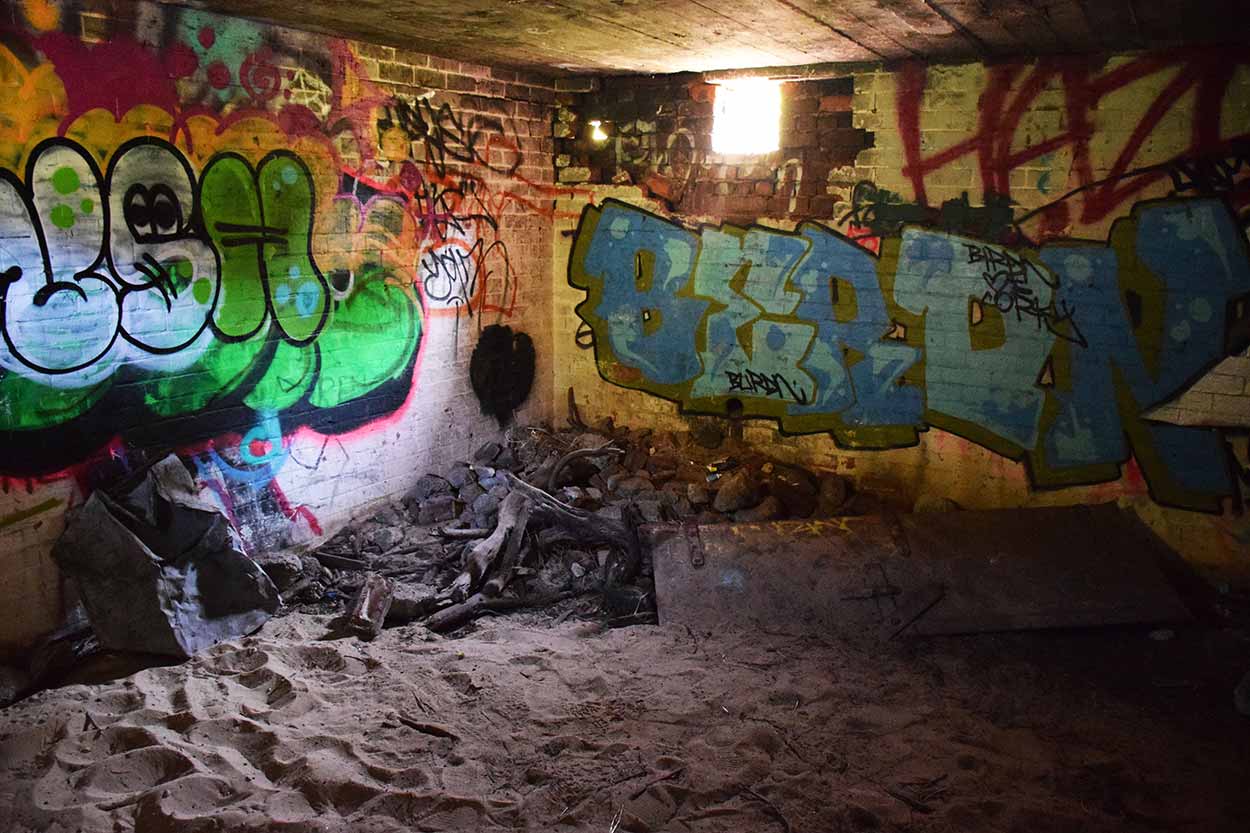
Since decommission in 1944, the site has been left to ruin. Some of the buildings are covered in vegetation, sinking into the sand, or covered in graffiti. The decay of the site is a pity. However, the following gun emplacement ...
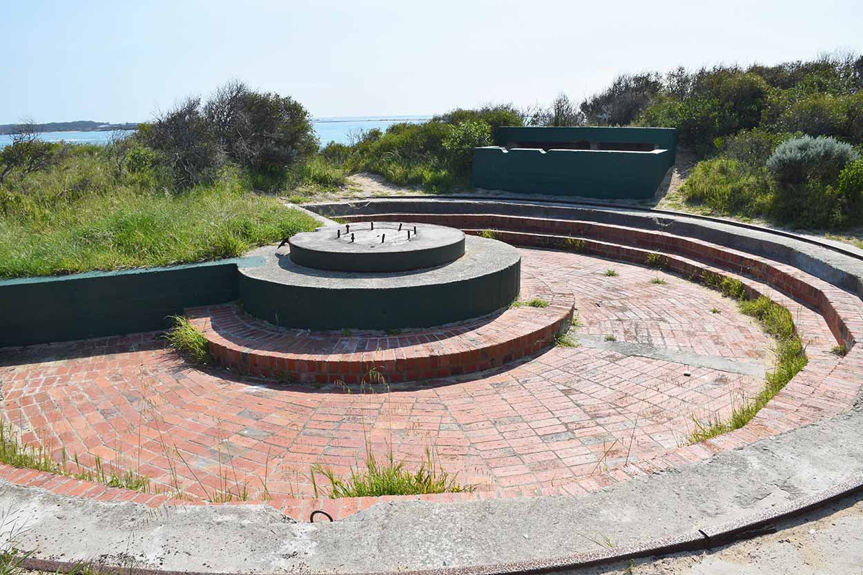
has recently changed (December 2020) with the installation of a replica of a Canon de 155 mm GPF. You can see the photograph of the cannon on Wikipedia. I hope to return one day soon to see it myself.
Despite little care since the early '40s, many of the structures have withstood the tests of time.


If you are feeling adventurous, you can enter some of the bunkers. Watch your step as it is rather dark.


As a final note on Point Peron, I would suggest visiting on a calm day. If the winds are blowing, this area is rather unpleasant, but you could always hide in a bunker.
Wait a minute. There is another thing you can do at Point Peron if the weather is calm � enjoy the water surrounding it. The beach is beautiful with vivid blue waters and is sometimes patrolled by Surf Lifesavers. For more information, please visit Beachsafe. Also, the shoals and rock pools around Point Peron, with an abundant array of sea life, are popular snorkelling spots. Although I'm not a snorkeller myself, I was honoured when one of my coastline photographs at Point Peron was included in the Newsletter of the Malacological Society of Australasia. The article on Page 5 is about sea slugs in the area.
Q: How do I get to Point Peron?
A: There are four small car park facilities at Point Peron but limited public transport. The nearest bus stop is near the corner of Safety Bay Road and Parkin Street. From the bus stop, you can walk along Point Peron Road or along the shoreline.
Q: What are the opening hours of Point Peron?
A: Point Peron is open 24 hours a day, 365 days of the year.
Q: What facilities are there at Point Peron?
A: The are toilets near the Point Peron Boat Launching Facility. There is no water, so bring your own water (there is often a coffee cart in the area, though). There are several park benches but no BBQ facilities.
Click Here To Read More ...
Q: What is there to see at Point Peron?
A: There are two good reasons to visit Point Peron. One, the stunning coastal scenery and two, the remains of an abandoned WWII artillery battery. Point Peron is a beautiful location with ocean views, rocky shores, beautiful beaches, stunning sunsets, Mushroom Rock, and a cantilevered lookout over the cliffs. The abandoned WWII battery consisted of two gun emplacements (the original guns are now gone), an observation post bunker, an operations bunker, two ammunition bunkers and several ancillary buildings. Many of these buildings can be reached and explored. Recently, a replica of a Canon de 155 mm GPF was installed at one of the gun emplacements.
View Photographs
Environment.gov.au: The Australian Heritage Database entry for Cape Peron Battery Complex, Point Peron Rd, Peron, WA, Australia.
Heritage Council of WA: Cape Peron K Battery Complex information.
Heritage Detection: Article entitled "The Battle of Point Peron" provides some history on the artillery battery and old photos of soldiers at Point Peron.
Wikipedia.org: Peron Battery entry with a picture of the newly installed Canon de 155 mm GPF.
Hello, I'm Marc and welcome to metrotrekker.
Be it seeing the city sights, exploring parklands and gardens, urban walks or day-hikes in the city outskirts, the metrotrekker website details walking routes and hiking trails accessible by foot and public transport in metropolitan areas.
The metrotrekker website provides you with all the details required for metropolitan exploration:
- a map with geolocation and a selection of map types (street, satellite, topographical)
- navigation formats compatible with common GPS devices, desktop browser/software or mobile apps
- trail length and difficulty
- start and finish options (particularly by public transport)
- photos/videos
- attractions or points of interest along the way
- other walks and hikes nearby
- often a story or detailed description of the trail (I have personally walked every single trail on the website)
- a comments section, so feel free to write about your experiences as well
- and more improvements and resources are continually being added
So let's get outside and explore our great metropolitan areas by foot. Click Here to begin exploring with metrotrekker.
Pleasant Trails,
Marc
Links To Help You Navigate