- Start or End: Rockingham Naval Memorial Park (Google Map Directions) or Port Kennedy Boat Ramp, which has a bus stop close by on Port Kennedy Drive (Google Map Directions).
- Length: 24 km (15 mi) in about 6hr
- Grade: Medium. Majority flat but long distance. Mostly paved or gravel (around Point Peron) with some beach sections.
Click Here To Read More ...
Click Here To Read More ...
A 25.4 km (15.8 mi) hike along the Rockingham coastline. Take in the stunning views of the Indian Ocean, Cockburn Sound and the Shoalwater Islands Marine Park. Other highlights include exploring the jagged limestone cliffs of Point Peron and among the sand dunes of Warnbro Sound. Keep an eye out for dolphins feeding close to shore!
Rockingham is a popular summertime holiday destination and it isn't hard to see why. With vast stretches of calm white sandy beaches, the jagged limestone islands of the Shoalwater Islands Marine Park and abundant sea and bird life, the Rockingham coast is a perfect place for walking.
The local Rockingham government has done a great job in providing excellent walking paths along the Rockingham coastline. If you enjoy ocean views this is a hike for you. The walk is flat and the majority of the paths are concrete, with some beach and gravel walks. Don't feel like hiking the whole way? There are plenty of car parking facilities and public transport options along the way so you can cut the hike into smaller trips.
The Rockingham Coastal Hike can be broken up into four sections.
Rockingham Beach & Palm Beach
- Start or End: Rockingham Naval Memorial Park (Google Map Directions) or Mangles Bay (Google Map Directions)
- Length: 3.9 km (2.4 mi)
- Grade: Easy, flat, fully paved, beach walking optional.
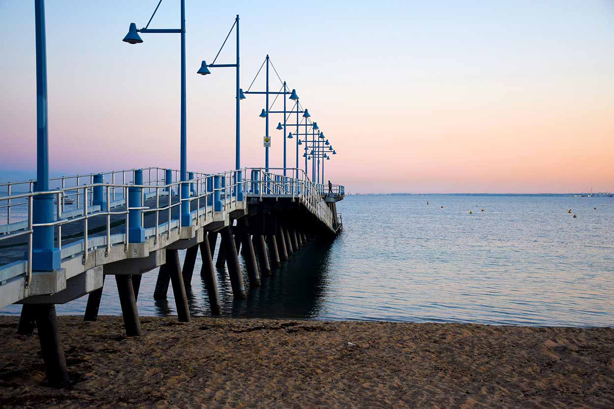
The most easterly section of the path starts near the Grain Terminal and traverses through a sand dunned area adjacent to parks. Some of the naval history of the area can be viewed (including an old gun turret and the top of a submarine) at the Naval Memorial Park next to the Grain Terminal. Heading west you will encounter Churchill Park and the main restaurant and bar strip of Rockingham, which can get very busy on a sunny weekend. Further along is the picturesque area of Mangles Bay.
Click Here To Read More ...


Mangles Bay & Point Peron
- Start or End: Mangles Bay (Google Map Directions) or Shoalwater Bay Beach at Point Peron (which has no public transport options, so best to backtrack to Mangles Bay or continue to Shoalwater).
- Length: 4.8 km (3 mi)
- Grade: Medium, large sections unpaved, mostly dirt tracks, beach sections, optional lookout on hill
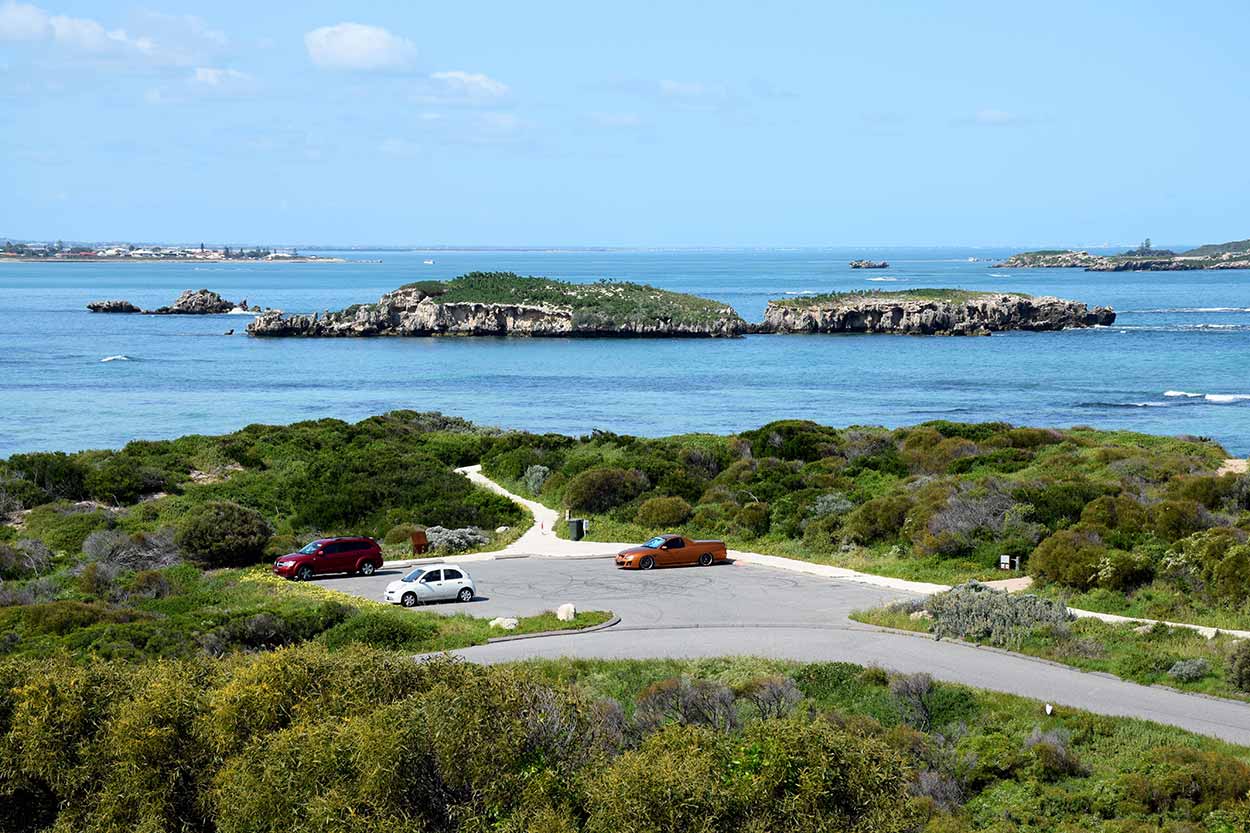
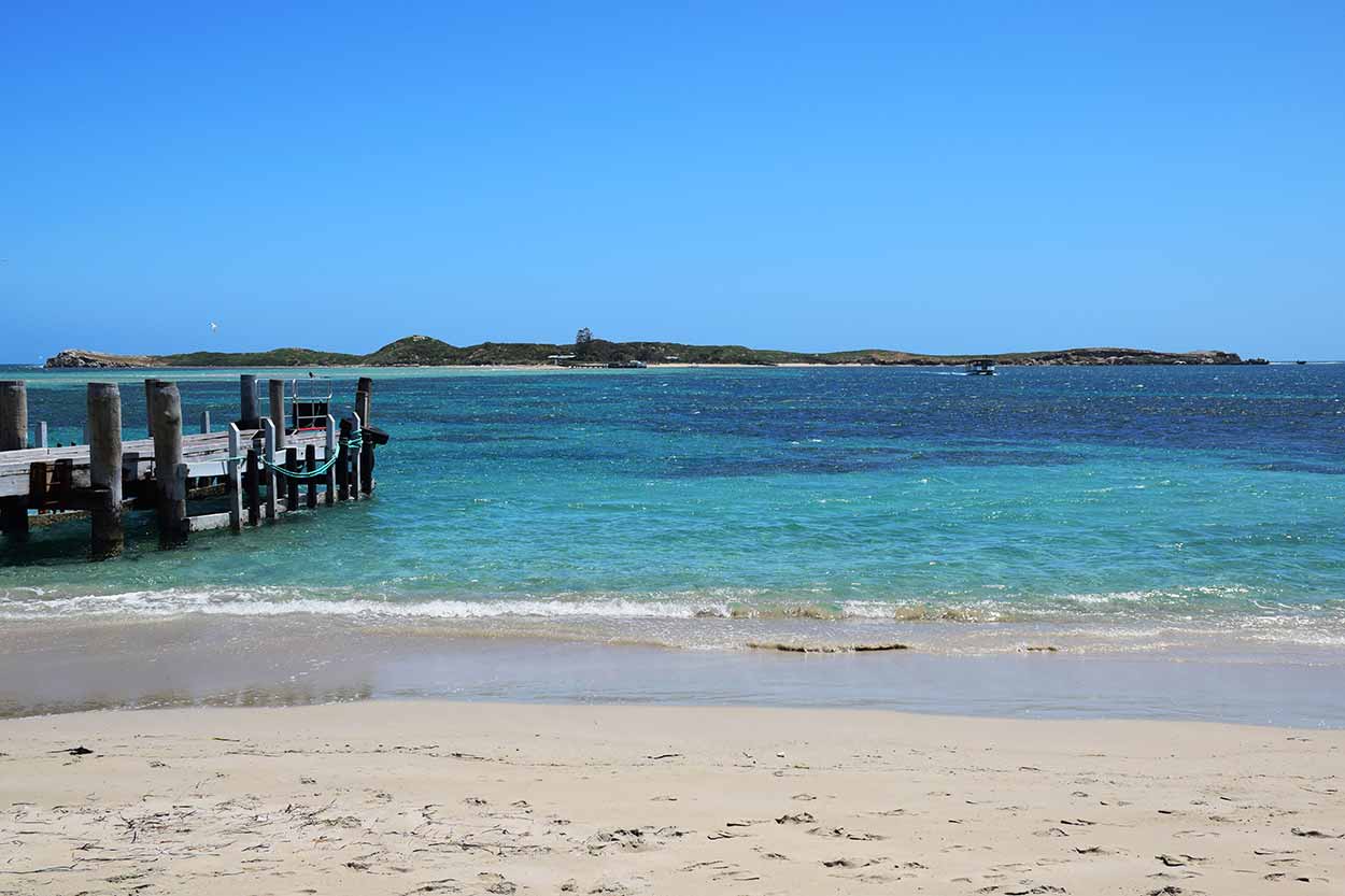
The eastern end of this walk starts as a beach walk along Mangles Bay, where you can view the moored boats against the backdrop of Cockburn Sound and Garden Island. After a short beach walk take a left onto Point Peron Road. The walk along Point Peron Road is not the most exciting part of the hike and there is no dedicated path for pedestrians, so watch out for cars. You can either continue along Point Peron Road to get directly to Point Peron, but I suggest taking a right into the car park of the boat ramp and then onto a beach walk. Once at Point Peron there are dedicated paths for pedestrians.
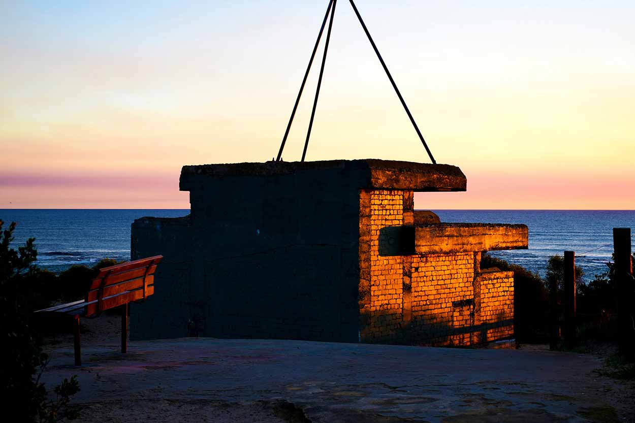
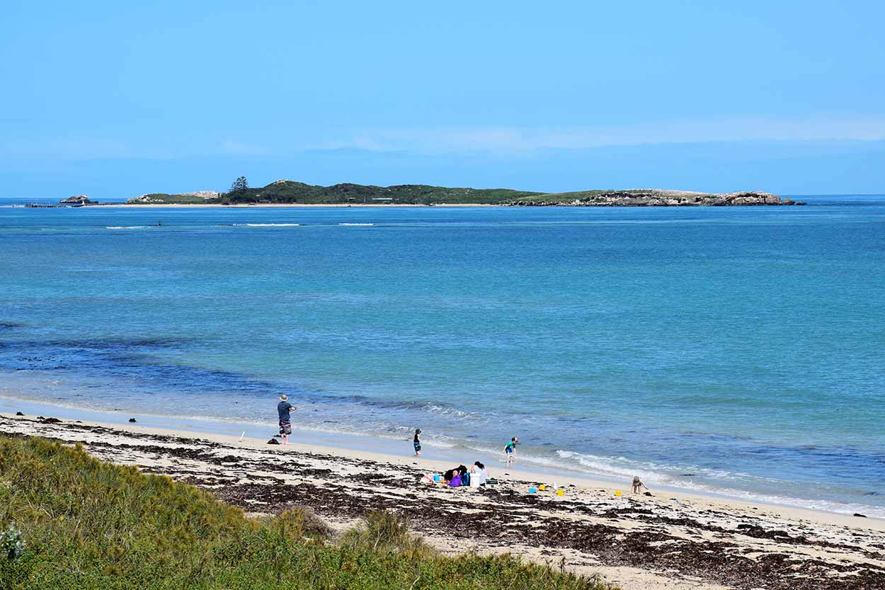
Point Peron is a great place to explore. The path I have provided is the main way around the point, but there are a number of side paths that are worth exploring. Point of interests include rocky limestone cliffs, World War II ruins and a lookout that reaches over the cliffs for great views. In the spring wild flowers are abundant and be on the lookout for dolphins feeding close to shore. This is also a fantastic place to watch the sun go down.
Shoalwater
- Start or End: Shoalwater Bay Beach at Point Peron or the Safety Bay Yacht Club (Google Map Directions).
- Length: 5.6 km (3.5 mi)
- Grade: Easy, mostly flat paved paths with a beach walk, other beach walks optional.
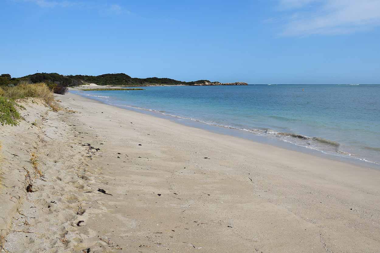
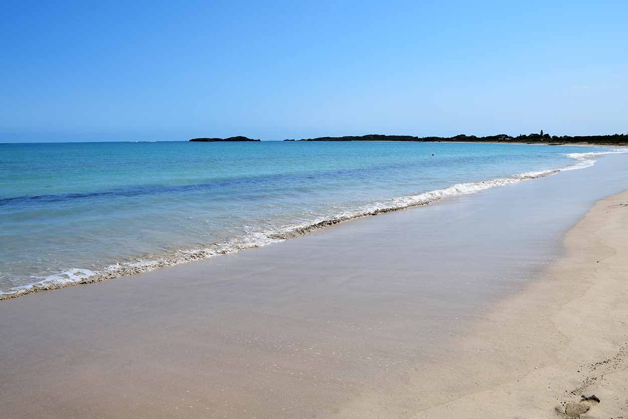
Shoalwater Bay is part of the Shoalwater Islands Marine Park and provides great views of Penguin Island, Seal Island and Shag Rock. For the most spectacular views sunset is a great time to walk. Be on the lookout for an array of seabirds, dolphins and sea lions. Even if the wildlife doesn't make an appearance the stunning views of jagged limestone islands surrounded by light blue shallow waters makes this one of the best walks in the Rockingham region.
The northern section of the walk along Point Peron is a beach walk and unpaved. Also, watch out for the tide along this northern beach section, you won't get washed away but the path can become quite narrow. The walk is fully paved south from the corner of Boundary Road and Arcadia Drive. The southernmost part of the walk terminates at the Safety Bay Yacht Club near the Safety Bay Shopping Centre. Alternatively, the entire walk can be taken along the beach.
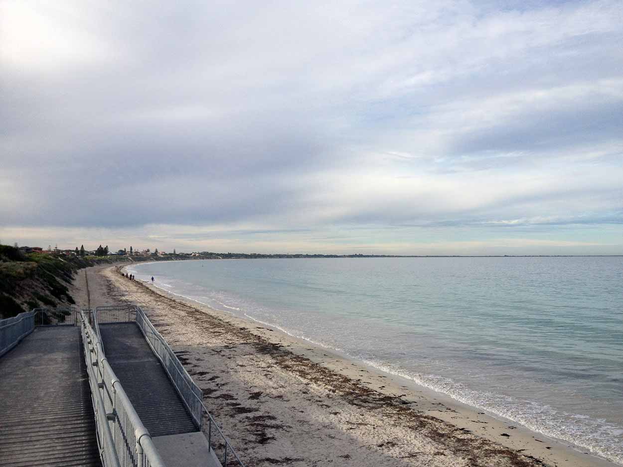
Warnbro Sound
- Start or End: Safety Bay Yacht Club (Google Map Directions) or Port Kennedy Boat Ramp, which has a bus stop close by on Port Kennedy Drive (Google Map Directions).
- Length: 9.9 km (6.2 mi)
- Grade: Easy, completely paved, a little hilly through the dunes, beach walk optional
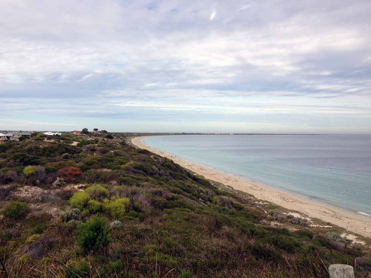
From the Safety Bay Yacht Club this section of the hike heads south to Port Kennedy. This is the longest stretch of the hike, however it is the best paved and provides some spectacular beach views. A highlight of the walk is the section which deviates of away from the road (at the corner of Warnbro Beach Road and Shelton Road) and heads into the dunes. Climb the stair cases to the highest dunes to get the best views. There are also plenty of opportunities for a walk along the beach.
After 25 km of walking you may need a cool down. There is a nude beach at the stretch near the Port Kennedy Golf Club if you are keen, but if that is not your thing the calm waters at the southernmost end of the hike are perfect. Actually, all the beaches along this section are worth of dip.

Click Here To Read More ...
View Photographs
RockinghamVisitorCentre.com.au: Official Rockingham visitors centre
ExperiencePerth.com: Official home of travel and tourism for the Perth metropolitan area
Hello, I'm Marc and welcome to metrotrekker.
Be it seeing the city sights, exploring parklands and gardens, urban walks or day-hikes in the city outskirts, the metrotrekker website details walking routes and hiking trails accessible by foot and public transport in metropolitan areas.
The metrotrekker website provides you with all the details required for metropolitan exploration:
- a map with geolocation and a selection of map types (street, satellite, topographical)
- navigation formats compatible with common GPS devices, desktop browser/software or mobile apps
- trail length and difficulty
- start and finish options (particularly by public transport)
- photos/videos
- attractions or points of interest along the way
- other walks and hikes nearby
- often a story or detailed description of the trail (I have personally walked every single trail on the website)
- a comments section, so feel free to write about your experiences as well
- and more improvements and resources are continually being added
So let's get outside and explore our great metropolitan areas by foot. Click Here to begin exploring with metrotrekker.
Pleasant Trails,
Marc
Links To Help You Navigate