- Start or End: I started at my hotel in Little India (Google Map Directions) and finished at Marina Bay Sands (Google Map Directions).
- Length: 4.7km (2.9mi) in about 1.5hr (not including the ride on the Singapore Flyer)
- Grade: Easy. Flat and fully paved.
- Date Walked: 22nd of October 2013
Trendy laneways, jungle covered highways, private carriages and the paparazzi. A walk to the Singapore Flyer and the Marina Bay Sands SkyPark.
Today's metrotrekking in Singapore is going to start with a visit to Marina Bay to check out the views from the man-made heights of the Singapore Flyer and the SkyPark of the Marina Bay Sands. I could just take the train there, but it is a lovely morning so I think I will walk and along the way visit Kampong Glam again. But first I need to find some breakfast. I have had Indian food far too much already so I wander around Little India until I find something different. I decide on a Chinese eatery on Dickson Road and order some noodles for breakfast. Noodles are not a breakfast food I generally have, but I really enjoyed it. Batteries are now full so it's off to my first destination of Kampong Glam.
There is an awful amount of construction around Jalan Besar road that I have to contend with first. Looks like there is going to be a new train station here. I make my way through the maze of diversions, across the Rochor River and finally make it onto Arab Street. Along Arab Street I get a good view of the colourful Rochor Centre, which I have walked past a number of times on my way between my hotel in Little India and the Bugis train station. The Rochor Centre is a mixture of flats, retail businesses and a large food centre. The colour scheme reminds me of the Old Hill Street Police Station in the colonial district. The bright colours do burn my retina, but it is much nicer than the grey of concrete.
Click Here To Read More ...

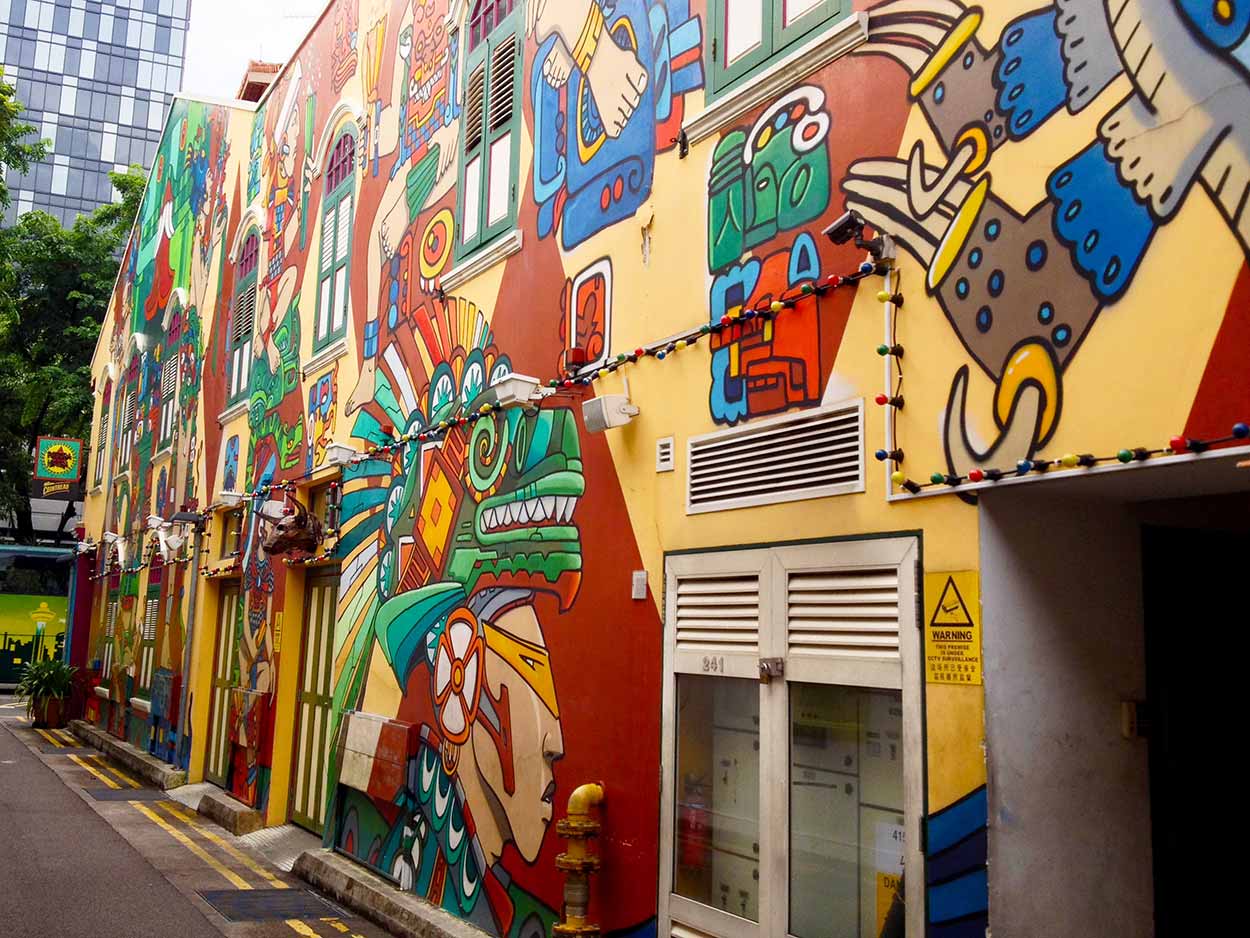
I make a loop around Kampong Glam along Pahang Street, Jalan Sultan and North Bridge Road, taking in some great examples of shophouse architecture and the Sultan Mosque, which I visited a few days ago. Off North Bridge Road, just south of Sultan Mosque, is Haji Lane. Haji Lane is a charming, brilliantly coloured laneway full of cafes, shops, bars and artwork. I must be here too early in the morning as the laneway is completely deserted and all the businesses are closed up. Lucky me, I get to enjoy the artwork all myself. My favourite part of the artwork along Haji Lane is at the easterly end on Beach Road, where there is a large Aztec inspired mural.
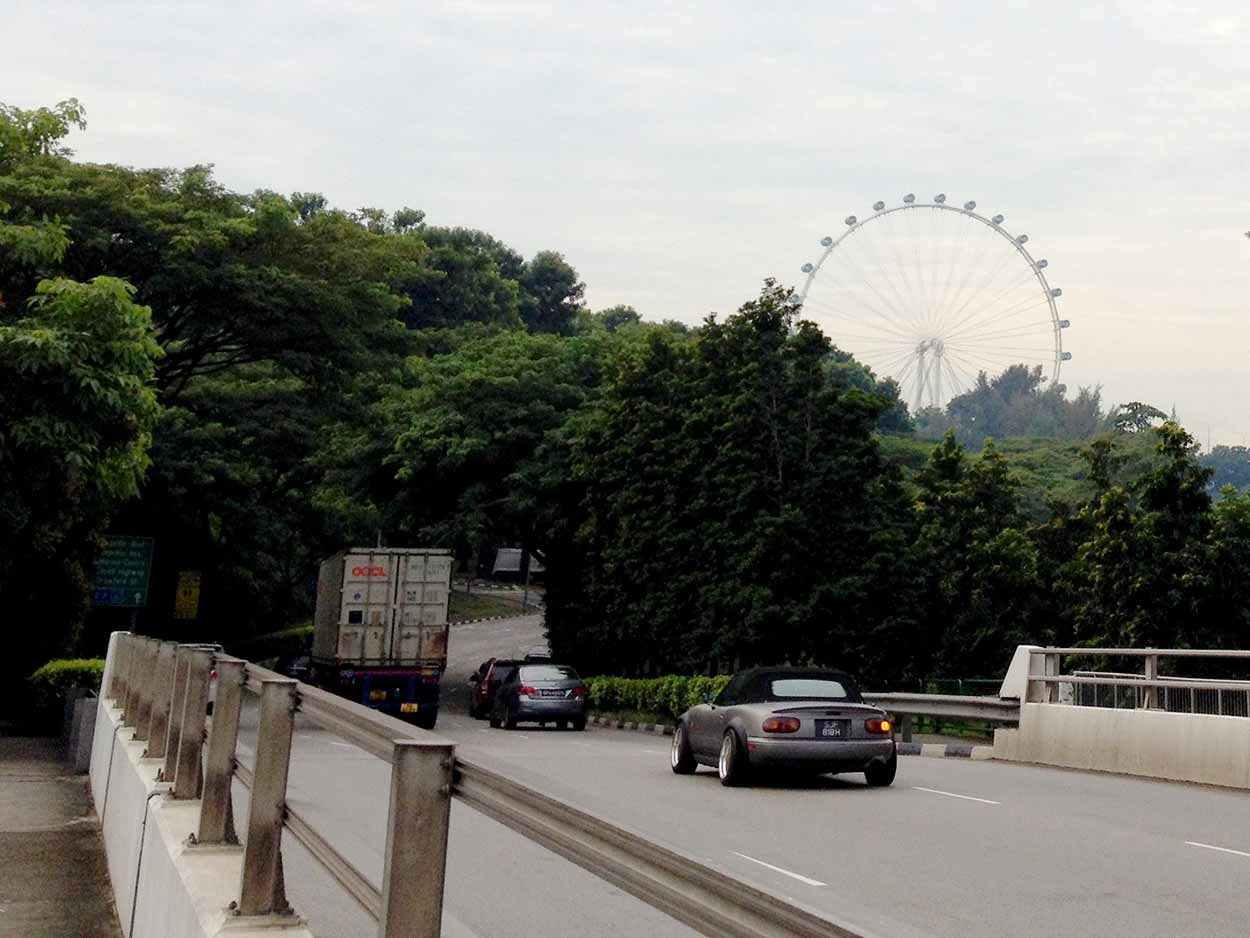
Leaving Haji Lane I catch of glimpse of my next destination, the Singapore Flyer, as I cross along the Ophir Road overpass. Damn that looks high!
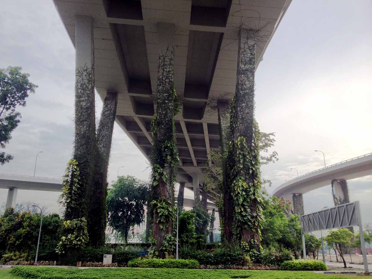
The walk along Ophir Road and Republic Boulevard is not the most inspiring. It is basically just a path along very busy roads. However, the large jungle vines creeping their way up the pylons of raised highways looked really cool.
Soon enough I am at my next destination, The Singapore Flyer, just at opening time. As they say, the early bird gets the worm. In my case the early walker gets a Singapore Flyer carriage all to himself.

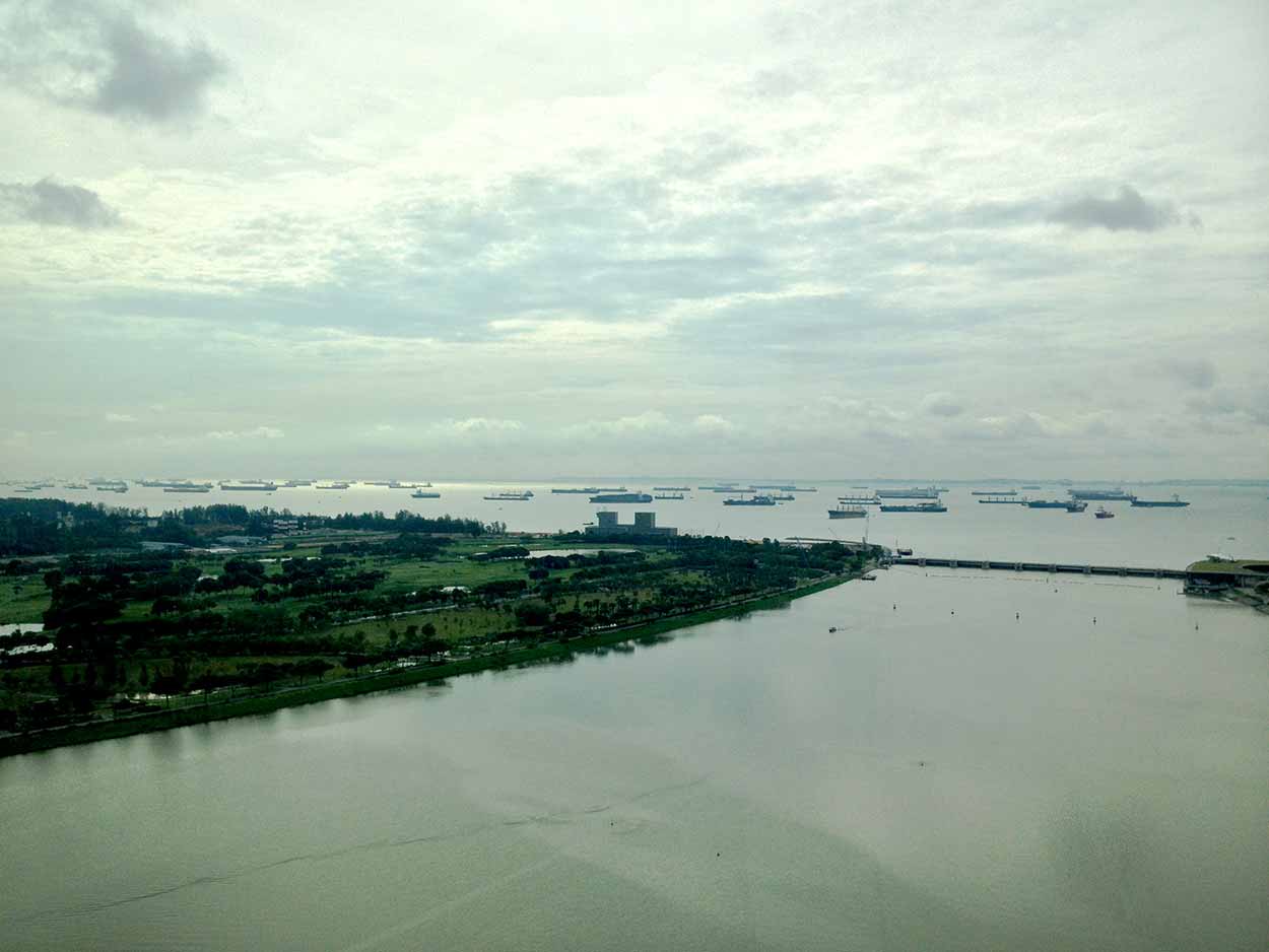
As you may already know, I am not a fan of heights. However the Singapore Flyer was awesome. This is probably the best attraction I have been to so far. One, because it is air-conditioned and two, the views are spectacular. He is a few examples of what you get to see (my only complaint is that the windows were a bit grubby, which makes it hard to take good photos).
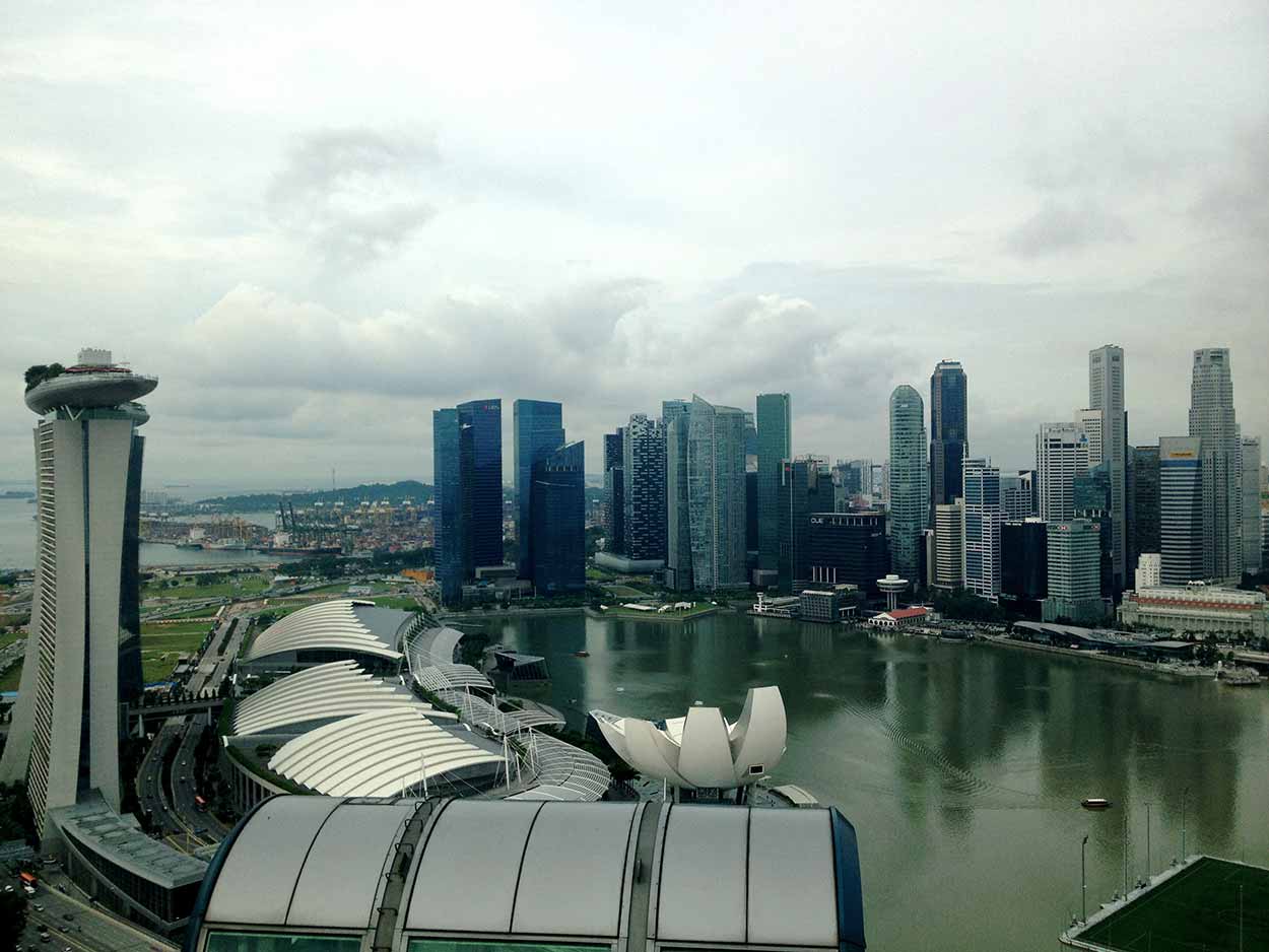
While I was up in the clouds I noticed these really strange structures behind Marina Bay Sands that looked like weird sort of trees. Between the trees I could just make out bridges and people walking on them. Also, there are these futuristic glasshouses right on the water.

What the hell is that? Can't remember coming across this in my research about Singapore. Once I did a quick bit of internet research on my phone I found that the weird trees and the glasshouses are part of a new attraction called Gardens by the Bay. Ok, so I am definitely going to have to check that out. Not just because it looks cool, but entry is free!
After returning to earth from the Singapore Flyer it is to the next man-made height of Singapore on my list, the SkyPark of Marina Bay Sands. The SkyPark is only a short walk down Raffles Avenue and then across the Helix Bridge, which I walked across a couple of days ago. Once in the Marina Bay Complex it was a short walk through the mall and its expensive retail outlets, and then into the hotel lobby where I found the entrance to the SkyPark. You would think that after paying I would take the elevator to the top and enjoy the views right? Wrong! Before I could enjoy the observation deck I had to deal with the paparazzi. You know, how you have to get your picture taken in front of a blue screen so they can then try and sell you some crappy picture of yourself superimposed on a picture of the SkyPark. This really gives me the shits. Sure, I can't blame them for trying to bleed tourists dry, but just leave me alone when I say I am not interested. I refused to smile at all for the forced photographs.
In a nutshell, the SkyPark observation deck is shithouse. There is no shade and the views from the Singapore Flyer are much better. Can't believe I paid $20 for this. Anyway, here's a picture.
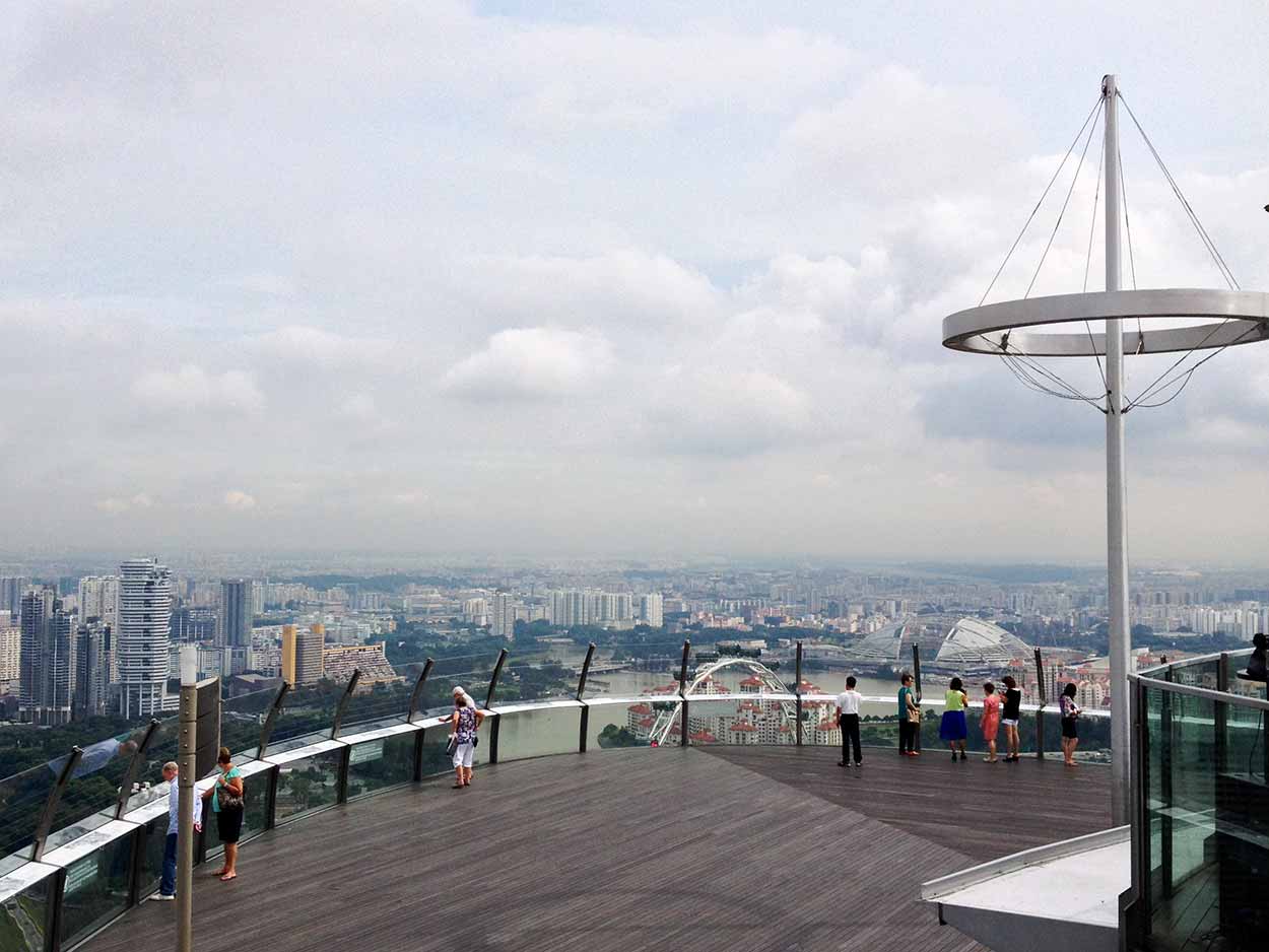
As you may have guessed, I didn't buy the picture from the hollering SkyPark gift shop employees as I left. I hate it when you are forced to go through the gift shop on the way out. What a tourist trap!
Maybe I am being a bit melodramatic about the SkyPark. Sure the Singapore Flyer is a bit more expensive at $33, but it is well better. I seriously have the shits now. Bloody paparazzi! Screw you SkyPark, I'm taking the train back to Little India to have lunch and a few beers.
Click Here To Read More ...
Click Here To Read More ...
Click Here To Read More ...
View Photographs
Hello, I'm Marc and welcome to metrotrekker.
Be it seeing the city sights, exploring parklands and gardens, urban walks or day-hikes in the city outskirts, the metrotrekker website details walking routes and hiking trails accessible by foot and public transport in metropolitan areas.
The metrotrekker website provides you with all the details required for metropolitan exploration:
- a map with geolocation and a selection of map types (street, satellite, topographical)
- navigation formats compatible with common GPS devices, desktop browser/software or mobile apps
- trail length and difficulty
- start and finish options (particularly by public transport)
- photos/videos
- attractions or points of interest along the way
- other walks and hikes nearby
- often a story or detailed description of the trail (I have personally walked every single trail on the website)
- a comments section, so feel free to write about your experiences as well
- and more improvements and resources are continually being added
So let's get outside and explore our great metropolitan areas by foot. Click Here to begin exploring with metrotrekker.
Pleasant Trails,
Marc
Links To Help You Navigate