- Start or End: Start or end at either Hindhede Drive, Bukit Timah Nature Reserve (Google Map Directions) or MacRitchie Reservoir Carpark on Reservoir Road (Google Map Directions).
- Length: 14.6km (9.1mi) in about 3.5hr
- Grade: Hard. Mostly flat, but some small hills. Some paved trails, but also muddy tracks and some road walking. The heat and humidity is the main issue.
- Date Walked: 23rd of October 2013
More lush jungle, monkeys, a hair raising TreeTop Walk, kids with machine guns and an icy dessert.
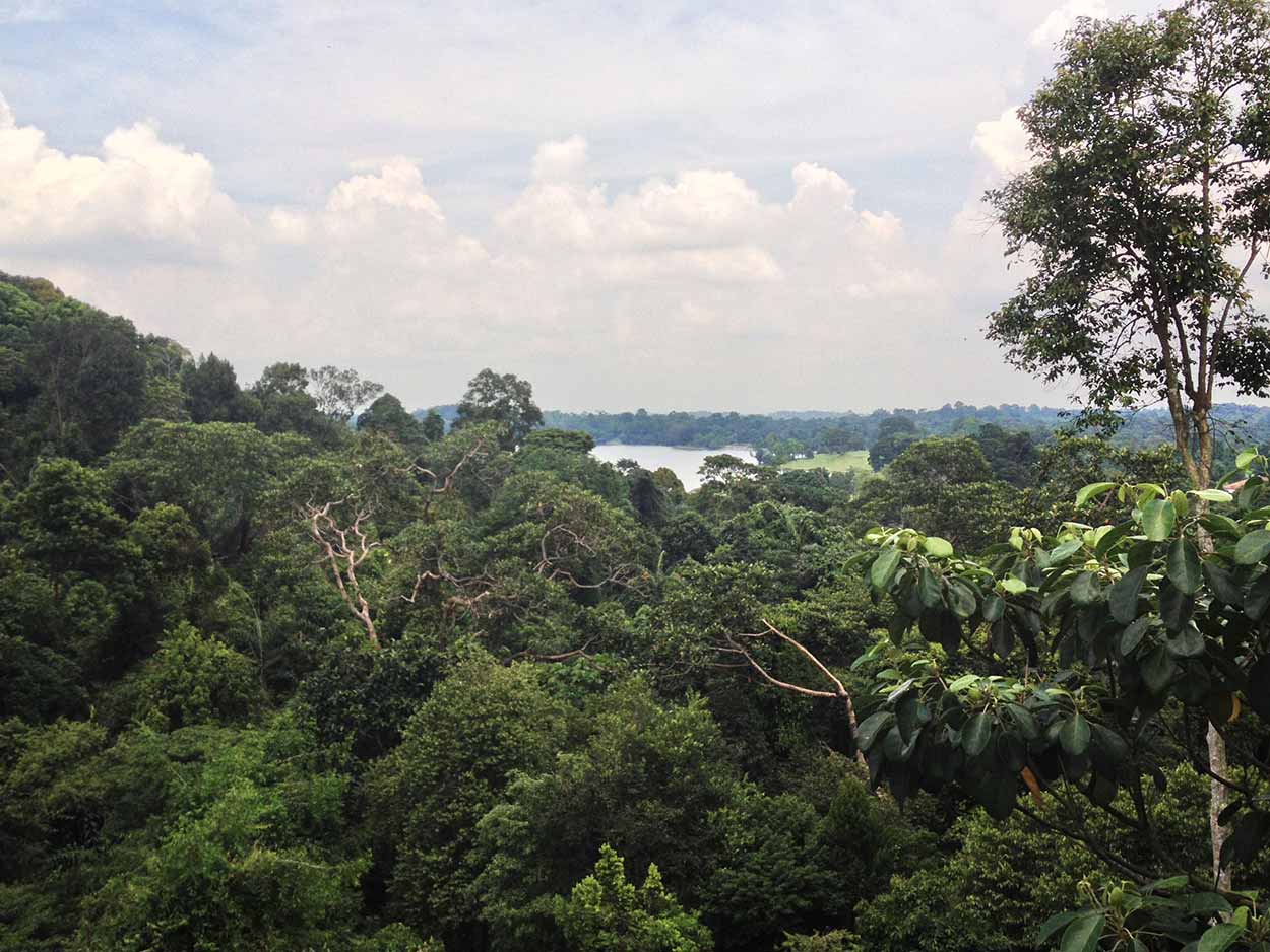
From Bukit Timah Nature Reserve I decided to take the Kampong Trail to MacRitchie Reservoir. A visit to MacRitchie Reservoir was definitely on the cards today as I had heard good things about the area, especially the TreeTop Walk. What wasn't on the cards was the massive walk over to MacRitchie via the Kampong Trail, which I had just discovered from a visit to the Bukit Timah Nature Reserve Information Centre. The 16.5km walk I was about to undertake was the longest single walk I had taken in Singapore and was going to be the longest of the whole trip.
Now, before I get into the details of my epic journey along the Kampong Trail I am going to start with the last picture I took on this walk.
Click Here To Read More ...

What you see before your eyes is an Ice Kacang, a dessert popular in Singapore which is made of shaved ice, red beans, corn kernels and coated with different flavours of sugar syrup. I bought this at the end of my walk at the Mushroom Cafe, which is located at the Amenities Centre of the MacRitchie Reservoir. Corn and red beans in a dessert I hear you say? Doesn't sound right does it, but it was just what the doctor ordered after the long walk I just took. After a 16.5 km walk through muddy tracks on a humid Singapore day with a monkey attack and a heart thumping walk across the TreeTop Walk, the sugar hit from an Ice Kacang is the least I deserved.
Ok, so that's enough about the dessert I had after the walk, what about the actual walk? This is a walking blog, not a culinary blog after all. The Kampong Trail starts just south of the Bukit Timah Nature Reserve Information Centre and is clearly signposted with a large map. It is rather well signposted most of the way as well. In a nutshell the Kampong Trail is a jungle walk serviced by clear, wide, flat but sometimes muddy tracks. However, the last stint of the walk is along Rifle Range Road with little dedicated pedestrian pathway, but that didn't matter as the road was rather traffic-less.
The Kampong Trail is made up of a number of smaller linked trails as shown in the map box below.

The first part of the trail is called the Pandan Trail and it heads in an easterly direction from the entrance of Bukit Timah Nature Reserve towards and then around the Bukit Timah Rifle Range. The trail was very peaceful and extremely lush.

The Pandan Trail then intersects with Rifle Range Road and follows the road in a northerly direction. This section is aptly named the Rifle Range Trail and is not as quiet as the Pandan Trail due to the proximity to the road, but nonetheless it was an enjoyable walk, if not a little muddy.

The Kampong Trail then deviates away from Rifle Range Road onto the Nangka Trail, which once again is full of lush vegetation.

At the end of the Nangka Trail there is a fork in the road, both paths of which are part of the Durian Loop. I took the northern path of the loop. Not sure why I went this way, it just seemed the most inviting I guess. As the name suggests the Durian Loop has a number of Durian trees. A Durian is a large fruit growing up to 30cm in length with a hard thorn covered husk, which has a strong, pungent and offensive (to some) odour. Eating a durian is said to be like eating custard in a public toilet. I couldn't smell anything too offensive around the Durian Loop but I did come across a few large smashed durian husks around. The fruit inside was probably devoured by the local wildlife.
Throughout the stroll along the Durian Loop I heard a number of crashes in the jungle. My guess is that the sound is either monkeys falling out of the trees or large Durian fruit crashing to the earth. Either way I kept my head up the whole time looking out for aerial bombardment. Apart from the problem of raining down killer fruit, the batteries on my phone were running very low and needed a recharge using my portable charger. So unfortunately I didn't get any pictures along this section, but to put it simply ... more jungle.
After the Durian Loop the Kampong Trail meets Jalan Kampong Chanteck road and follows it north along a reservoir up to Rifle Range Road. The trail then follows Rifle Range road all the way to the MacRitchie Reservoir Nature Reserve with rarely any dedicated pedestrian paths. The walk along Jalan Kampong Chanteck and Rifle Range Road is not the most enjoyable walk in the world as it is just a road amongst more jungle. There was a lot of shade though, which is a plus, and the road was quiet, so I didn't have to jump out the way of cars too many times.

Sure Rifle Range Road was not the most enjoyable walk I have ever taken, but there was a small amount of "excitement". As I walked along I could see in the distance some movement along the road. With a squint through the humid air I saw my first Singaporean monkeys! There were about 10 of them. Ok, so I am trekking along a road, but I finally feel I have reached Singapore's wild side. As I approached a lot of them scattered, but one stayed behind with the plastic bag they were all gathering around (must be some food in there, either that, or the monkeys are into autoerotic asphyxiation ... dirty monkeys).

Just as I took the picture above the little monkey bastard had a go at me. Snarled, exposed its sharp, gleamy white teeth and lunged at me. I was just walking along the road and I didn't even get that close! I quickly scampered to the other side of the road fearing it would bite me and give me rabies or whatever diseases filthy monkeys have. My God I can't stand monkeys. Horrible little shits they are. Really should have kicked the little mongrel back into the jungle where it belongs. I guess I shouldn't be so harsh, I don't like having my picture taken either.
So the last section of the Kampong Trail was not the best, but the majority of it was rather good. The best feature of the Kampong Trail? There was absolutely no one on it (apart from monkeys). I did not see another walker on the trail until it ended at the MacRitchie Reservoir area. Despite the lack of other walkers I never felt desolate as a lot of the time you could still hear traffic and the rumbling of Singapore city in the distance.
Walking along the Kampong Trail was rather enjoyable, but I did find it a little repetitive with all the trees. Think this is why I enjoy trekking around cities the most. The whole bushwalking and nature thing isn't really for me. It's not that I am against nature (except angry monkeys that is) it's just that I have a short attention span and I need constant input. Saying that though, the peacefulness of the surroundings was very pleasant and well worth the trek.
At the end of Rifle Range Road the Kampong Trail ends and I enter MacRitchie Reservoir Nature Reserve. Guess what ... more jungle!

However, MacRitchie Reservoir Nature Reserve is a bit more than just paths through the jungle, there are also some interesting sights as shown on the map box below.

The main sights on the northern side of the reserve are the Jelutong Tower and the TreeTop Walk, while along the actual reservoir there are a number of boardwalks along the banks. I am currently on the north-western side of the park so what should I check out first, the Jelutong Tower or the TreeTop Walk? Think I will go with the TreeTop Walk.
Access to the TreeTop Walk is gained from the Sime Track and then the Peirce Track. What's confusing me is that TreeTop Walk is located on a loop, which is only one way. Why would the path be only one way? Anyway, I make my way to the one way loop through the jungle. Once again the path is a little muddy and within thick vegetation. The only real surprise along the walk was a group of about 8 kids carrying machine guns. Yep, that's right ... machine guns. Felt like I was in some sort of Lord of the Flies combined with Rambo movie scene. Well they weren't really kids, probably teenagers or twenty something's carrying out military service. They gave me an absolute fright when I first noticed them grouped within the jungle. They seemed friendly enough and I think they realised that they startled me.
After almost pooing my pants due to kids with guns I made it to the TreeTop Walk. It was relatively easy to get there, but it did get a little hilly on the Pierce track just before the entrance to the walk. Just before the entrance to the TreeTop Walk is a little hut, and within the hut was a park employee overlooking the entrance. Why is there a guy stationed here in the middle of nowhere? I said a quick hello (he was one of the few people I had seen on this walk) and continued to the entrance. Ok .. now I understand why the loop to the TreeTop Walk is only one way, and now I understand why someone is guarding the entrance. The TreeTop Walk has large secure doors that only allow you to pass in one direction. Once you enter the TreeTop Walk there is no going back, you have to finish it, or I guess beg the guard to let you out (i.e. the wimps exit).
After passing through the gate of no return I soon realise why some people may want to turn back. The TreeTop Walk is extremely high and the bridge gets some motion as you walk across.

So now my heart is racing and the fear of heights is definitely kicking in. I am seriously considering begging the guard to let me out and once and for all destroying my manhood. Oh why, Oh why did I not go to the Jelutong Tower instead (on second thought that would probably be just as bad). Instead I take a deep breath and head across. As I walk across my nerves did settle a bit, however I was very conscious of walking across in a constant soft stride to limit any motion of the bridge. I am praying that no one else hops on the bridge and starts shaking it with their discourteous rough walking. Despite the nerves and spending most of the time with my head down I did manage to take some pictures.
Really wish I wasn't such a wuss when it comes to heights. I walked all this way to experience what is a really awesome TreeTop Walk, and then I rush across it so I don't wet my pants. Anyway, I am glad I came and I would definitely recommend it to those who can take heights.
The TreeTop Walk has been achieved and now I need to complete the loop to get back to where I began. The section of the loop from the TreeTop Walk back to the Sime Track, the Petaling Trail, is extremely well serviced with a raised boardwalk the whole way. No muddy tracks here, but still plenty of jungle.

I am really starting to get sick of walking now and my stomach is starting to grumble. Unfortunately, I am out in the middle of nowhere and need to make it back to civilisation before I can even think about food and getting back to the hotel for a well-deserved rest. Think I am going to have to pass on the Jelutong Tower and make my way down the eastern side of the reserve back to civilisation.
Along the eastern side of the MacRitchie Reservoir is the MacRitchie Nature Trail, which is very similar to all of the tracks I have been on today. The MacRitchie Nature Trail is the quickest way back to civilisation (N.B. on hindsight I could have got out easier taking the Venus Loop to the north-eastern exit) but it is kind of boring, so I am tempted by the Petai-Prunus Trail (two trails off the MacRitchie Nature Trail), which gets out of the deep jungle and snakes its way around the water's edge. Really happy I took the Petai-Prunus Trail, sure it took longer but the boardwalk along the water's edge was a nice change.

Soon enough I was at the Mushroom Cafe located on the southern bank of the MacRitchie Reservoir devouring a curry and then that beautiful Ice Kacang mentioned earlier. That is definitely enough walking today, time to get back to Little India and rest my weary legs.
What does tomorrow have in store? I can tell you one thing, definitely no jungle. That's enough jungle for this trip.
Click Here To Read More ...
Click Here To Read More ...
Click Here To Read More ...
View Photographs
Hello, I'm Marc and welcome to metrotrekker.
Be it seeing the city sights, exploring parklands and gardens, urban walks or day-hikes in the city outskirts, the metrotrekker website details walking routes and hiking trails accessible by foot and public transport in metropolitan areas.
The metrotrekker website provides you with all the details required for metropolitan exploration:
- a map with geolocation and a selection of map types (street, satellite, topographical)
- navigation formats compatible with common GPS devices, desktop browser/software or mobile apps
- trail length and difficulty
- start and finish options (particularly by public transport)
- photos/videos
- attractions or points of interest along the way
- other walks and hikes nearby
- often a story or detailed description of the trail (I have personally walked every single trail on the website)
- a comments section, so feel free to write about your experiences as well
- and more improvements and resources are continually being added
So let's get outside and explore our great metropolitan areas by foot. Click Here to begin exploring with metrotrekker.
Pleasant Trails,
Marc
Links To Help You Navigate