- Start or End: I started at Esplanade Park (Google Map Directions) and finished on the Clarke Quay side of Fort Canning Park (Google Map Directions).
- Length: 2.7km (1.7mi) in about 45min
- Grade: Easy. A short walk, but it does get a bit hilly around Fort Canning Park.
- Date Walked: 20th of October 2013
Cricket clubs, rainbow colored police stations, epic stairs and jungle shade. A walk to and around Fort Canning Park.
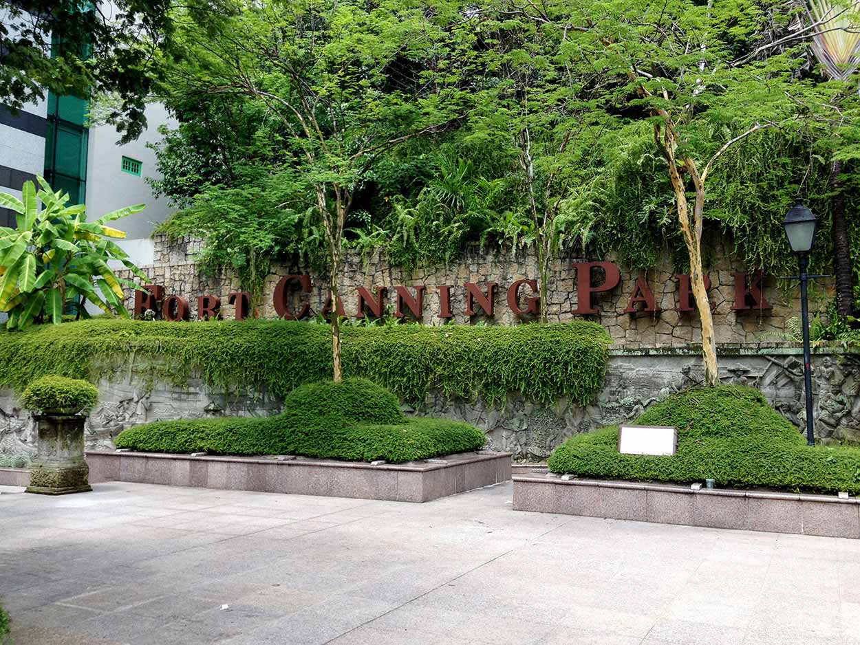
Think it is time to get out of the concrete jungle and experience the green jungle that is Fort Canning Park. Fort Canning Park is one of Singapore's most historic areas, with relics dating back to the 14th century when Malay Kings ruled over the area. Other historical events which occurred in Fort Canning Park include the construction of Government House, the home of Sir Stamford Raffles, which was later demolished to make way for a Fort. The park was also the location of the British surrender to the Japanese during World War II.
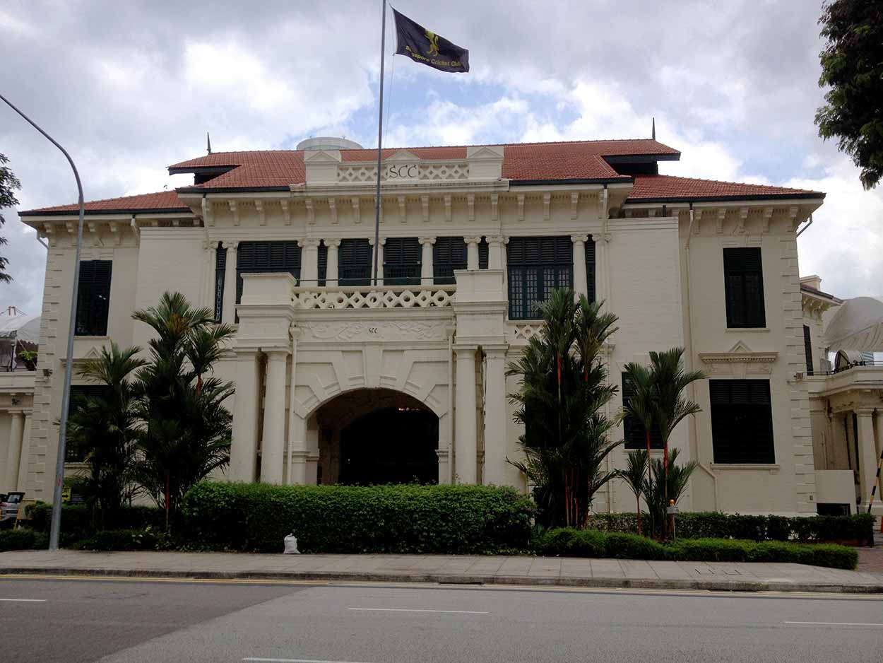
But before exploring the history of Fort Canning Park I need to get there from Marina Bay. On my way I pass through the colonial district and a number of impressive historical buildings. First on the list is the Singapore Cricket Club, which was established in 1852 and is supposedly one of the premier sports and social clubs in Asia. The current Singapore Cricket Clubhouse was built in 1887 with extensions constructed in the early twentieth century. I dare say you would have to be part of Singapore's elite to join this fancy club. I don't think the sort of cricket I play, which involves an old bat, a tennis ball, a garbage bin as stumps and a compulsory beer in one hand, would be welcome at this place.
Click Here To Read More ...
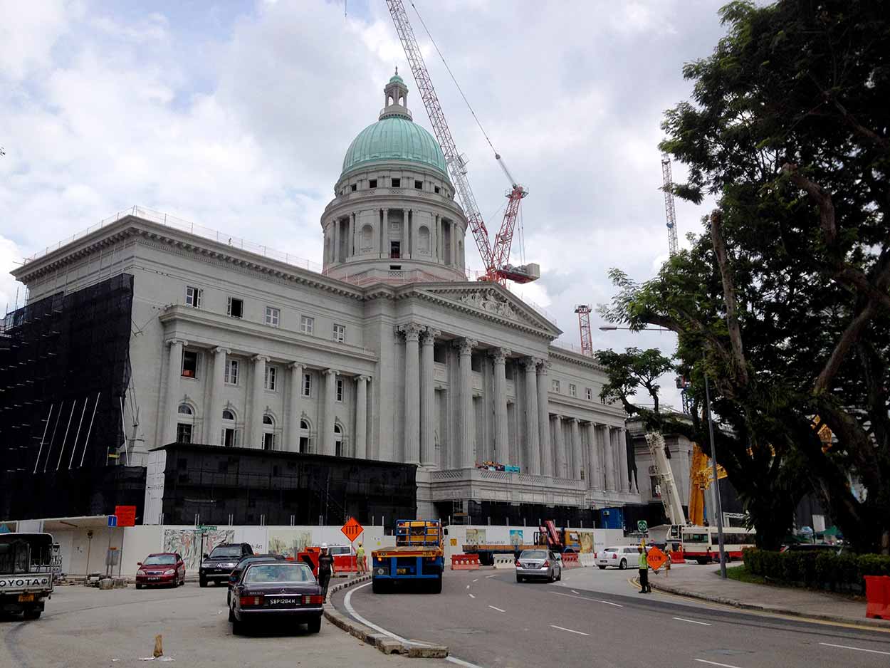
Across the road from the Singapore Cricket Club is the imposing Former Supreme Court Building, which backs onto the New Supreme Court Building that I passed by earlier this morning. As you can see from the cranes, scaffolding and road works, the Former Supreme Court Building is currently under renovation and will soon be home to The National Art Gallery. Think I like the classical design of the Former Supreme Court Building compared to the modern spin of the New Supreme Court Building.
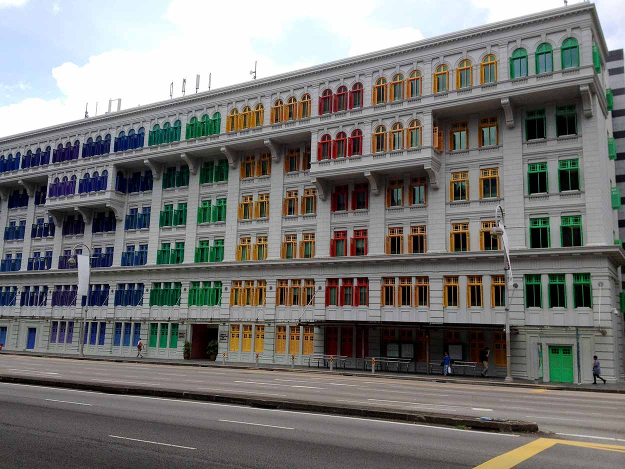
At the base of Fort Canning Park is the Old Hill Street Police Station which was built in 1934 and is now home to the Ministry of Communication and Information. It's hard to miss this building. You have to love the rainbow coloured window shades. Really adds to the character of the building and street.
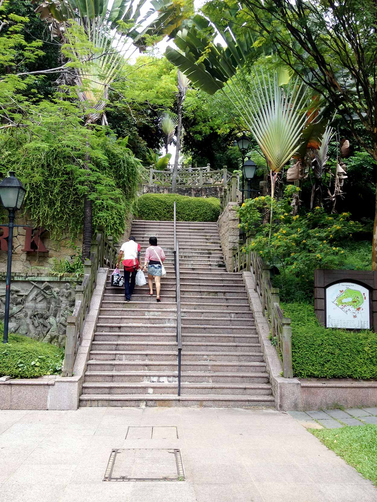
Just behind the Old Hill Street Police Station is Fort Canning Park and the ominous staircase leading into it. My plan was to come to Fort Canning Park and take a relaxing stroll under the shade, not climb a mountain! It wasn't really that bad and I should have realised the park was on a hill as it is home to a water reservoir that feeds the city.
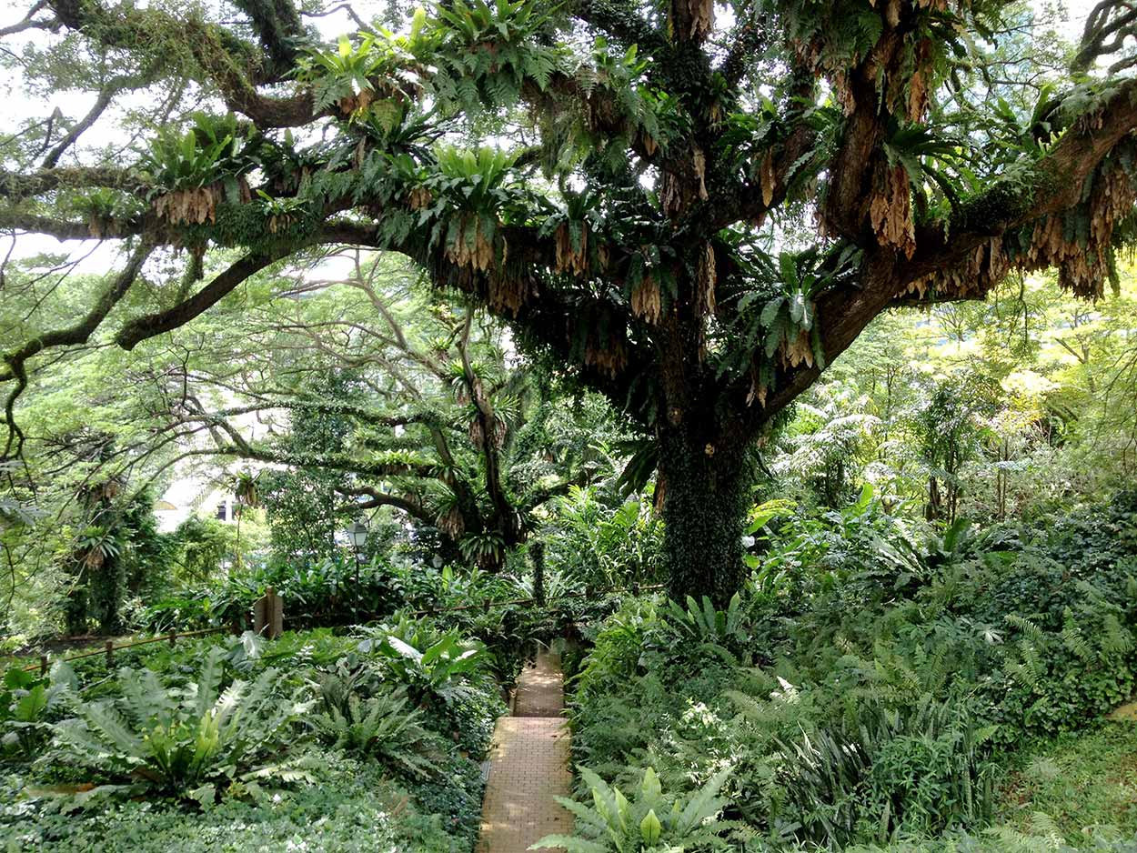
Within the park it is very jungle like with massive trees shading vast areas of green undergrowth. Dotted around the park are a number of cannons and other Fort like constructions. I have to admit, there wasn't that much going on and it wasn't the most exciting place I had been to today, but it is definitely worth a stroll, especially during the midday heat. I only walked a small fraction of the paths and definitely would like to explore more. But I want to get back to the excitement of the urban jungle.
After all the route tracking and photography with my iPhone it was running low on batteries. A nice sit in Fort Canning Park is the perfect opportunity to both recharge myself and the iPhone (using the portable charger that I bought in preparation for this trip).
One thing I have noticed already during my time in Singapore is the plentiful vending machines offering cool drinks. They seem to be around every corner, which is handy in this climate. Apart from the standard Coke and water the vending machines also offer some drinks I have never seen before. This time I tried an aloe vera juice. Cactus juice? That's a bit weird. I was a little apprehensive at first but it was really nice and refreshing and I particularly liked the chucks of aloe vera.
As I enjoy a cactus juice I contemplate the next leg of my journey. Think I might head into Chinatown.
Click Here To Read More ...
Click Here To Read More ...
Click Here To Read More ...
View Photographs
Hello, I'm Marc and welcome to metrotrekker.
Be it seeing the city sights, exploring parklands and gardens, urban walks or day-hikes in the city outskirts, the metrotrekker website details walking routes and hiking trails accessible by foot and public transport in metropolitan areas.
The metrotrekker website provides you with all the details required for metropolitan exploration:
- a map with geolocation and a selection of map types (street, satellite, topographical)
- navigation formats compatible with common GPS devices, desktop browser/software or mobile apps
- trail length and difficulty
- start and finish options (particularly by public transport)
- photos/videos
- attractions or points of interest along the way
- other walks and hikes nearby
- often a story or detailed description of the trail (I have personally walked every single trail on the website)
- a comments section, so feel free to write about your experiences as well
- and more improvements and resources are continually being added
So let's get outside and explore our great metropolitan areas by foot. Click Here to begin exploring with metrotrekker.
Pleasant Trails,
Marc
Links To Help You Navigate