- Start or End: A loop walk starting at the Lesmurdie Brook Carpark on Palm Terrace (Google Map Directions). Could also start at the Lesmurdie Falls Carpark on Falls Road as well (Google Map Directions). I started at a bus stop on Lewis Road, near Anderson Road in Forrestfield (Google Map Directions), which is probably the best public transport option for Lesmurdie Falls. I finished by walking all the way to Welshpool Road East to catch the bus home (Google Map Directions). It was the quickest option at the time, but not the most convenient.
- Length: 10.0km (6.2mi) in about 5hr (I took a lot of time taking pictures)
- Grade: Easy to medium. Gravel paths most of the way, with a small section along the road. Some steep sections. Be careful at the bottom of Lesmurdie Falls as the rocks are slippery.
- Date Walked: 16th of September 2016
Taking the day off work to enjoy the flowers, panoramic views and waterfalls of Mundy Regional Park.
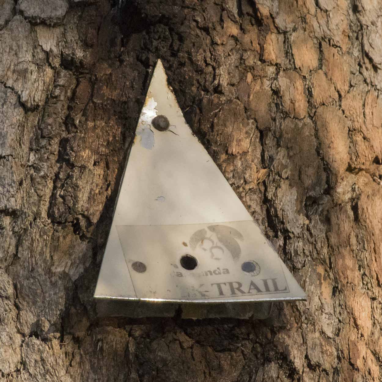
It's Friday, but no work for me today. Taking the day off to go hiking in Mundy Regional Park and Lesmurdie Falls National Park. I hear Lesmurdie Falls is certainly falling and hopefully, there are plenty of wildflowers to see. Today I am going to try the Palm Terrace Walk, which is marked by the City of Kalamunda.
I leave the city via Bus 288 at about 6:45 am from Elizabeth Quay Bus Port and arrive at the junction of Lewis Road and Anderson Road, Forrestfield, at about 7:30 pm. It's then just a short walk up Lewis Road before turning onto Palm Terrace and reaching the Lower Lesmurdie Falls Car Park. The trail starts at the south-west corner of the carpark (there are big rocks at the start of the path) and the first beige trail marker is easy to spot.
Click Here To Read More ...

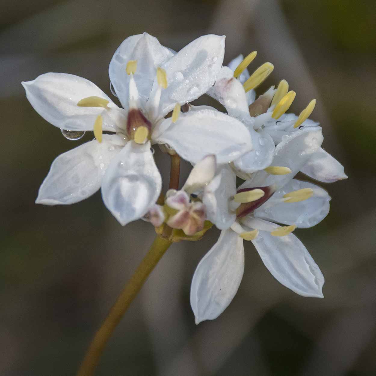
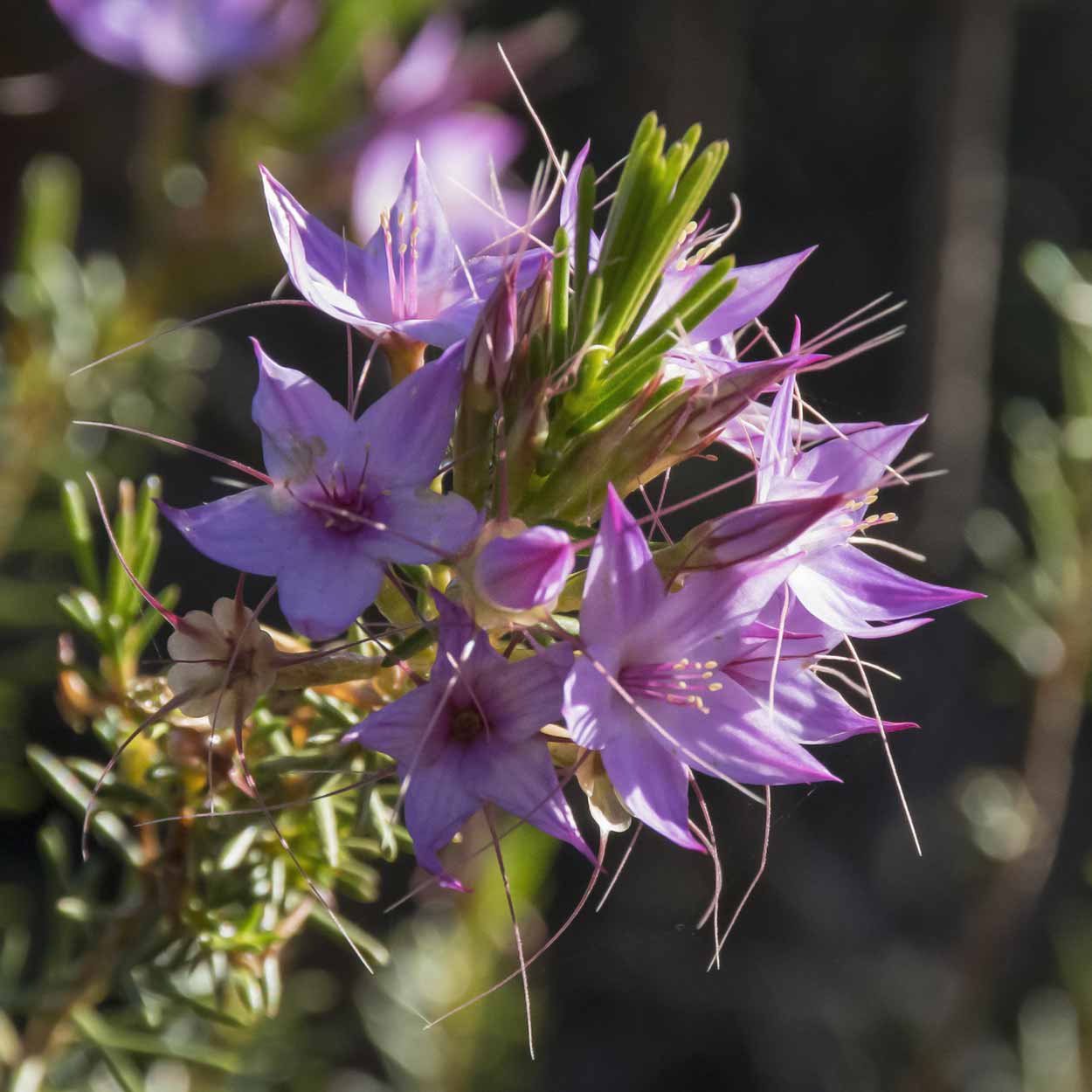
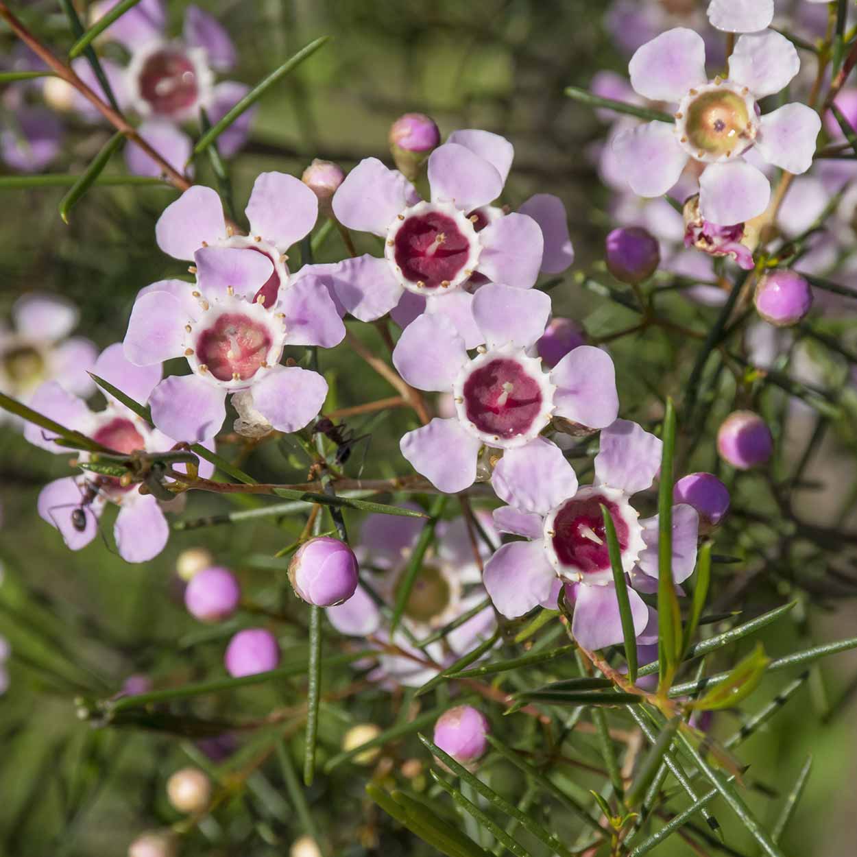
The southern section of the path is flat at first, but it does slowly get steeper (it's not that bad though). If your fitness levels aren't that high, you will have plenty of excuses to stop and have a rest if you are here when the flowers are in bloom. Couldn't believe how many there were! Took me ages to walk this section as the number of flowers was staggering.
And here is what the path is like ...
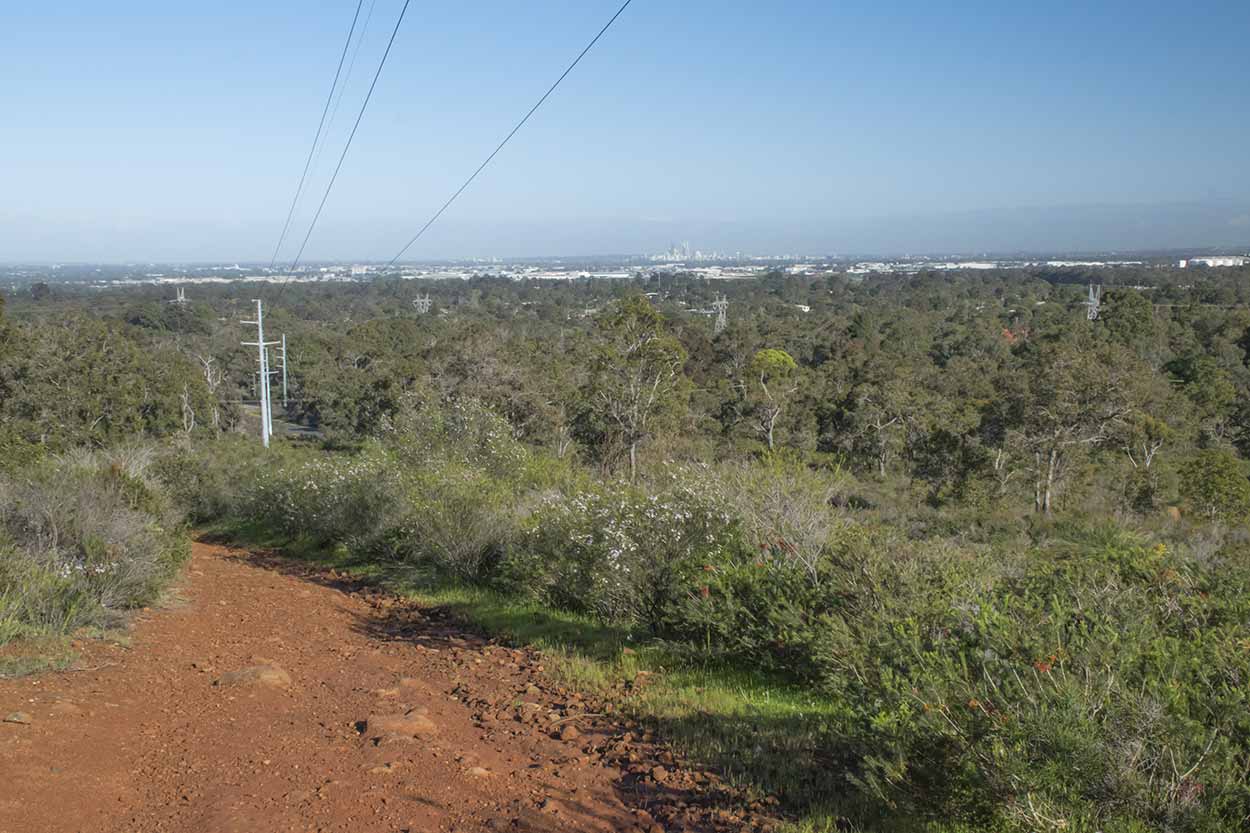

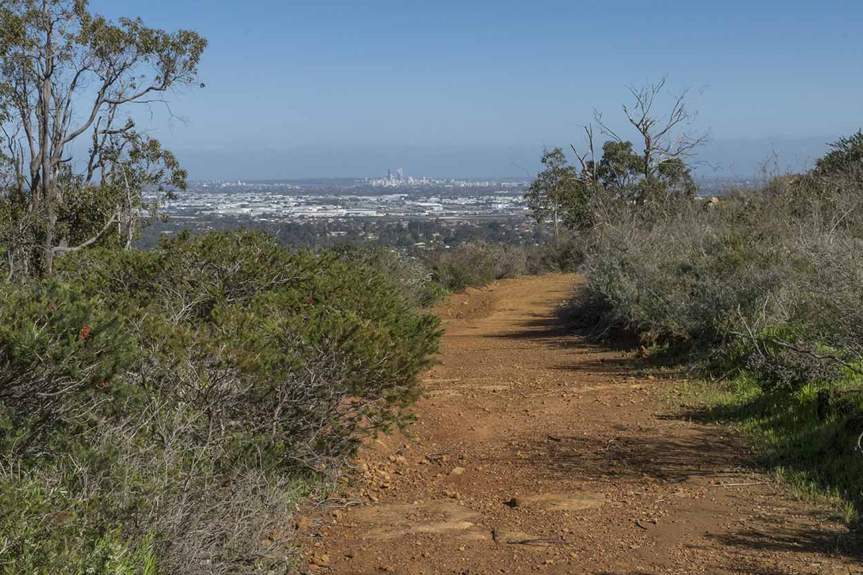
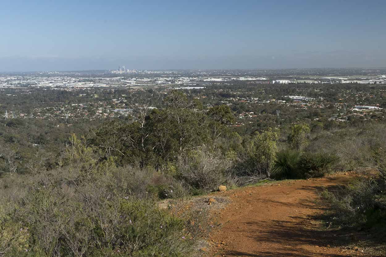
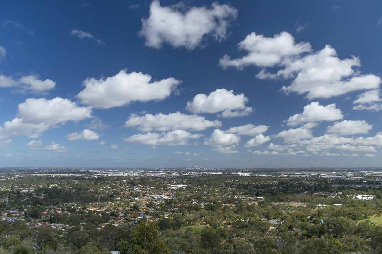
Not too steep and there are plenty of views over the Swan Coastal Plain to the Perth CBD (will need to look back if you are heading to the east as I am).
The ascent is basically finished when the path heads north and joins Falls Road, Lesmurdie. There are good views from here. I am rather jealous of the people that live along here. Good views and the perfect spot to walk out the door and go for a morning walk.

It's away from the road when I reach the Lesmurdie Falls Car Park. I lost my bearings around here, one because I came across this ...
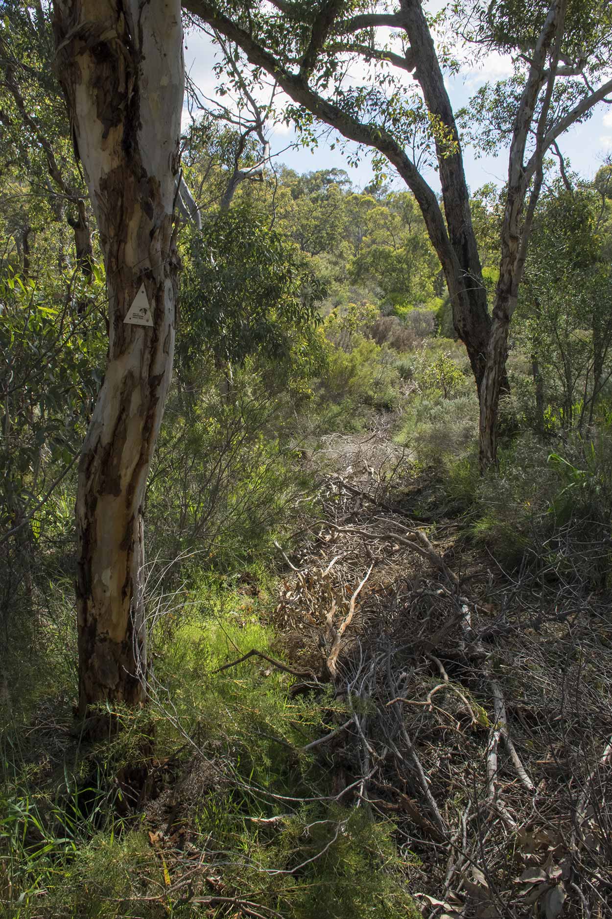
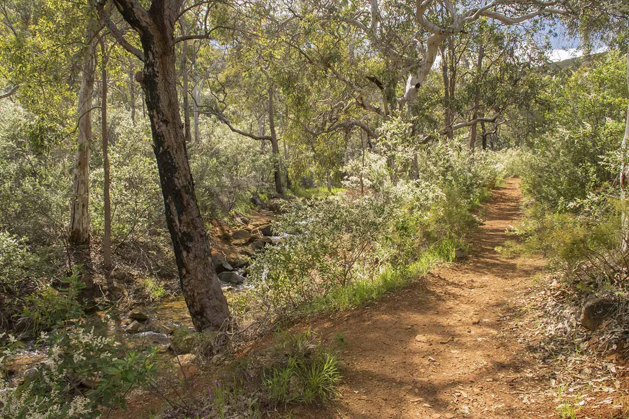
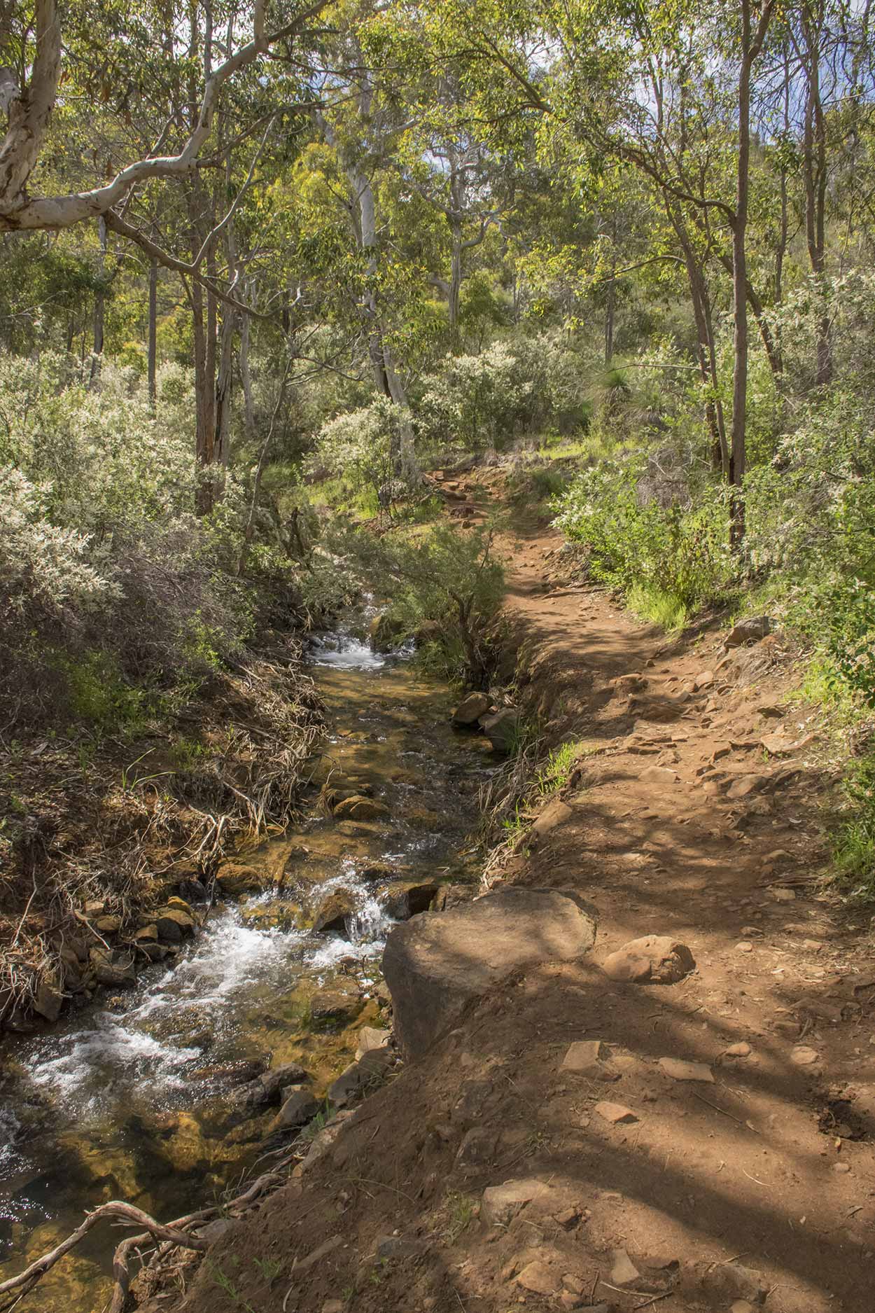
a clearly marked Palm Terrace Walk trail with branches strewn across it (the local authorities must be getting rid of this section), and two because the area along Lesmurdie Brook has had a significant upgrade. Nice wide paths now.

The Cascades are at this section of the path near the Lesmurdie Falls Car Park. I bought my small tripod along today to try and get some good photos of flowing water. Perfect spot to have a try.
One with a slow shutter speed ...
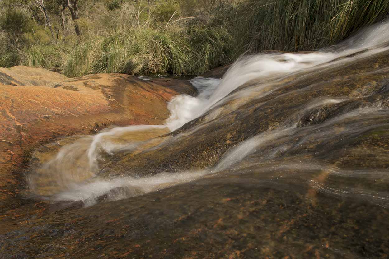
and one with a fast shutter speed ...

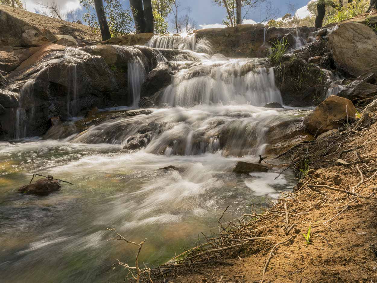
This small waterfall is near the bridge that crosses Lesmurdie Brook.
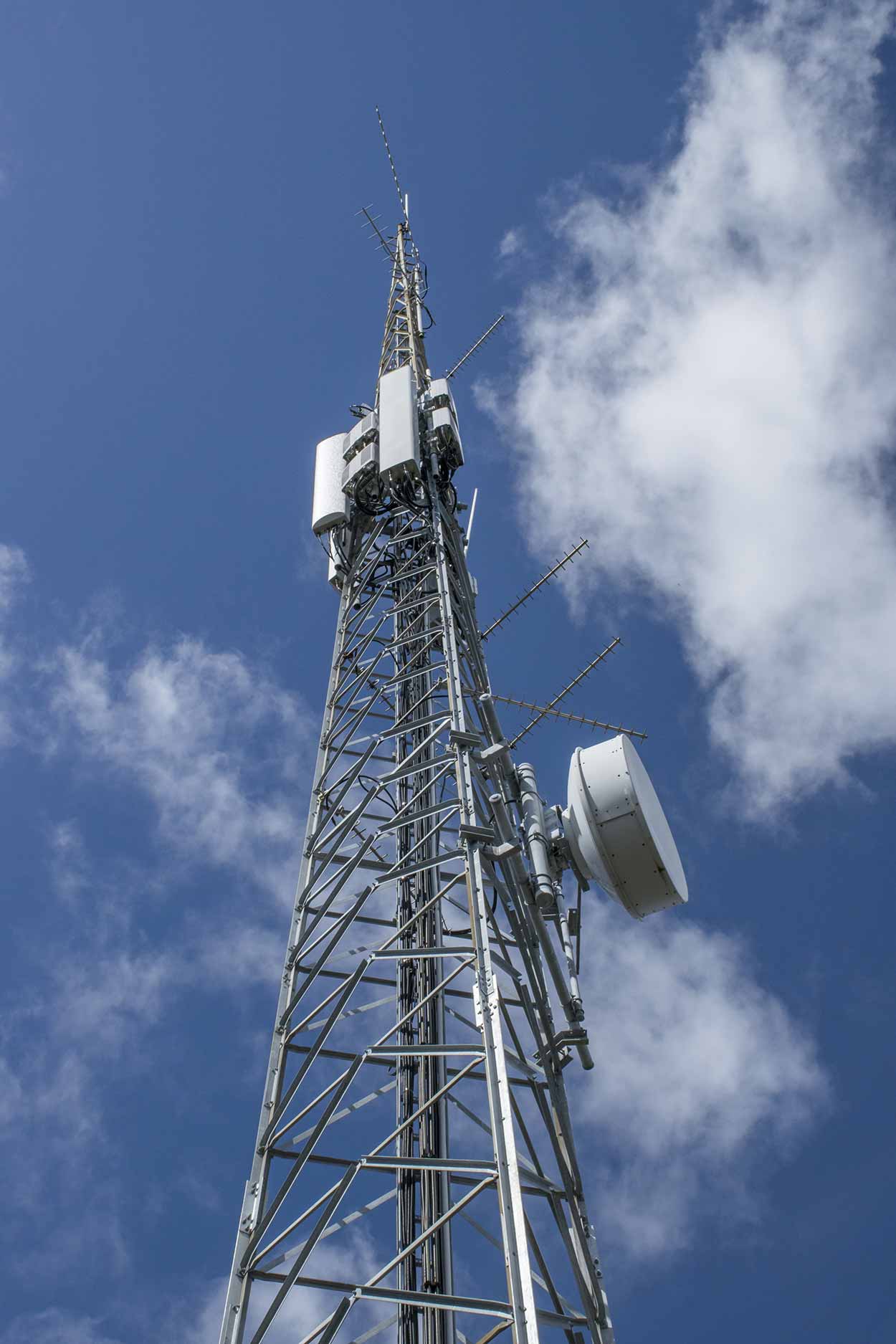
From the bridge, it is an uphill walk north along a not so exciting section to a telecommunications tower.
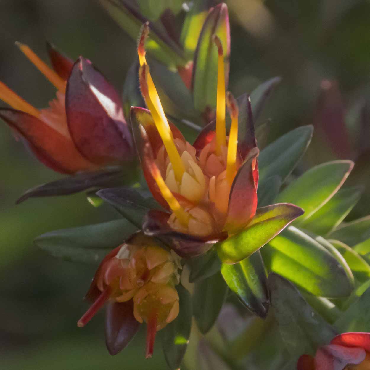
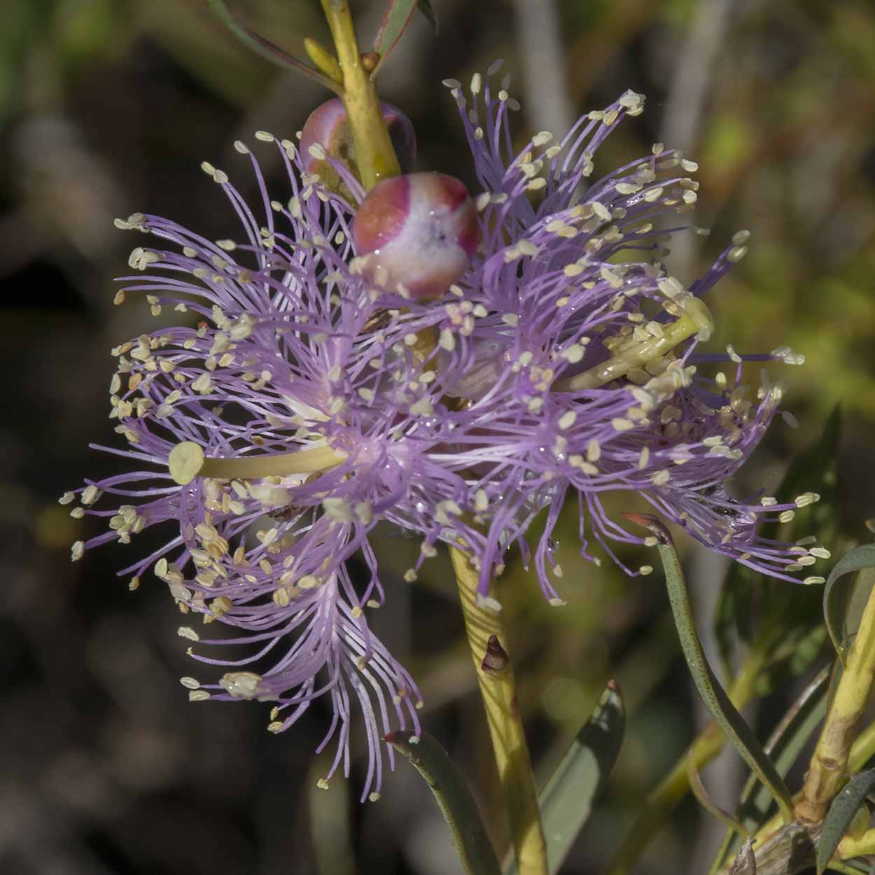
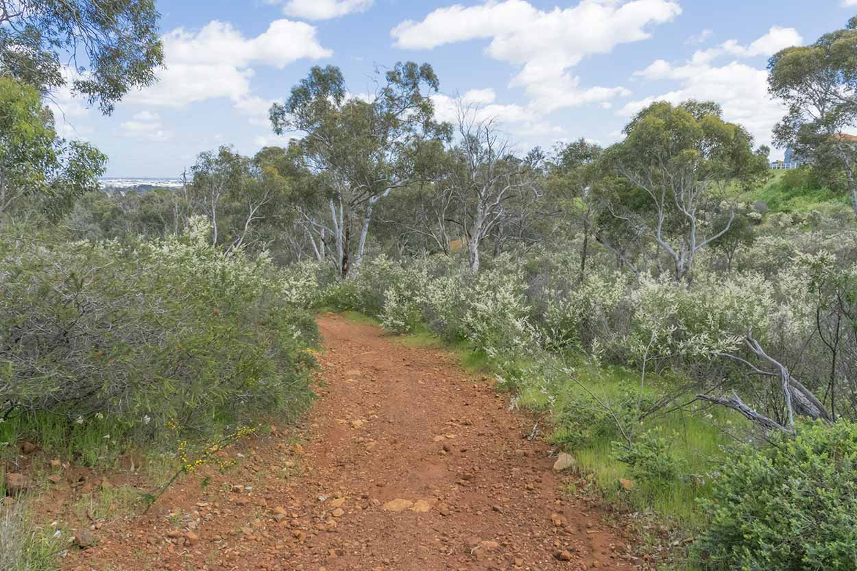
The section downhill from the tower is more exciting as I come across a few flowers under the tall trees.


It's also more exciting as the path is a little more difficult to traverse. It's a bit steep and eroded in places.


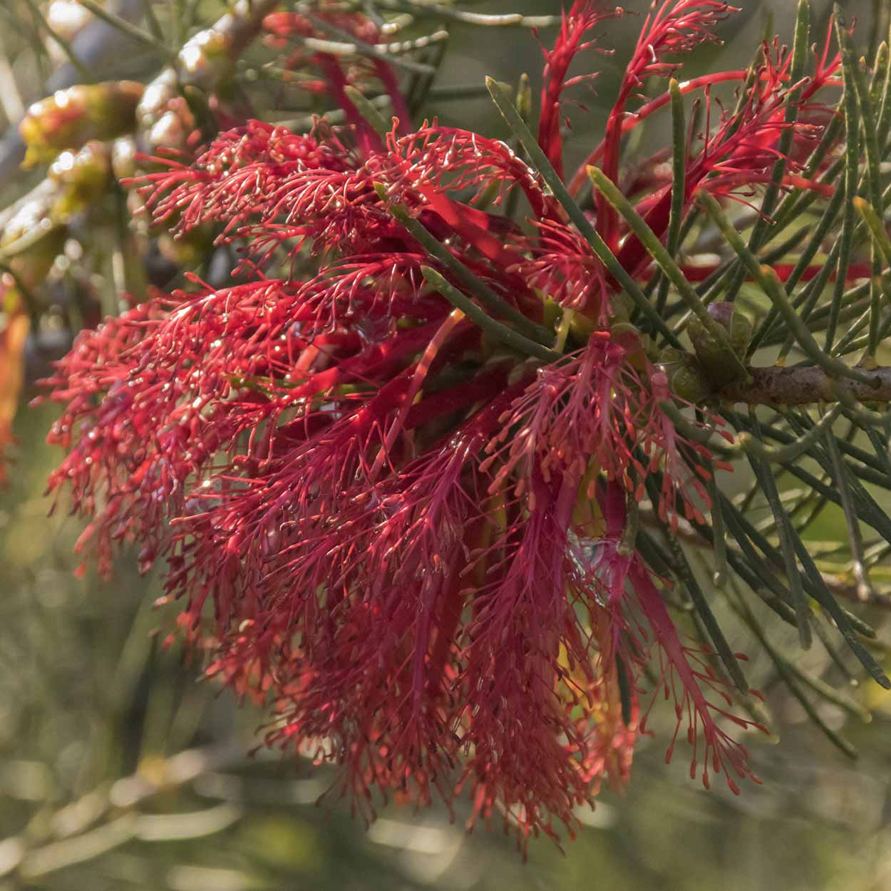
After a walk under the tall trees the path heads west and opens to areas of colour.
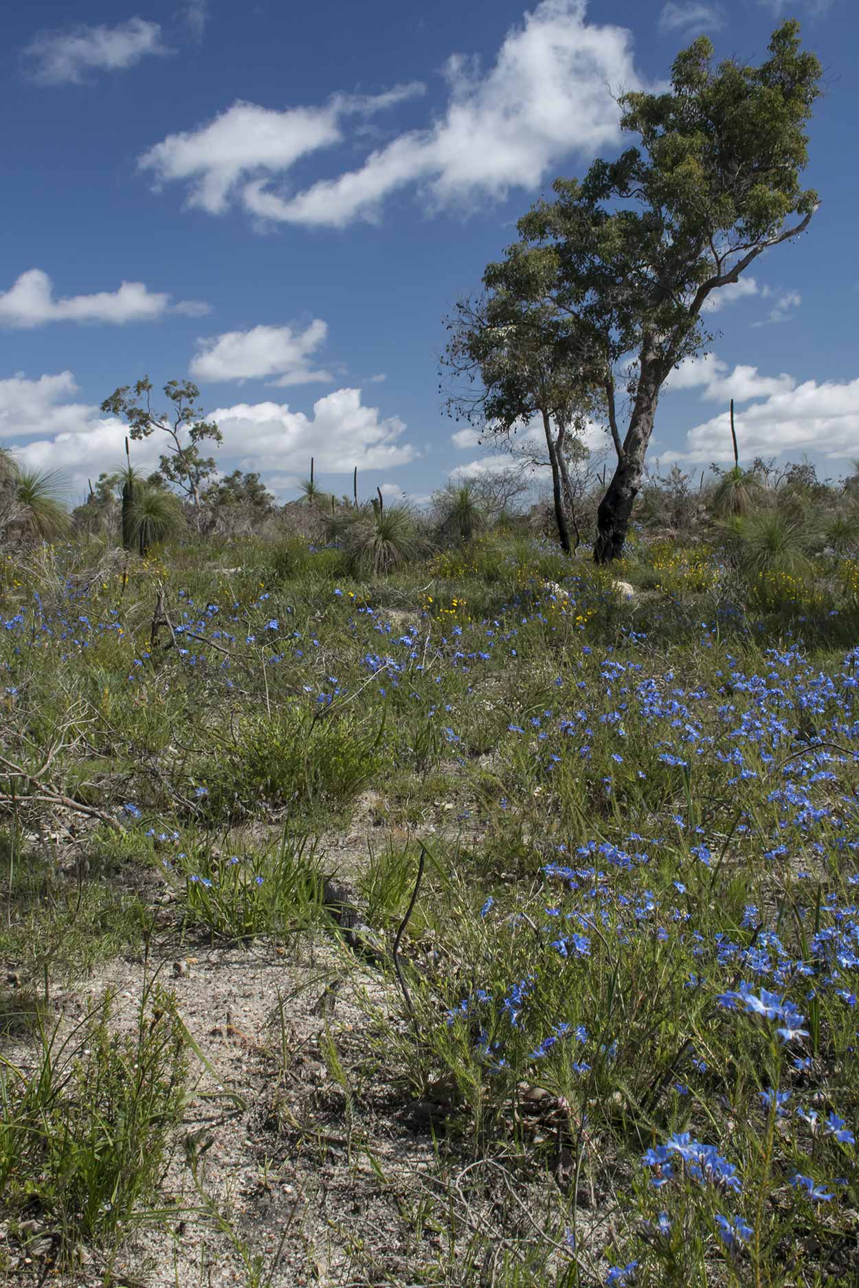

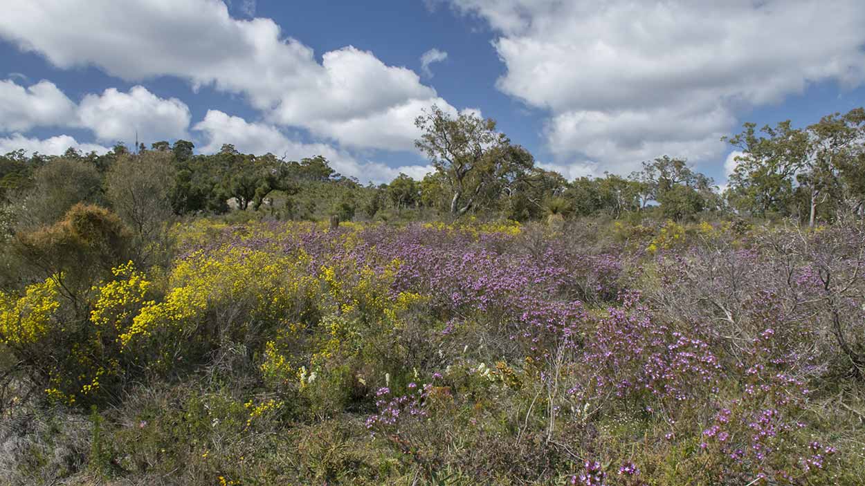
The pink is from the Starflowers (Calytrix) while the yellow is from Feather Flowers. Not sure what the blue flowers are?
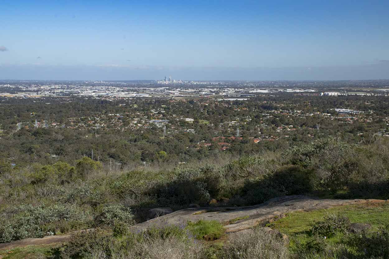
The path turns left to the south and downhill. I am treated to some clear views over the Swan Coastal Plain to the Perth CBD.

The path does get a little steep and rocky as well.

But much of the way is a gentle decline.
The rocky path ends when I meet Palm Terrace again. I have walked the entire Palm Terrace Walk, but I am not yet satisfied. One of the main reasons I came today was to check out Lesmurdie Falls in full flow and hopefully get some good pictures with the combined forces of my DSLR and tripod.
I keenly walk along Lesmurdie Brook to reach my destination.
I am not disappointed.

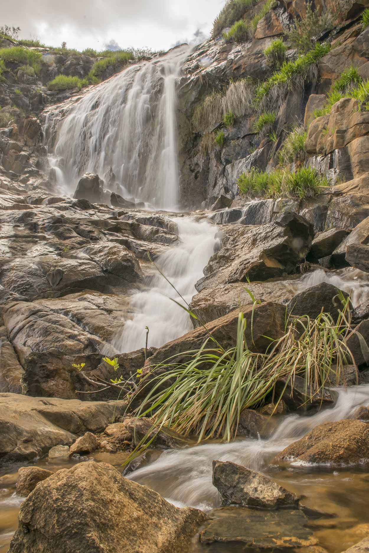
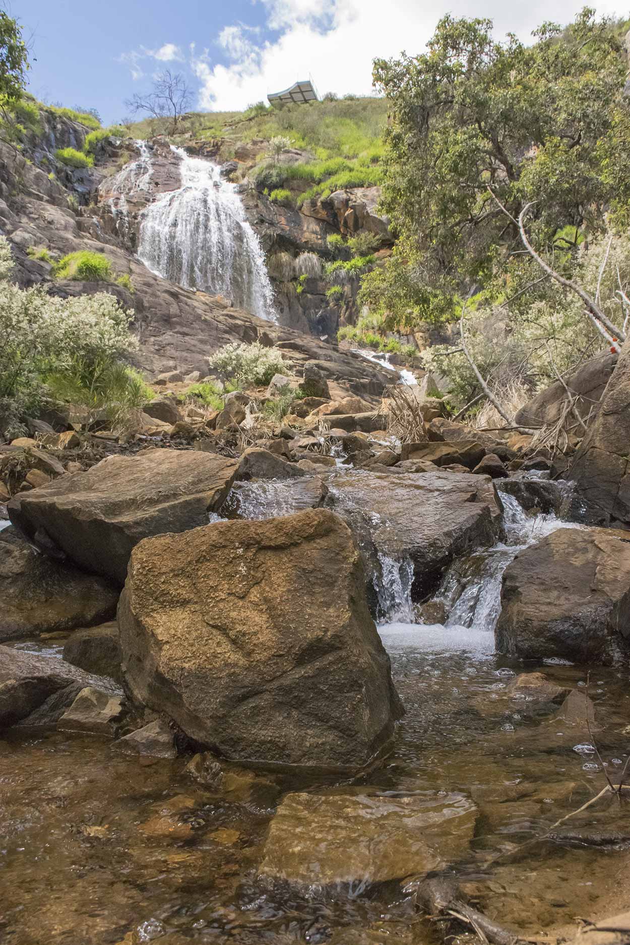
One reason I wanted to come here on a weekday was to have Lesmurdie Falls to myself. There wasn't a soul around. After carefully climbing over the slippery rocks I made it as close as I could get without getting wet and had some fun playing with the camera settings. Even from this distance, mist from the falls hitting the camera lens was still a problem.
After playing with the camera and having a break, I call it a day and head back to the Lower Lesmurdie Falls Car Park. I intended to head back to Lewis Road and catch the 288 bus back to the city, however, Google Maps suggested otherwise and instead I went to Welshpool Road East to catch the 282 bus home. The route home is longer on foot, but I like walking, so I didn't mind.
All in all, I am very glad I took the day off work to explore the Palm Terrace Walk and see Lesmurdie Falls in full flow. I highly recommend this walk, especially after good rains and in wildflower season. I walked a total of 10km in 5 hours, which is very slow. You should be able to walk this trail much faster, but I recommend taking your time and enjoying the panoramic views, wildflowers and plummeting water.
Click Here To Read More ...
Click Here To Read More ...
Click Here To Read More ...
View Photographs
Hello, I'm Marc and welcome to metrotrekker.
Be it seeing the city sights, exploring parklands and gardens, urban walks or day-hikes in the city outskirts, the metrotrekker website details walking routes and hiking trails accessible by foot and public transport in metropolitan areas.
The metrotrekker website provides you with all the details required for metropolitan exploration:
- a map with geolocation and a selection of map types (street, satellite, topographical)
- navigation formats compatible with common GPS devices, desktop browser/software or mobile apps
- trail length and difficulty
- start and finish options (particularly by public transport)
- photos/videos
- attractions or points of interest along the way
- other walks and hikes nearby
- often a story or detailed description of the trail (I have personally walked every single trail on the website)
- a comments section, so feel free to write about your experiences as well
- and more improvements and resources are continually being added
So let's get outside and explore our great metropolitan areas by foot. Click Here to begin exploring with metrotrekker.
Pleasant Trails,
Marc
Links To Help You Navigate