- Start or End: Can start at either Kalamunda Bus Station (Google Map Directions) or Mundaring (Google Map Directions). Both have semi regular bus services.
- Length: 25.4km (15.8mi) in about 7hr
- Grade: Hard. A rather flat walk but long. Do this on a cool day, unlike I did, and it probably wouldn't be that bad.
- Date Walked: 16th of April 2016
It only took me three years, but I am finally experiencing a slice of Western Australia's famous 1000km track.
It's April and the temperature has finally dropped to a manageable 28°C. Much better than the high 30's experienced recently. Funnily enough, the drop in temperature is also associated with some recent rain and an increase in humidity. Not ideal conditions for a long walk, but stuff it, I'm going for it.
Before setting out on the walk I have a confession to make. I have lived in Perth for over 3 years now and have enjoyed many walks around the area. However, as of yet I have not laid a single foot on the most famous hiking trail in all of Western Australia, The Bibbulmun Track. Why is it so famous? Because it's a 1000km track that leads from Kalamunda in Perth's east all the way down to Albany. Along the way it passes through some of the most scenic areas of Western Australia's south-east. How could I have waited so long to walk such a well-known path? Shame on me. Time to clean this stain from my hiking reputation.
I received most of my inspiration for walking the Bibbulmun Track from the blogs of The Life of Py and Walking Two by Two. Definitely visit these blogs if you want more info on hiking around Western Australia. Unfortunately, I don't own a car and I'm not really into camping, so a lot of the Bibbulmun Track is not accessible to a public transport rider like myself. However, the start of the Bibbulmun Track at Kalamunda is easily accessed by public transport from Perth City. Mundaring, although not on the Bibbulmun Track, is also accessible and is serviced by the Mundi Biddi Track which links to the Bibbulmun Track near Mundaring Weir. I decide to start my walk from Mundaring. From Perth Station I catch the train to Midland and then the 320 bus to Mundaring. It takes about one hour and twenty minutes.
A short walk from the bus stop is the Munda Biddi Trail. Or is it the KEP track? The Kattamorda Heritage Trail? There are trail markers for all three. Or is it as Google Maps calls it, the Mundaring Loop Trail? It appears that it's all four. So that's four trails at once. Four birds with one stone on this hike. I'll just call it the Munda Biddi Trail though.
Click Here To Read More ...

The trail hugs Mundaring Weir Road and heads south towards Mundaring Weir. I have to admit, it's not the most exciting hike in the world. But the bushland setting is very nice and the path is very flat so it makes for an enjoyable stroll.

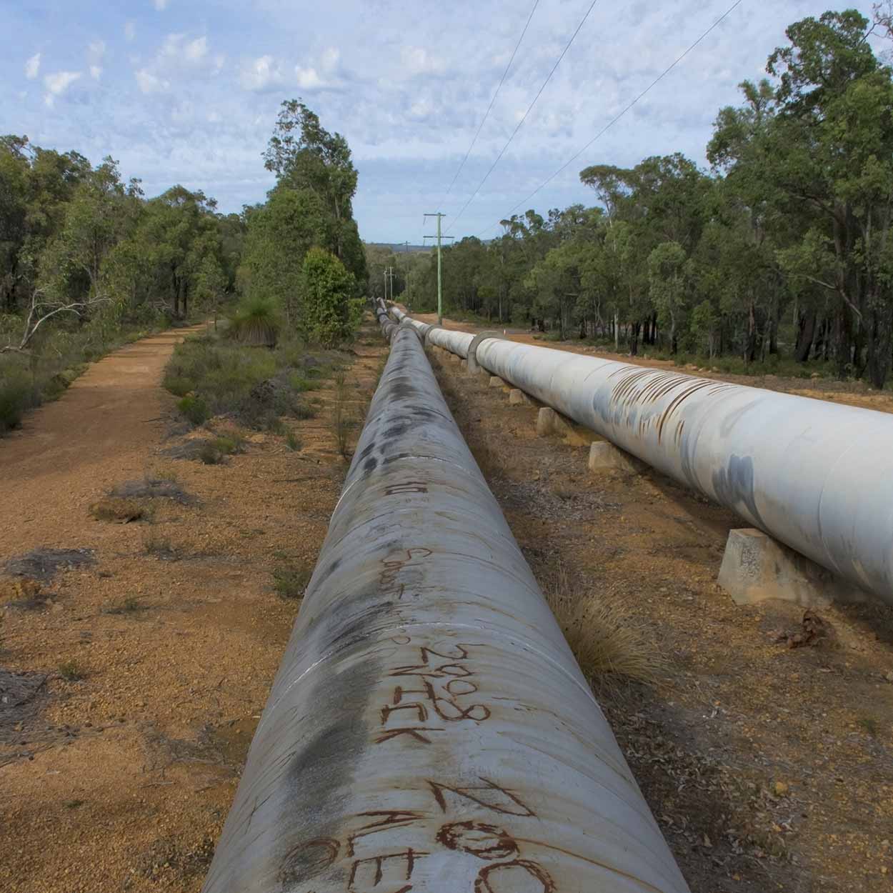
But it's not all natural, soon enough I hit the pipelines which feed Perth with water from Mundaring Weir.
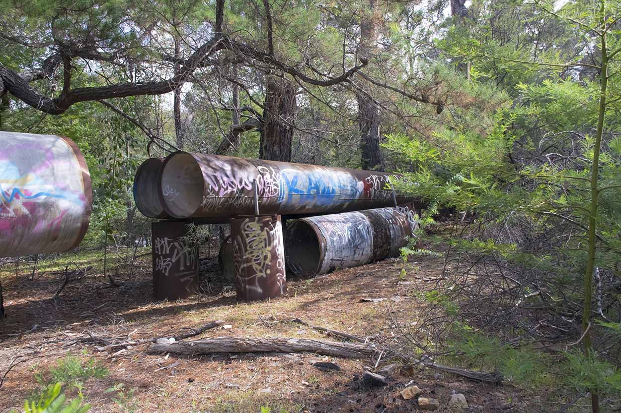
And some pipelines which formally fed water to Perth.
The entrance of the Mundaring Weir greets me.

Along with my first steps on the Bibbulmun Track. I can finally say I have experienced it.

Following the pipeline further I find myself at Mundaring Weir. A good spot for a rest and plenty of photo opportunities.
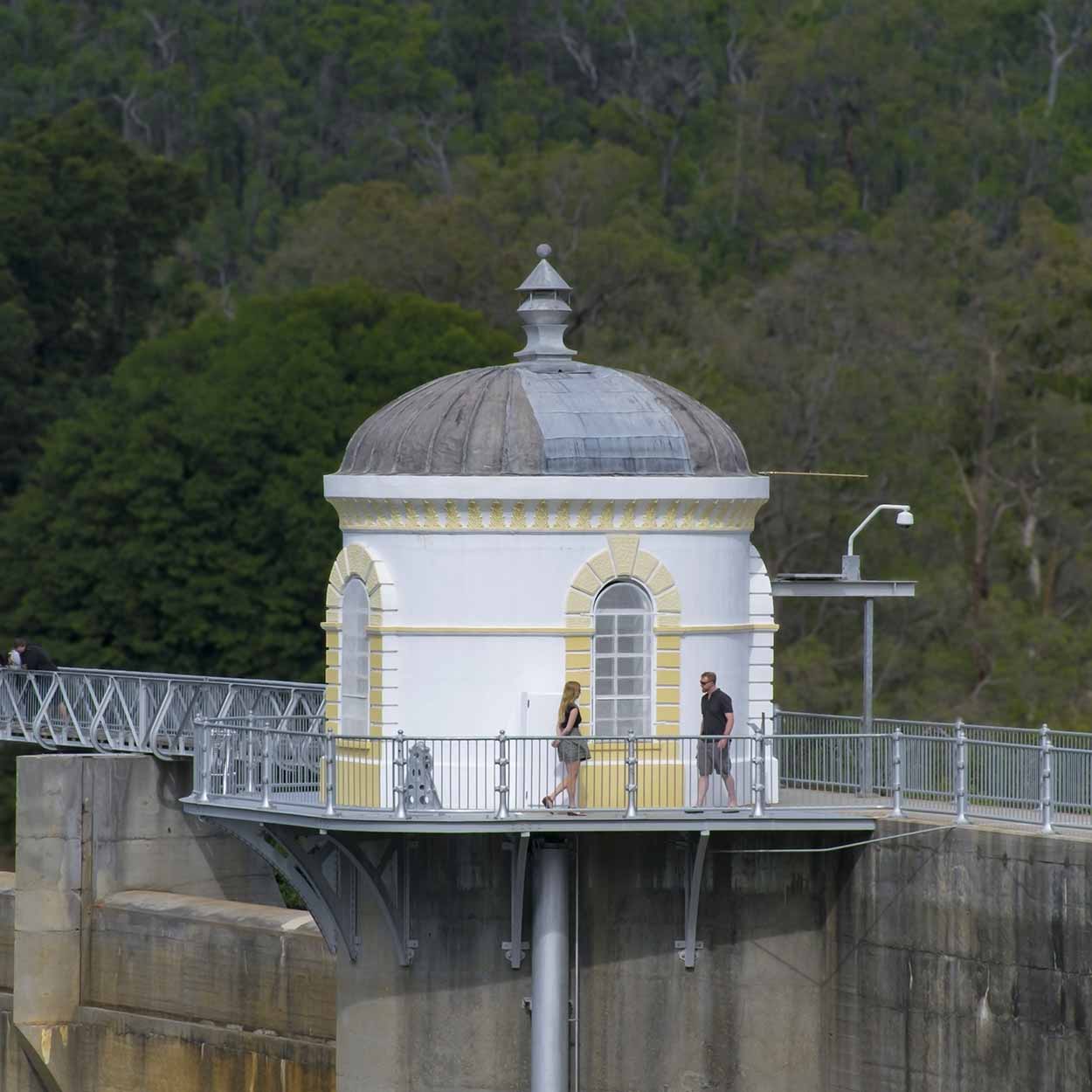
From Mundaring Weir there are brilliant views over Lake C.Y. O'Connor to the east and the Helena River Valley to the west.


The towering brick stack of the old Number 1 pumping station can also be clearly seen.

As I walk along Mundaring Weir I think to myself "Isn't this a dam, not a weir?". What is the difference between a weir and a dam anyway? I thought a weir let water spill over it and was generally used to alter the river upstream. While a dam was used more for water storage with the ability to let water overflow at a certain section if the water level got too high. See the two photos below.


Looks like a dam to me. One, it is for water storage. Two, water won't flow over the whole construction, just a certain section. In the second image above you can see a spillway clearly under the walkway. The first image shows the spillway in the distance and what I would call a dam wall in the foreground. Anyway, I am probably wrong. Let's stick with Mundaring Weir then.
After a quick rest on the weir wall, it's back onto the Bibbulmun Track and on my way west to Kalamunda.


What can I say about the Bibbulmun track? It's definitely a bush walk. Plenty of bushland, trees and shrubs galore with the occasional run in with some birdlife, especially black cockatoos. Not too far from Mundaring Weir is a lookout near South Ledge Road which allows good views of Mundaring Weir and the surrounding bushland.

The Bibbulmun Track is fairly well marked by yellow triangles with a snake logo on them. However, do be on the lookout for them, especially when the track intersects with other trails. For a while I was off in my own little world (as I often am when I go walking) and I completely missed a left hand turn. Most markers are nailed into trees so be on the lookout. There are occasionally large signs as well.

Many sections of the trail are under the shade of trees but there are also sections exposed to the sun. Even though it is only 28°C today I am certainly feeling it. There is plenty of sweat and plenty of water being consumed from my Camelbak.

Probably my favourite section of the Bibbulmun Track from Mundaring Weir to Kalamunda is through the Kalamunda National Park. The foliage is much sparser than other sections and there are numerous rock formations to study.

Some of the rock formations are indeed interesting.

Ok. Maybe I have a dirty mind, but that rock looks like something else to me. Something phallus. A penis, it kind of looks like a penis. I do get a laugh out of that rock, but the fact that I have run out of water is nothing to laugh about. I have a headache and I feel dehydrated. Should have bought more water. But luckily I am near the end of the hike.
I think the heat may have turned other hikers off the trail today. I did run into a few other people, mainly real hikers who have tents and big backpacks, but most of the time I was clearly alone in the wilderness. As I made my way through the rocks of the Kalamunda National Park I did run into a lady who was off in her own little world. Probably the same little world I was off in when I missed that turn off. She quickly left that little world when I politely moved to the side of the path and said hello. Scared the absolute crap out of her. Made me laugh though.

In the distance I can hear mankind again. I must be getting close to Kalamunda. The sound of an industrial wood chipper churning is a welcome sign as I truly need to rehydrate. In my rush to make it to a shop I actually miss the final section of the Bibbulmun Track and instead walk up Spring Road to Station Road. I did plan to see the official start of the Bibbulmun Track but my quest for Gatorade was much stronger (also the next 282 bus to the city leaves in a few minutes).
So what of my first encounter of the Bibbulmun Track? It was ok, but nothing to really write home about. If you enjoy 10's of kilometres of serene bushland definitely have a hike. I think the hot muggy day probably ruined it for me a bit. Luckily the trail was relatively flat or I would have been stuffed. I would love to try it again, but probably after the winter rains have greened up the area and the cool and colour of spring has arrived. I'll make sure I see the official start of the trail next time as well.
Click Here To Read More ...
Click Here To Read More ...
Click Here To Read More ...
View Photographs
Hello, I'm Marc and welcome to metrotrekker.
Be it seeing the city sights, exploring parklands and gardens, urban walks or day-hikes in the city outskirts, the metrotrekker website details walking routes and hiking trails accessible by foot and public transport in metropolitan areas.
The metrotrekker website provides you with all the details required for metropolitan exploration:
- a map with geolocation and a selection of map types (street, satellite, topographical)
- navigation formats compatible with common GPS devices, desktop browser/software or mobile apps
- trail length and difficulty
- start and finish options (particularly by public transport)
- photos/videos
- attractions or points of interest along the way
- other walks and hikes nearby
- often a story or detailed description of the trail (I have personally walked every single trail on the website)
- a comments section, so feel free to write about your experiences as well
- and more improvements and resources are continually being added
So let's get outside and explore our great metropolitan areas by foot. Click Here to begin exploring with metrotrekker.
Pleasant Trails,
Marc
Links To Help You Navigate