- Start or End: Start or end at either Fremantle Train Station (Google Map Directions) or Elizabeth Quay Train Station (Google Map Directions).
- Length: 25.7km (16.0mi) in about 5.5hr
- Grade: Medium to Hard. Paved the whole way, with a couple of small hills. Rather long. Several public transport options along the way if you decide to cut the walk short.
- Date Walked: 27th of January 2014
Avoiding bogans, Water Police river views, Space Age restrooms and howling winds. A walk along the north bank of the Swan River.
Australia Day public holiday! No work means time to walk.
Today I am finally going to complete the last leg of the Swan River Three Bridges Loop. The other legs of the loop, Narrows Bridge to Canning Bridge and Canning Bridge to Queen Victoria Street Bridge, were completed last year. The final leg is from the Queen Victoria Street Bridge to the Narrows Bridge along the north bank of the river.
But what direction should I choose to do the final leg? Decisions had to be made and these decisions depend on public transport, more specifically, the type of people I am likely to encounter on public transport. Do I catch the train to the Narrows Bridge and walk west or take the bus to the Queen Victoria Street Bridge and walk east? To get from basecamp to Fremantle via public transport it is best to take the bus. This bus passes through Kwinana, a well-known low socio-economic area, and from a previous afternoon ride on this bus I know that a number of undesirables frequent this service. So how do I limit the chance of an encounter with such undesirables? Think the best thing to do is catch the bus really early and hope the undesirables are still in bed. So decision made, Fremantle by bus and then a walk east.
Despite my logic a number of undesirables were on the bus. A "lovely" couple consisting of two young males who were nursing a goon sack (i.e. boxed wine) hopped on. They didn't offer me any wine, which I thought was rude, but they were ok. Then a "lady" (an obvious long time drug user and/or a result of poor breeding) got on at Kwinana shopping centre. In a loud voice she started talking to some grossly overweight woman about her drug dealing and something about burnt out cars. Luckily the bus driver had the guts to tell her to shut up. The bus journey was soon over and on arrival at Fremantle Train Station I headed towards the Queen Victoria Street Bridge.
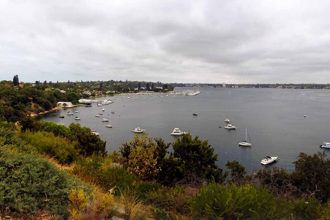
The Queen Victoria Street Bridge is relatively old, built in 1939, and is a great vantage point to watch luxury water craft zoom underneath. The path across the bridge is not the greatest. The path is narrow and the balustrading is rather low, which is not the best for someone with a slight fear of heights. Once off the bridge it is a short walk through the suburbs to Sorrell Park. Not really that much to see here, just some good views of the river.
Click Here To Read More ...

From Sorrell Park the path deviates away from the river and back into the suburbs. I get back to the river at a reserve near the Water Police Station. The path around this area is not very clear and thinking that I can follow the river I head past the Water Police Station. Unfortunately I found a dead end. Fortunately the dead end was a quite location with excellent water views. Those water police sure do have a good spot to work.

The path back into the suburbs is steep in some sections. At the end of Rule Street a dedicated foot path along the river is available. Brilliant path along here with great views of the river and set amongst native flora. The path passes through a number of parks which are perfect for a rest. I had a pit stop at Minim Cove Park where I found the public toilet of the future. It was the oddest public toilet I have encountered so far in Perth. Everything was automated. It felt like I was in the Discovery One spaceship from the movie 2001: A Space Odyssey and HAL, the sentient computer, was controlling everything. The toilet paper was even dispensed automatically! Even though I didn't need any toilet paper I had to press the button anyway. To clean my hands I had to place my hands under certain areas within the washing station: on the left soap was automatically dispensed; in the middle water automatically flowed and on the right hot air dried my hands. It is only a matter of time before toilets can automatically give you a shake and re-zip your pants after you have finished.
The path once again heads into the suburbs around the Mosman Golf Club and you do not see the river again until Bay View Park. Bay View Park was the perfect place to recharge the phone, eat some nuts are carrots sticks, and slap on some sunscreen while taking in the expansive views. It was a bit cloudy and windy, but still an enjoyable rest.
After a rest I continue along the path. The path follows the river with only a short diversion inland at the Royal Freshwater Yacht Club. Along the Esplanade in Peppermint Grove I deviated off the main path and followed a gravel path that hugs the foreshore. Along the gravel path are good views of the river on one side and close ups of the cliff face on the other side. Take advantage of this area as it is the last time you will see the river for a while. Back into the suburbs the path leads ... boring.

The river can be accessed at Ales Prior Park and Mrs Herberts Park in Claremont, but it is only a few minutes of walking before it is back onto the suburban path. Once I reached Bishop Road Reserve it is time to take a break again. The wind is howling so it is not the most enjoyable break but it is good to rest the legs and fill up on some nuts and water. After a short break it is off again. The foreshore appears accessible at Bishop Road Reserve and I am sick of walking along the road so I venture out onto the sand.
In hindsight I really should have stuck to the path in the suburbs. The wind is absolutely howling along the foreshore and I have a lot of trouble controlling my big straw hat. Sure it would be a really pleasant walk along here if the weather was better. As I walk along the strip of sand gets thinner and the rocks get closer to the shore. Surely this is not a dead end? The rocks get even closer to the shore and the waves from the river are crashing against them. I did not expect waves in a river, but from the size of the water craft speeding past I should have. The waves were probably only a foot tall, but that is a foot too tall when you are walking. Just when I thought I was on a path to nowhere I come across a boardwalk path heading inland to Point Resolution Reserve.

Despite all my previous complaining about having to walk along paths in the suburbs it was a relief to be away from the river and on a solid path that looked like going somewhere. Along Jutland Parade there are no great views of the river but there are some really spectacular art deco mansions. Off Jutland Parade is Iris Avenue where the Edward Bruce Foreshore Path begins. It is from this point that a dedicated path follows the river all the way to the Perth CBD. There are some slight detours but no chance of getting lost.

The Edward Bruce Foreshore Path is definitely the most pleasant section of the walk. It is quite, flat and provides good views of the river. The quietness abruptly changes once I reach Matilda Bay, which is full of families picnicking by the shore. Once the path hits Mounts Bay Road the four lanes of traffic make it even noisier, but the views onto the river are some of the best of the entire walk. Soon enough I reach the Narrows Bridge. Yes! Completed the final leg of Three Bridges Loop! With the satisfaction of my achievement I take in some CBD views as I slowly make my way to the train station. My legs are a bit sore, but that is to be expected after a 27km walk.

The train ride home was pleasant. No undesirables at all. Glad I did not walk the other way and have to deal with the Kwinana undesirables on the Fremantle to Rockingham bus. Would have ruined a perfectly good day.
Click Here To Read More ...
Click Here To Read More ...
Click Here To Read More ...
View Photographs
Hello, I'm Marc and welcome to metrotrekker.
Be it seeing the city sights, exploring parklands and gardens, urban walks or day-hikes in the city outskirts, the metrotrekker website details walking routes and hiking trails accessible by foot and public transport in metropolitan areas.
The metrotrekker website provides you with all the details required for metropolitan exploration:
- a map with geolocation and a selection of map types (street, satellite, topographical)
- navigation formats compatible with common GPS devices, desktop browser/software or mobile apps
- trail length and difficulty
- start and finish options (particularly by public transport)
- photos/videos
- attractions or points of interest along the way
- other walks and hikes nearby
- often a story or detailed description of the trail (I have personally walked every single trail on the website)
- a comments section, so feel free to write about your experiences as well
- and more improvements and resources are continually being added
So let's get outside and explore our great metropolitan areas by foot. Click Here to begin exploring with metrotrekker.
Pleasant Trails,
Marc
Links To Help You Navigate