- Start or End: Loop walk. Start and end at the bus stops near the corner of the Great Eastern Highway and Park Road, Glen Forrest (Google Map Directions).
- Length: 21.3km (13.2mi) in about 6hr
- Grade: Hard. Long and several hills on gravel/dirt paths. It is suggested that you sign in at the Rangers Office near the John Forrest Tavern.
- Date Walked: 15th of August 2015
Wildflowers in bloom, babbling brooks, eagle views and tourists slipping into waterfalls.
Today's walking adventure is in John Forrest National Park, specifically the 15km Eagle View Walk Trail which loops into the lesser explored areas of the national park. I have been meaning to visit John Forrest National Park but have hesitated due to the lack of rain. On a previous walk along the Railways Reserve Historic Trail, which I took back in February, the park was bone dry and the waterfalls the park is famous for (National Park Falls and Hovea Falls) were not even a trickle. There has been rain recently, nothing substantial, but hopefully enough to green up the park and wet those creek beds.
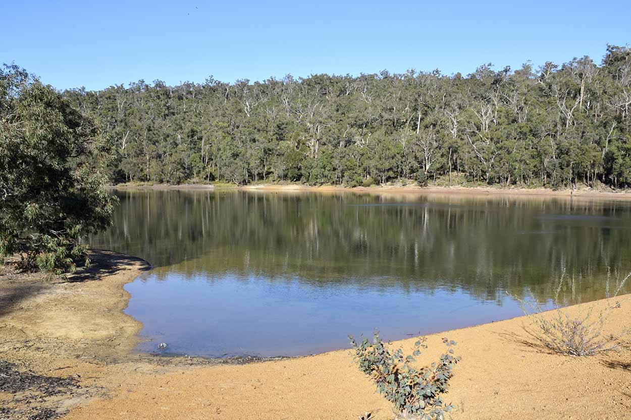
John Forrest National Park isn't that far from the Perth CBD so it only took me about an hour to get here by public transport. I rode the train from Perth Central to Midland station and then caught the 320 bus to the front of the park. It was then a 20 minute walk from the Great Eastern Highway along Park Road to the tavern, Rangers office and the start of the trail. The walk along Park Road is not the most inspiring and you have to watch out for speeding cars (if you do have a car you need to pay to enter the park). The only real point of interest is Glen Brook Dam.
Click Here To Read More ...
At the Rangers office I pick up a brochure (which you can also get online) and sign in. I think this is the first time I have ever registered for a walk. Not sure this is a good sign. The fact that the registration is required suggests that a number of people in the past have got into trouble out there. Oh well, I'm sure I will be fine. What's the worst that could happen? Dehydration? I've got 2.5 litres of water and a couple of protein shakes so I should stay well hydrated even though it is expected to reach 26�C today, the hottest August day in 17 years. Snake bite? I've got long pants on and I will stick to the track so I should be fine. Little did I know that on the other side of the city a woman was bitten by a snake and later died, a rare case of a snake fatality in modern Australia.
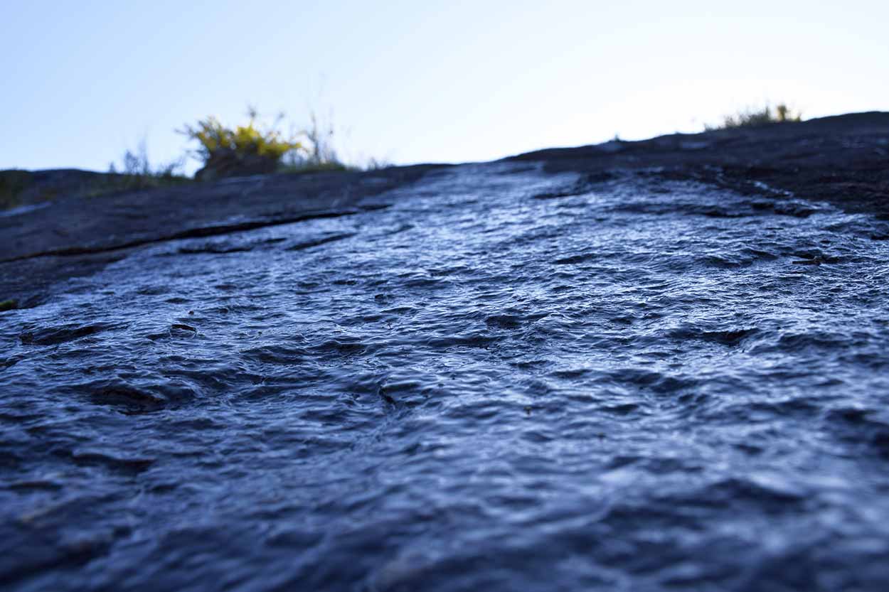
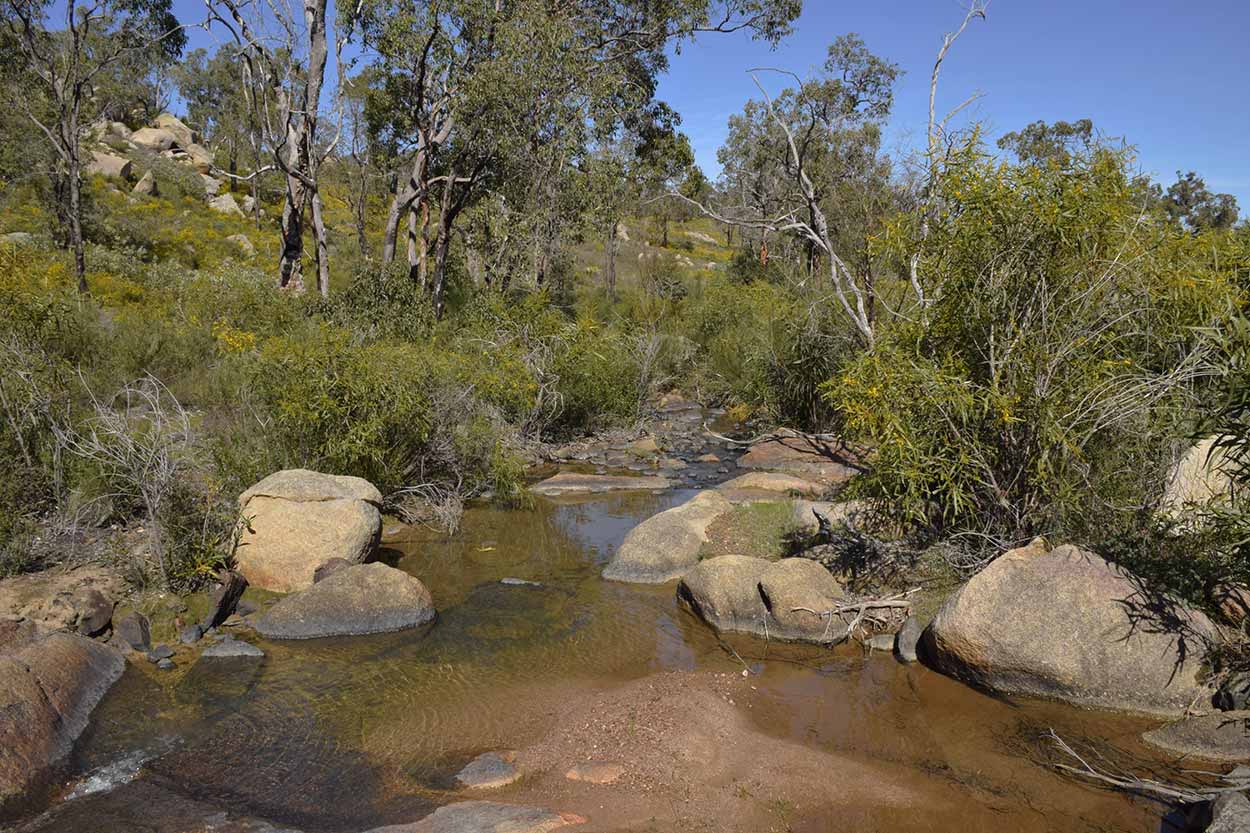
First it is across Jane Brook. Look there is flowing water!
After crossing Jane Brook I have a decision to make. As the Eagle View Walk Trail is a loop I can go either in a clockwise or an anti-clockwise direction. The brochure states that the walk was originally designed to be walked in a clockwise direction, but is just as enjoyable in an anti-clockwise direction. Think I will take the clockwise route as it follows along Jane Brook to National Park Falls. Can't wait to see those waterfalls.
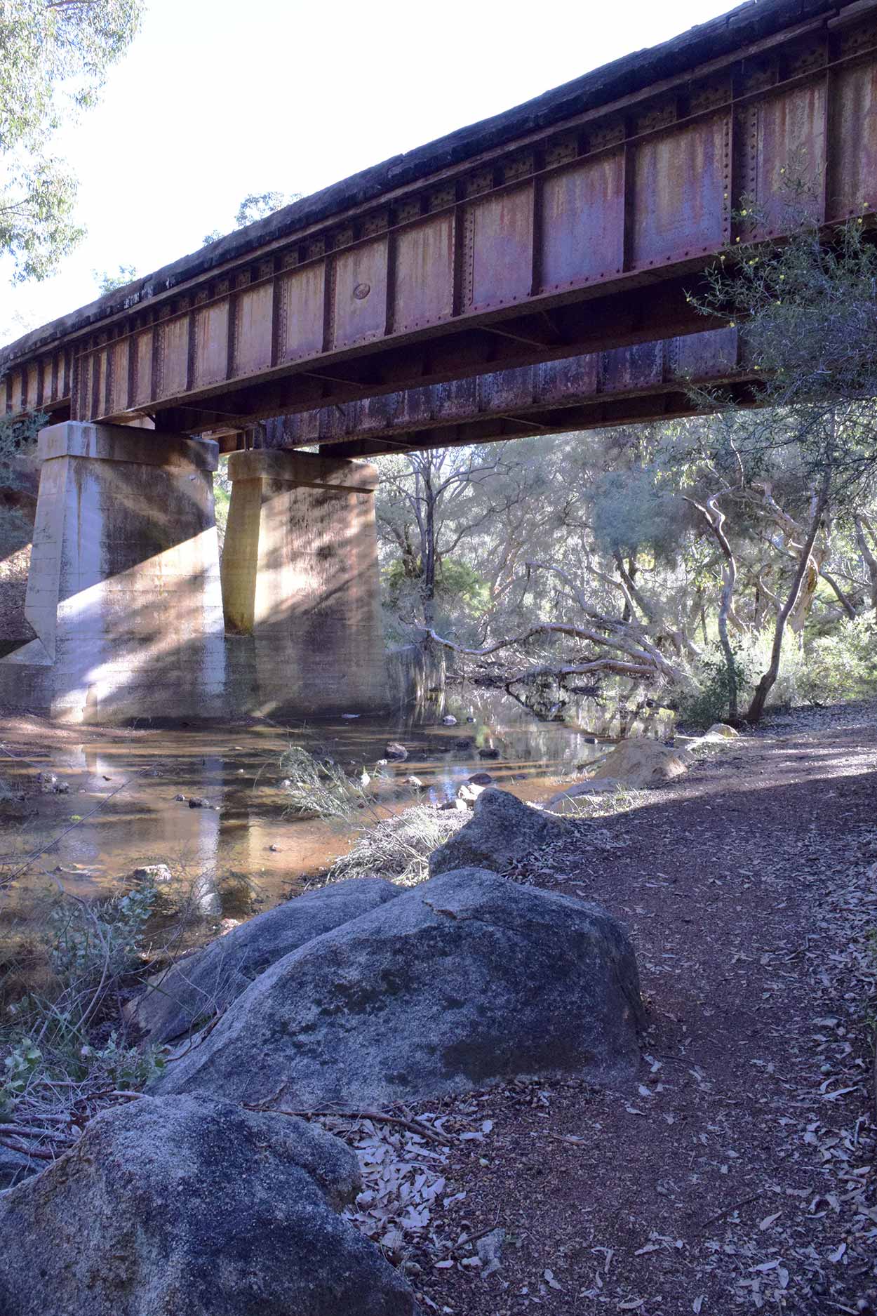
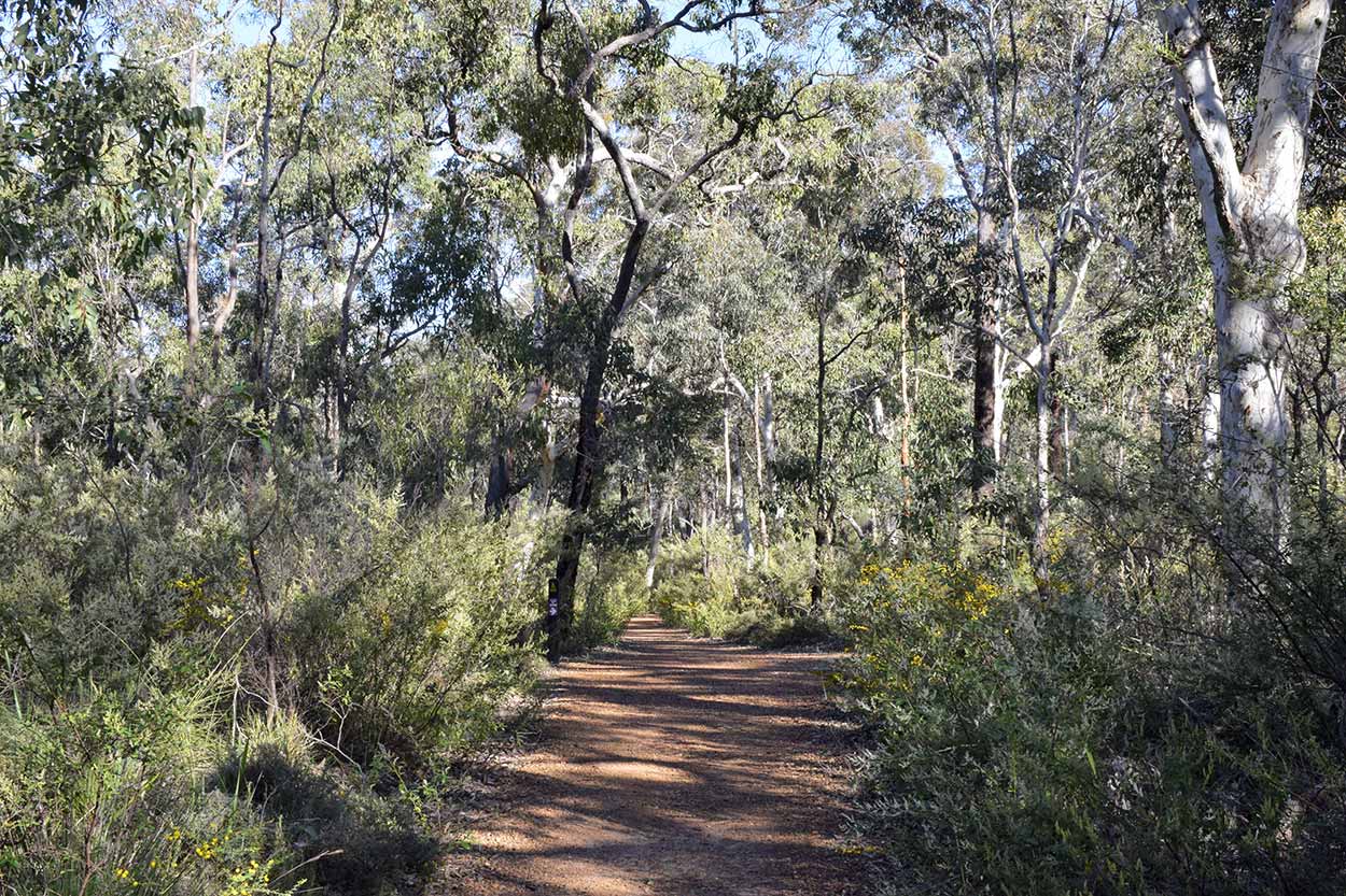
Before National Park Falls I head under an old railway bridge which now serves as the Railway Reserves Historic Trail (I have walked this previously).
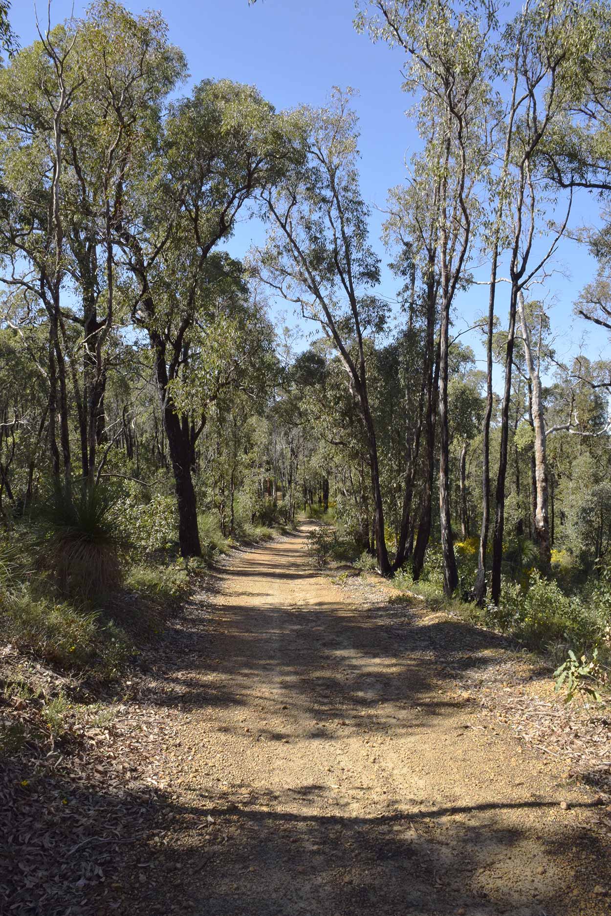
After the bridge I am into the bush and WOW! It is lush, the wildflowers are coming into bloom and the babbling of Jane Brook is so relaxing.
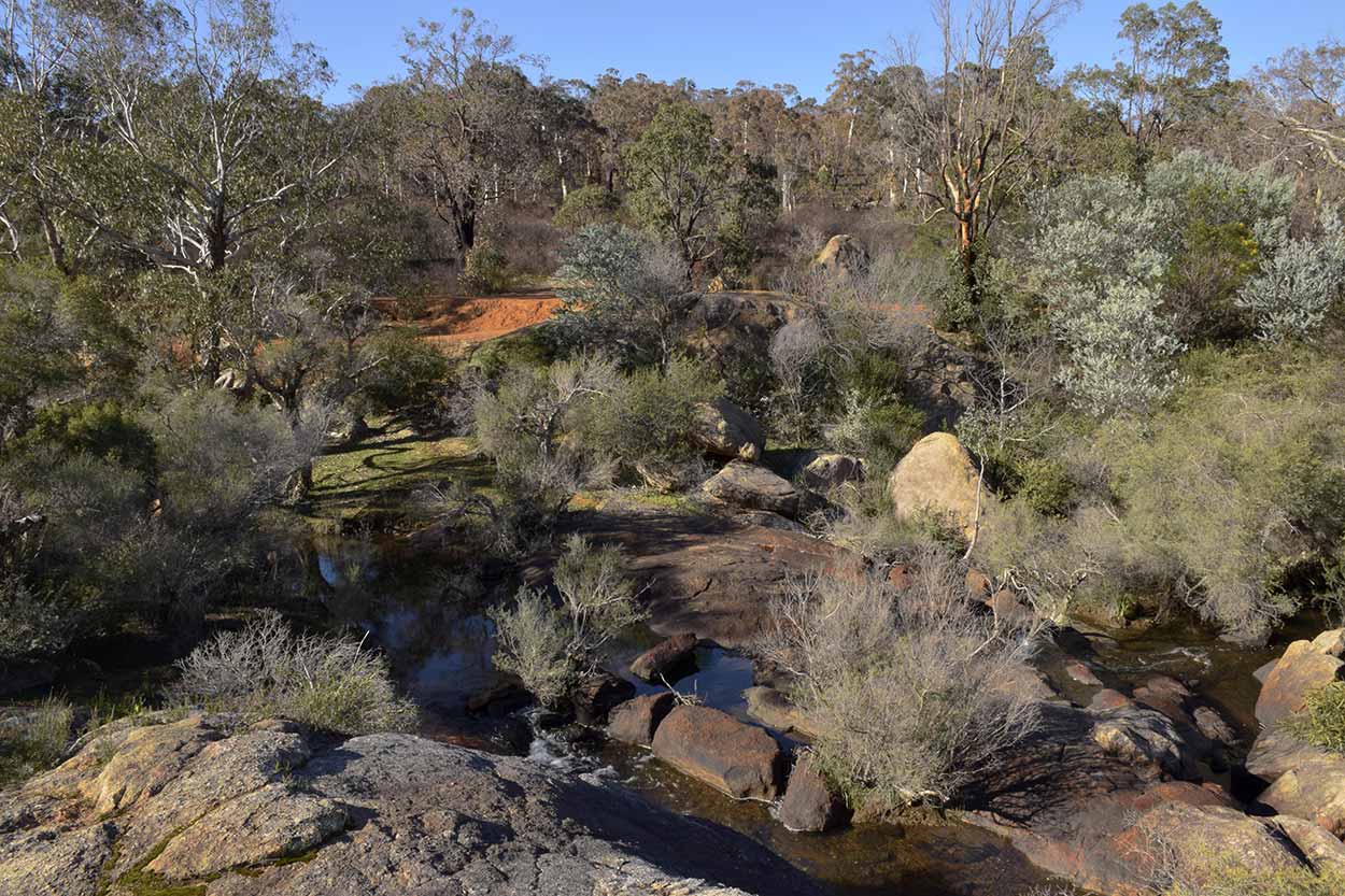
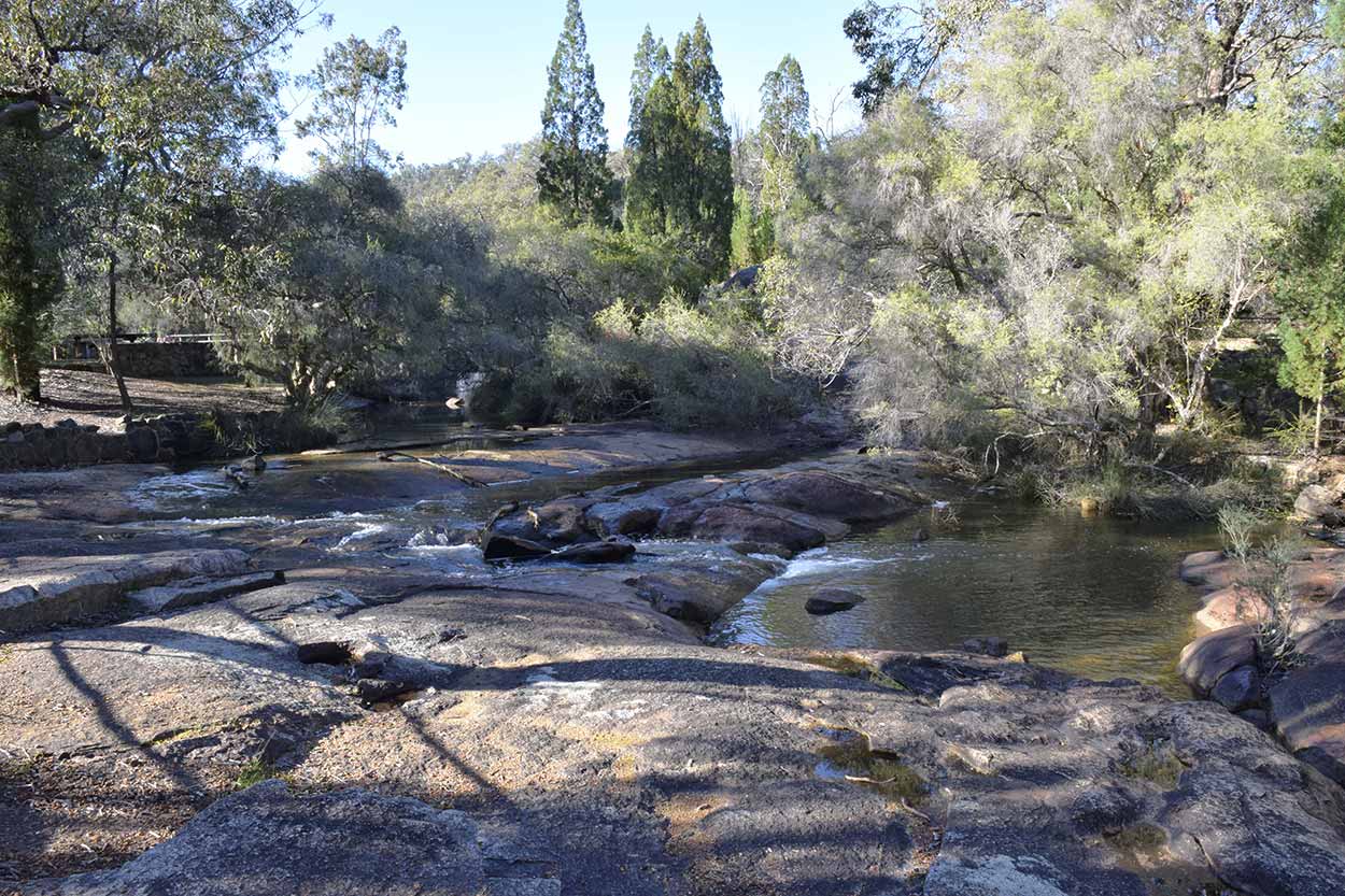
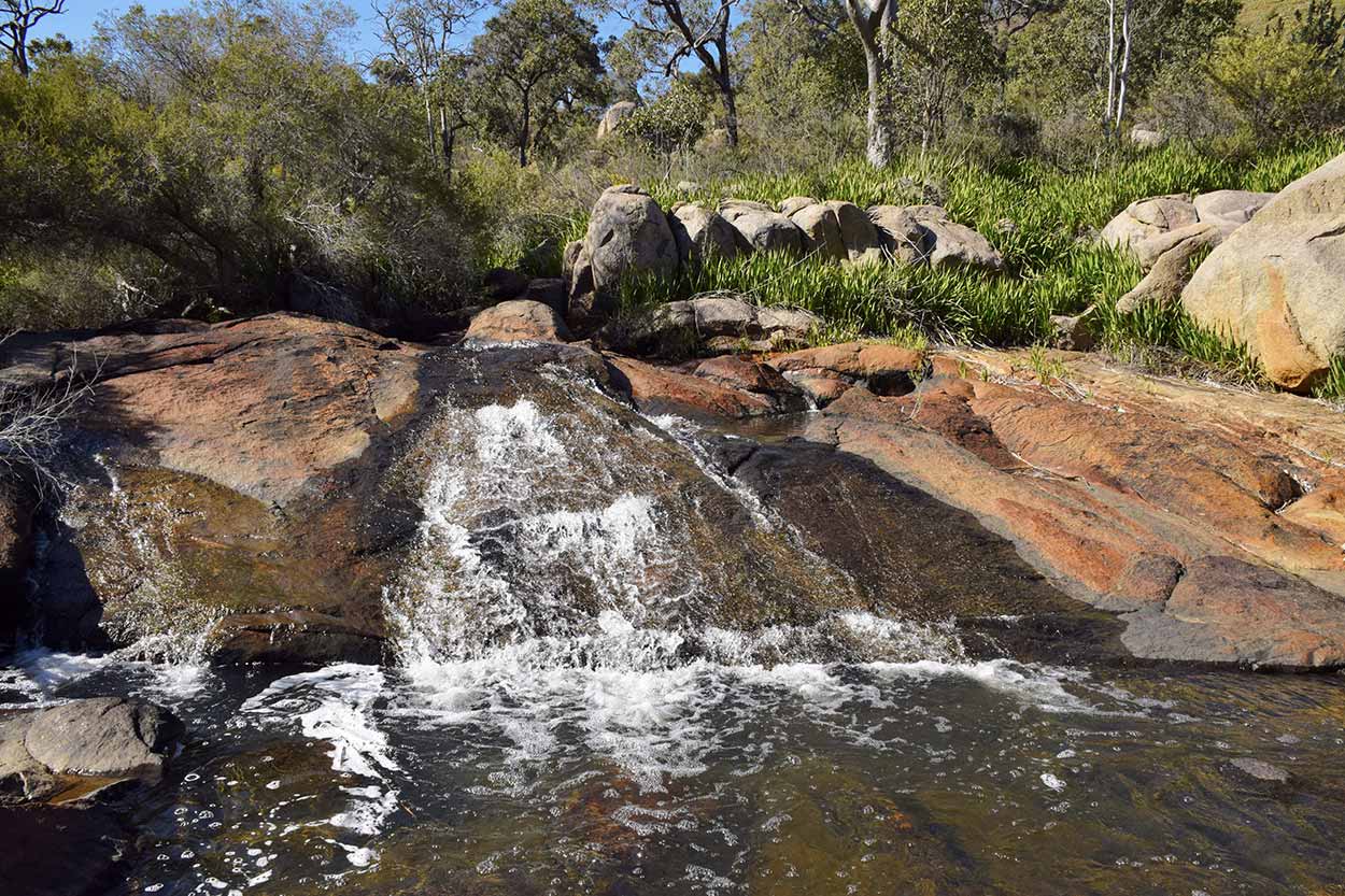
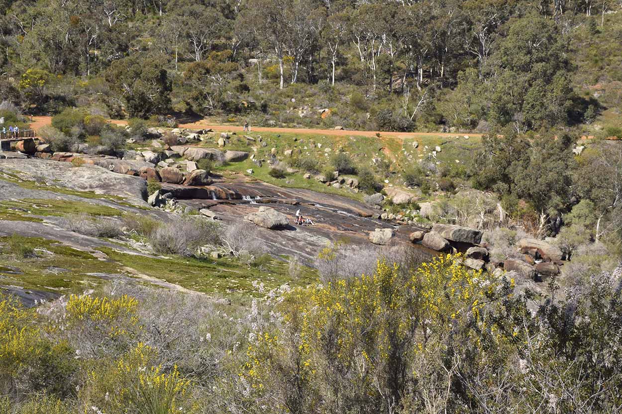
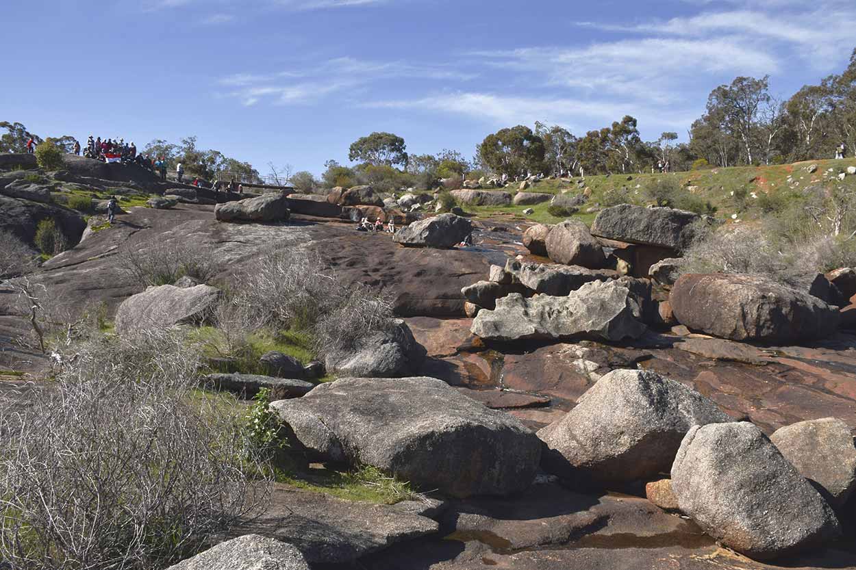
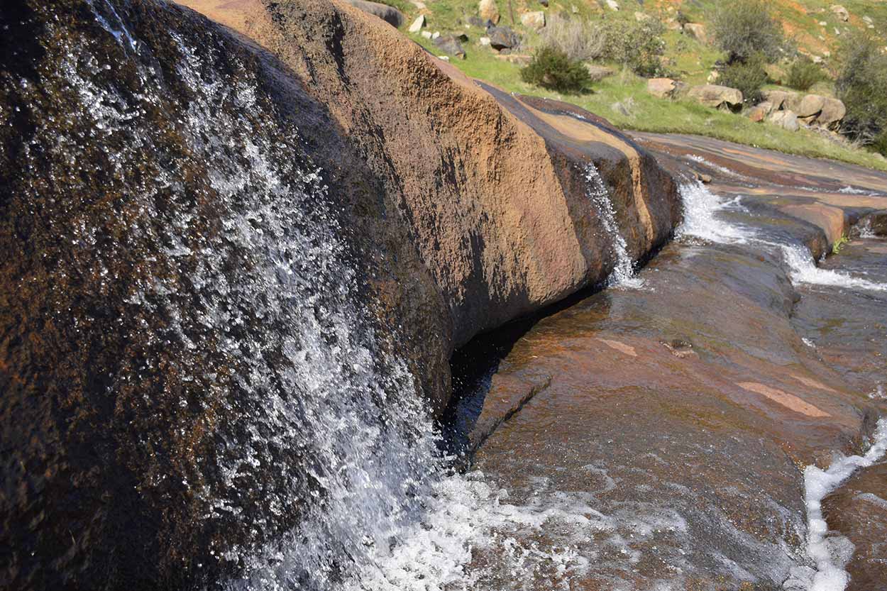
Soon enough I am at National Park Falls.
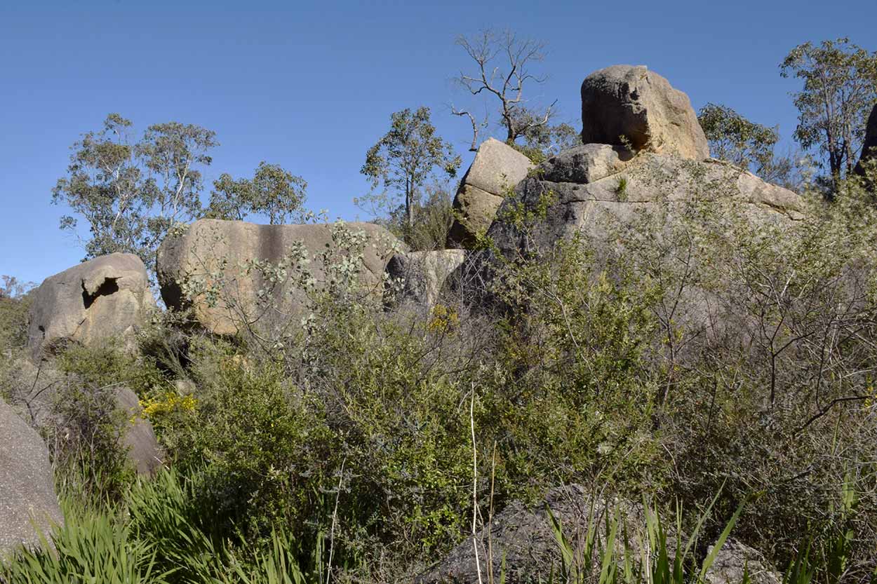
Ok ... I've got to admit, I was expecting more of National Park Falls. Obviously the recent rain has not been adequate enough to create some spectacular rapids. Oh well, at least it is wetter than my previous visit. At National Park Falls there is a fork in the trail. I can either continue along Jane Brook or head up along the ridgeline to the north. I'm hungry for more water views so I take the Jane Brook section. Lucky I did take the Jane Brook section as a found I little side path which deviates around a massive set of boulders to the lower end of National Park Falls.
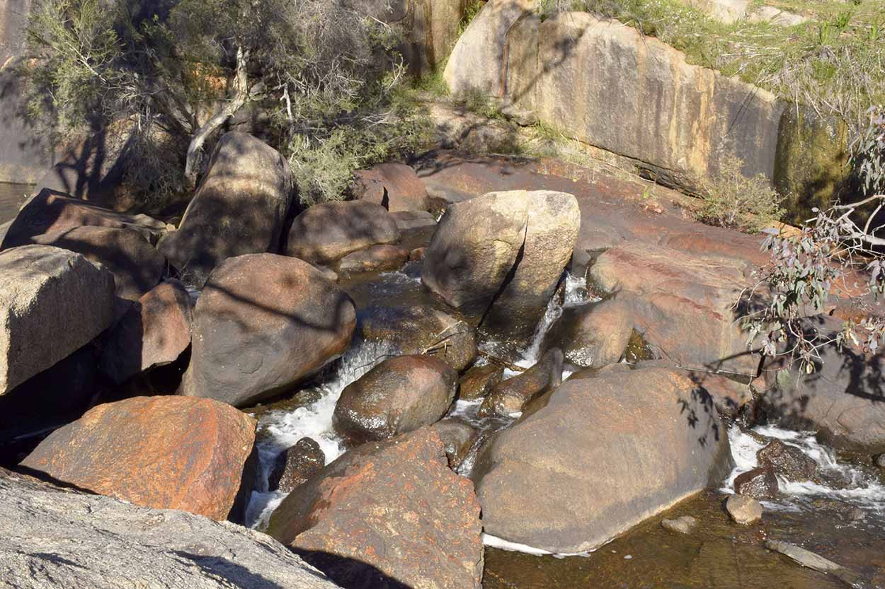
Once again not the greatest sight in the world, but if the rain was much more significant I could envisage some impressive rapids hurtling over those rocks. I will have to come again another time when it is much wetter.
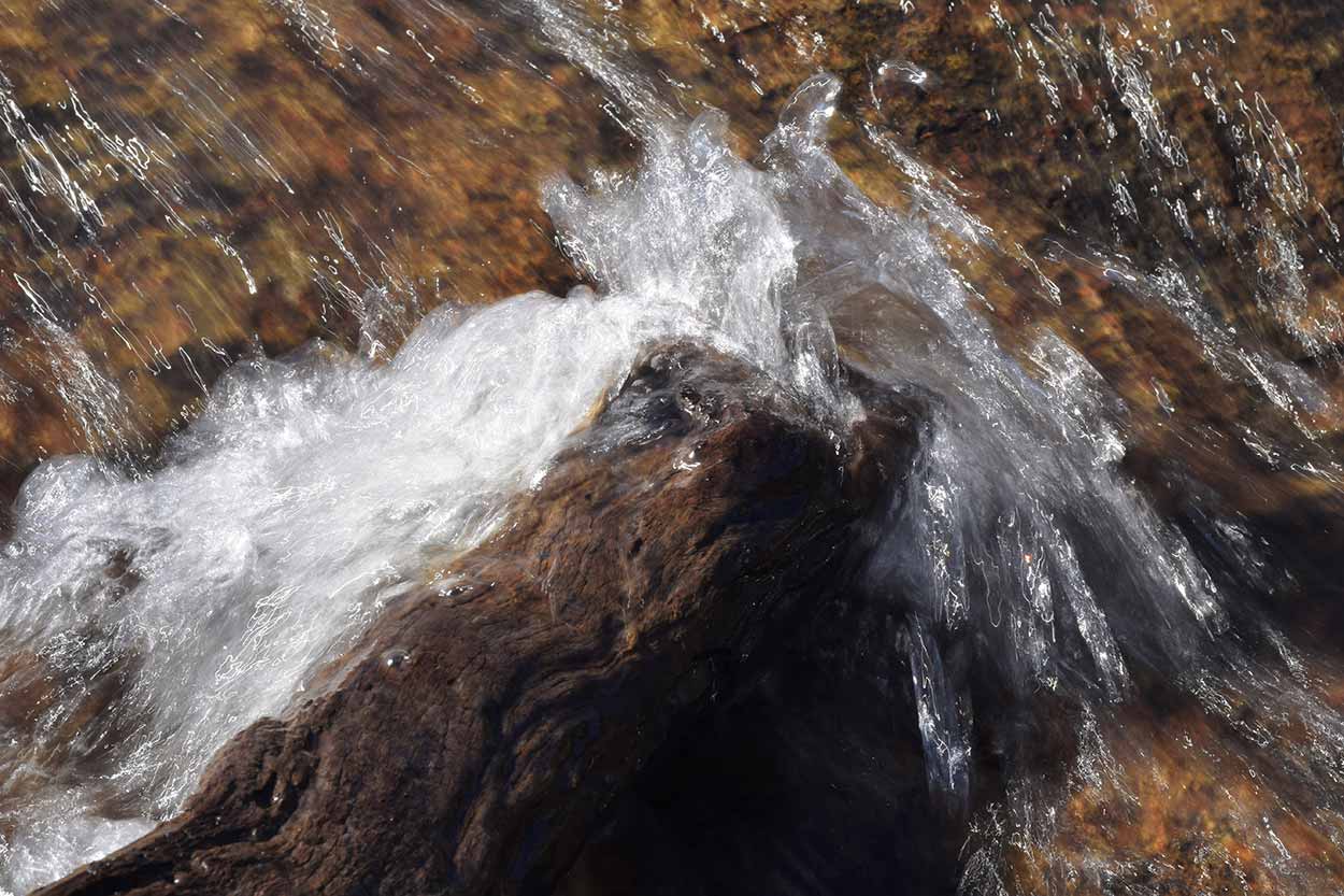
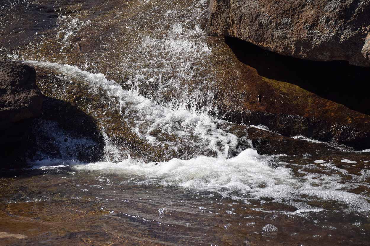
Despite the lack of roaring rapids the walk along Jane Brook was spectacular. It did get rather rocky in some sections and the vegetation often grew thick over the trail. But what a walk! The large boulders and the quiet little areas where Jane Brook babbled over rocks were definitely my favourite parts. The best way to describe it is through pictures, so here goes.
I have walked about 2kms from the start of the Eagle View Walk Trail to where the path deviates from Jane Brook and uphill into the drier bush. Think it is time to have a rest near the water, take a drink from my camelback and fill up on some nuts. This is what I am treated to.
I have been walking for about 1.5 hours so a rest in this scenery is well deserved. Wait a second? It took me about 1.5 hours to walk 2kms? How slow am I going? At this rate it's going to take me 11 hours to finish. No wonder the brochure states the walk can take anywhere from 4.5 to 7 hours. There is too much to look at and enjoy. Damn you scenery, you have slowed my progress! I better get moving if I want to finish the walk by dark. It's time to head up hill towards the Eagle View Lookout.
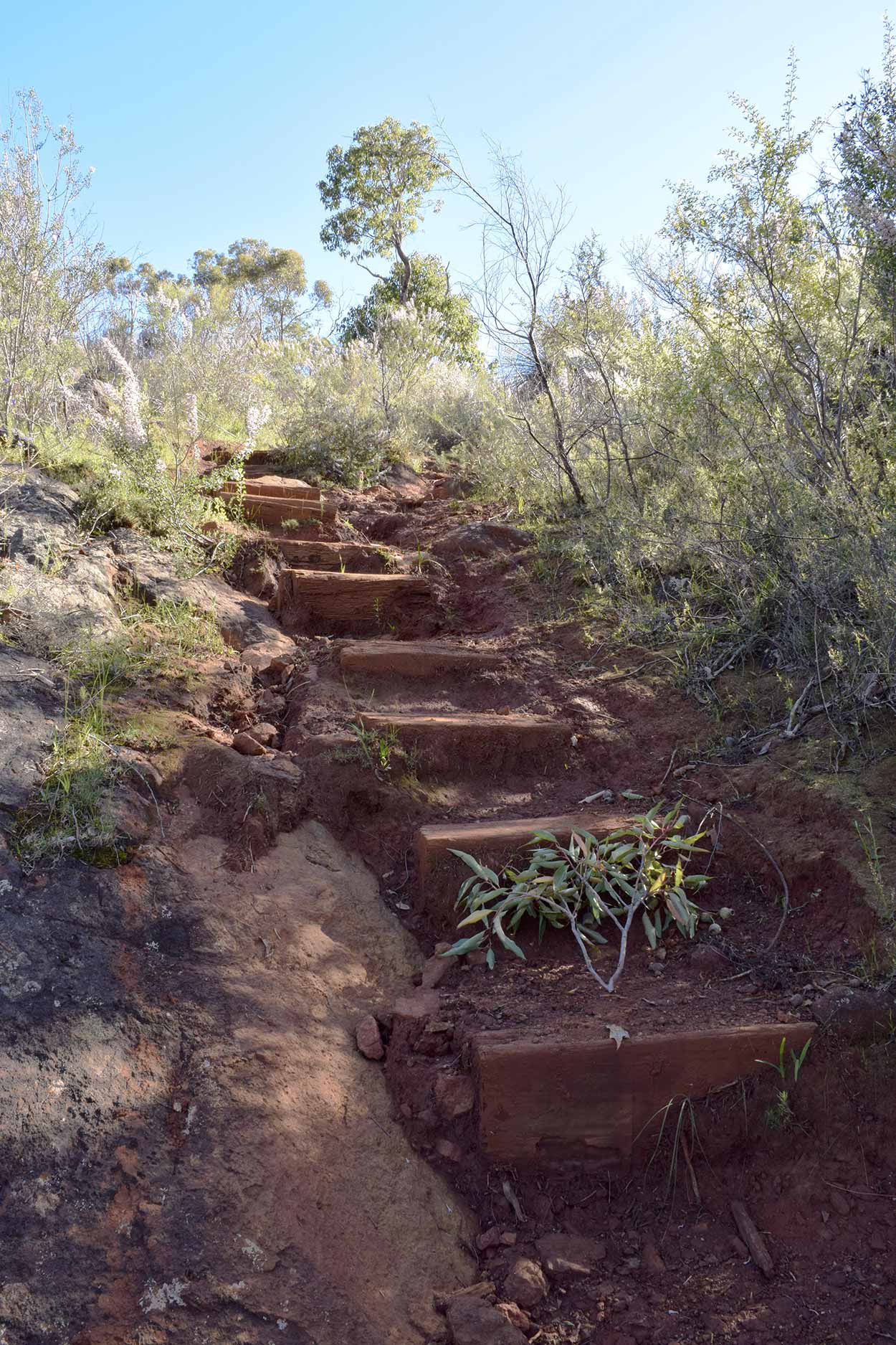
Trying to make up time I ascend rather quickly towards the lookout. The path is steep, nothing too tough, but I do need to occasionally take a rest to catch my breath and enjoy the view.
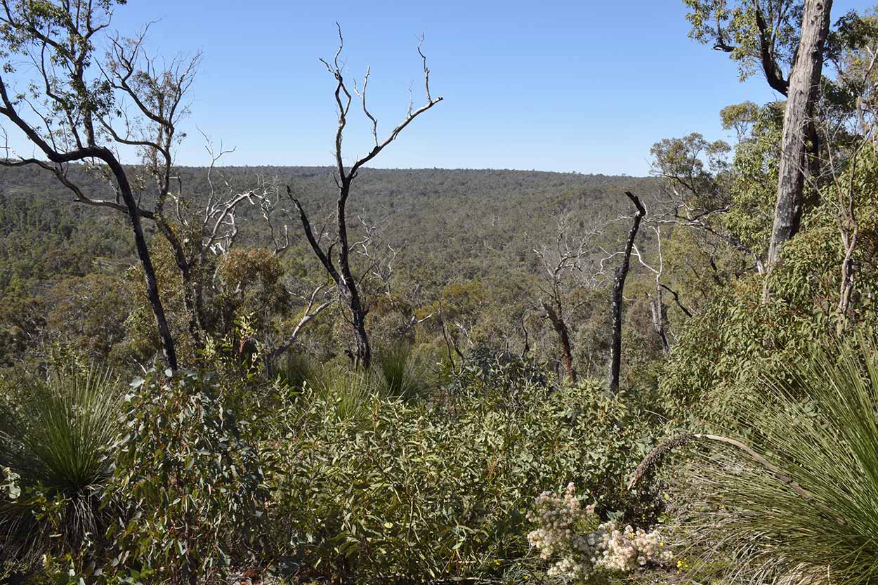
Along with the altitude the vegetation is also changing. Much sparser and not as lush as back down at Jane Brook.
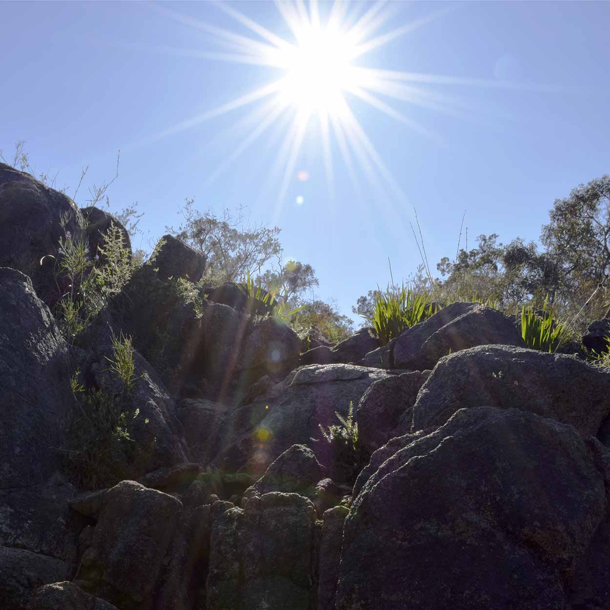
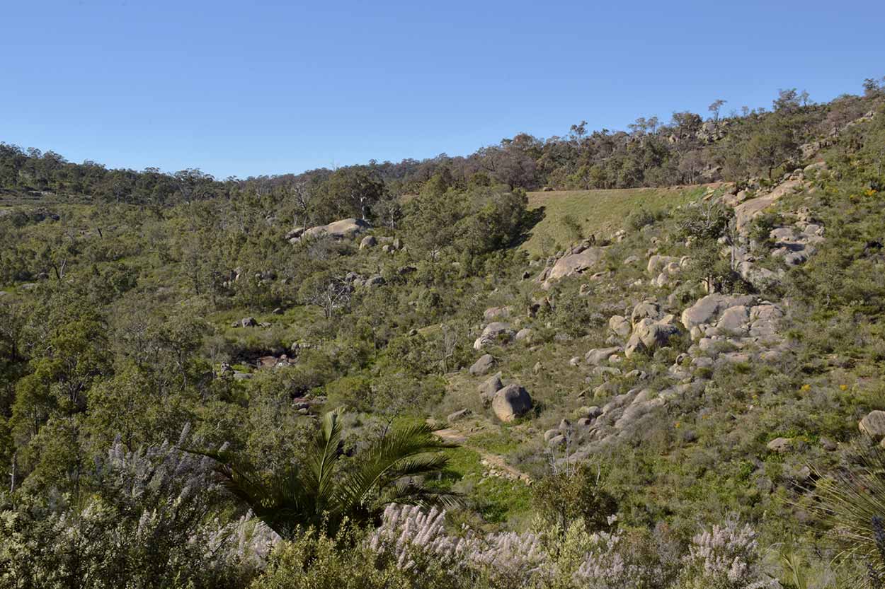
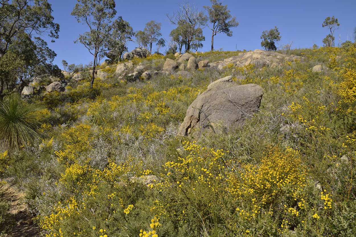
Soon enough I reach Eagle View Lookout where I am greeted with outstanding views and massive boulders.
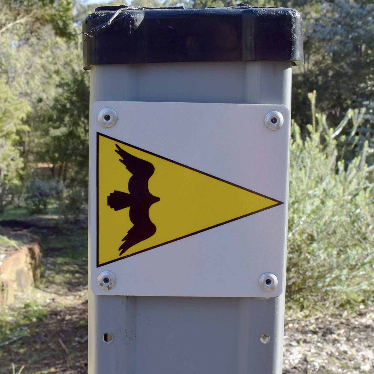
There is definitely an eagle's eye view from up here. You would think the path was entitled the �Eagle View Walk Trail� due to this view, but the brochure informs me that in fact the name is due to a massive 2m high wedge-tailed eagle's nest that stood high in the trees during the construction of the trail from 1993 to 1998. Unfortunately the nest was destroyed by bushfire in 1997.
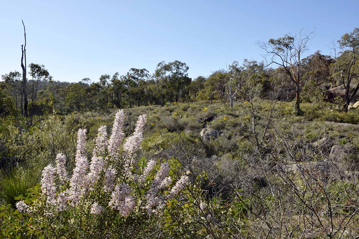
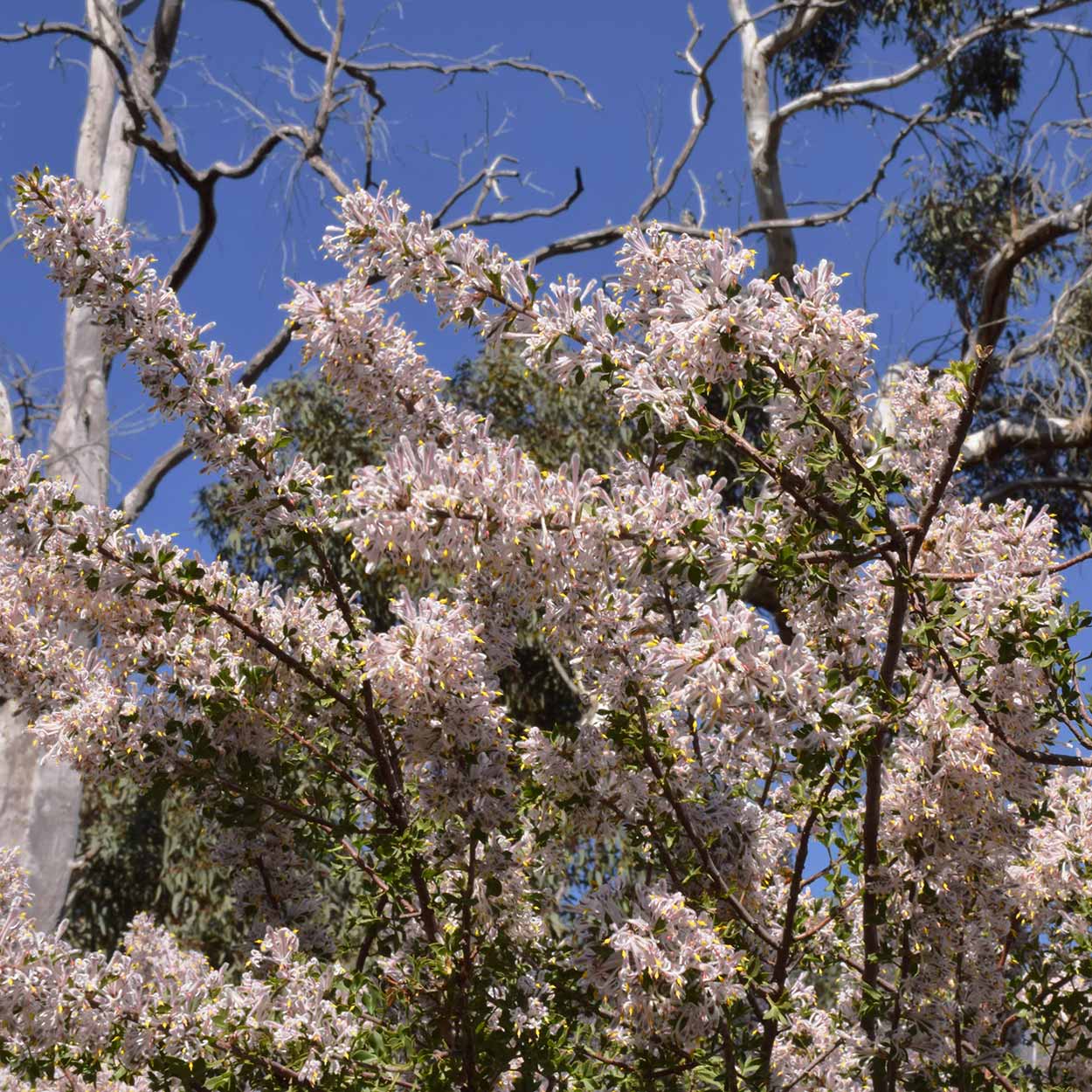
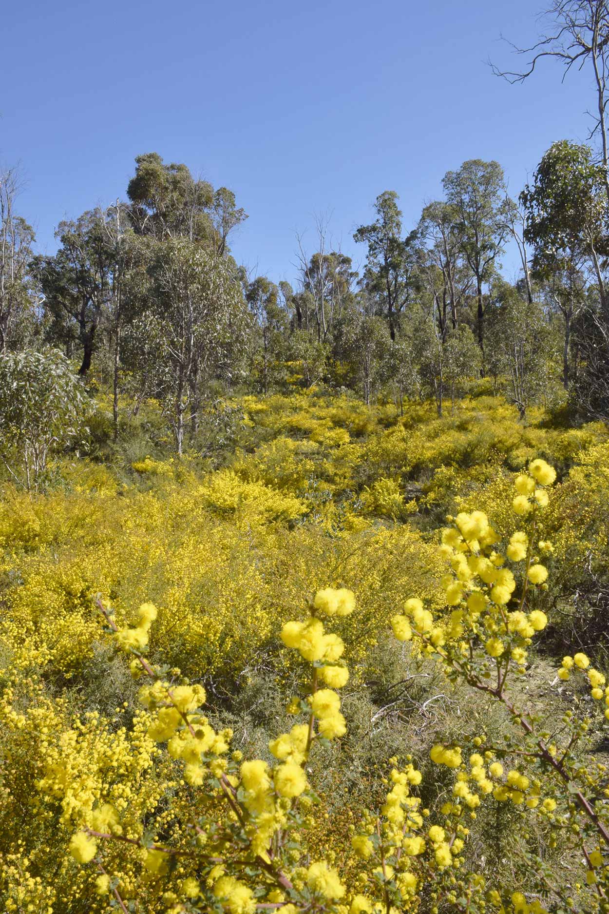
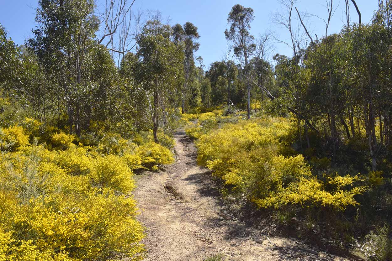
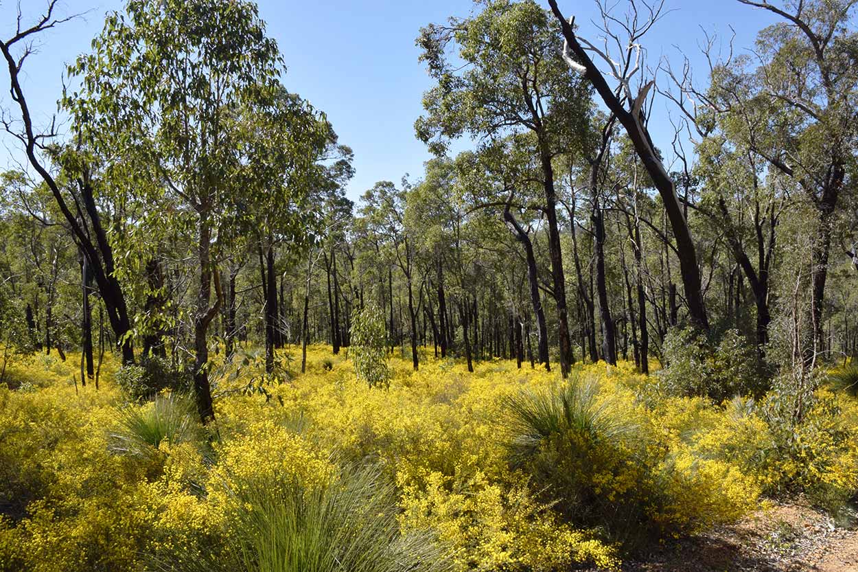
After a rest and a good look at the views it is time to continue along the trail north towards Christmas Tree Creek. Along the way I am treated to an amazing display of wildflowers. Particularly golden fields of blooming wattle.
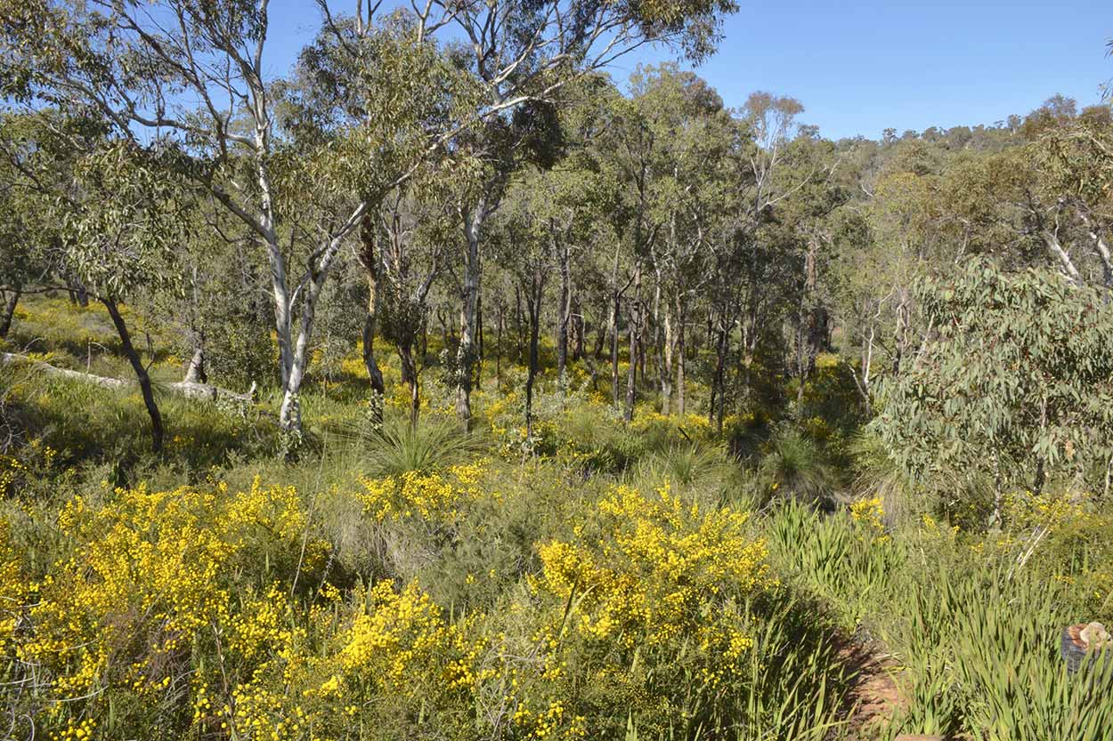
With all these flowers there are also plenty of bees. The hum they produce seems to be everywhere I walk. The path heads north until reaching Christmas Tree Creek, at this point the path follows the creek east and then north again. Unlike the walk along Jane Brook, at Christmas Tree Creek you rarely get that close to the water, but instead you are surrounded by an amazing wildflower display.
With all these flowers there are also plenty of bees. The hum they produce seems to be everywhere I walk. The path heads north until reaching Christmas Tree Creek, at this point the path follows the creek east and then north again. Unlike the walk along Jane Brook, at Christmas Tree Creek you rarely get that close to the water, but instead you are surrounded by an amazing wildflower display.
I'm not sure why it is called Christmas Tree Creek. Anyone? I didn't see a single Christmas tree the whole time. Would have been weird to see one as generally Christmas trees are plastic fakes in Australia. My guess is that the "Christmas Tree" is the common name for a native tree that blooms during late December, much like how Christmas Beatles are prevalent during the Christmas period. Not sure if I would like to venture out here during a Perth Christmas summer though, it would be much too hot.
One thing I did come across in the Christmas Tree Creek section was a couple of other walkers heading in the opposite direction. From the start of the trail all the way to this point I didn't cross paths with a single other person. There is a younger couple behind me and I did see from afar a few bicyclists and walkers on the Railway Reserves Historic Trail, but apart from that I have been left to myself. I find the desolation a surprise as this is such a beautiful area and it is such a perfect winter's day. I'm not complaining though, the fewer people the better.
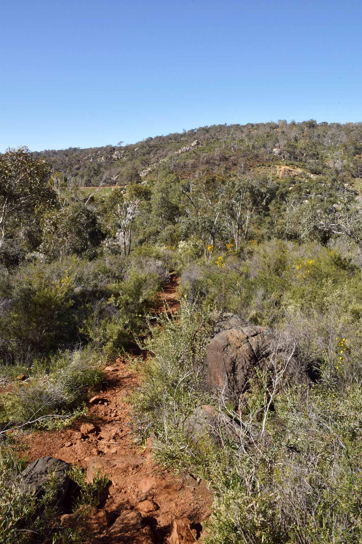
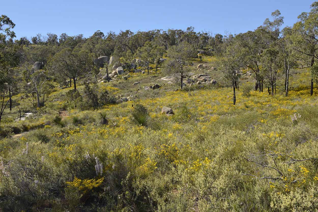
As I head north along the Eagle View Walk Trail the path deviates away from Christmas Tree Creek and heads uphill onto a ridgeline. Clear views across the valley to the east are rare due to the thick vegetation, but you occasionally catch a glimpse.
But who cares about valley views to the east when to the west you can see wildflower spectacles such as these.
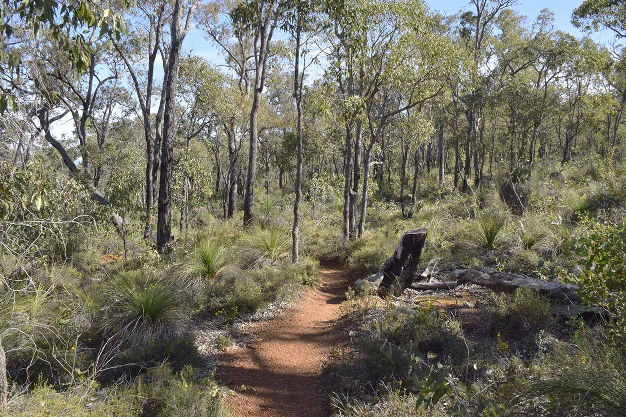
The wildflower display diminishes the further north I walk and the vegetation becomes much more dry, brown and dark green. This is especially true along the service road, the northern most section of the Eagle View Walk Trail, which heads east.
Along the service road I pass by a middle aged woman staring into the bushland. What is she doing? As I approach she asks "Is this the Eagle View Walk Trail?" I confirm her location. Her and her daughter became confused by a series of bunting tied to trees along the trail and sometimes into the bush on less worn tracks. The mother stayed on the well-worn trail while the daughter was sent into the bush to investigate where the bunting lead. My suggestion to managing the Eagle View Walk Trail, just stick to the well-worn path and you will be fine. Any changes in direction are well marked by the black and yellow eagle icons. Don't get confused by colourful bunting. Who knows where you will end up?
Soon enough I am off the service road and back on a dedicated walking track south and downhill. I am now more than halfway around the Eagle View Walk Trail loop. The wildflower display is back. Sorry to do this to you, but here is some more golden wattle.
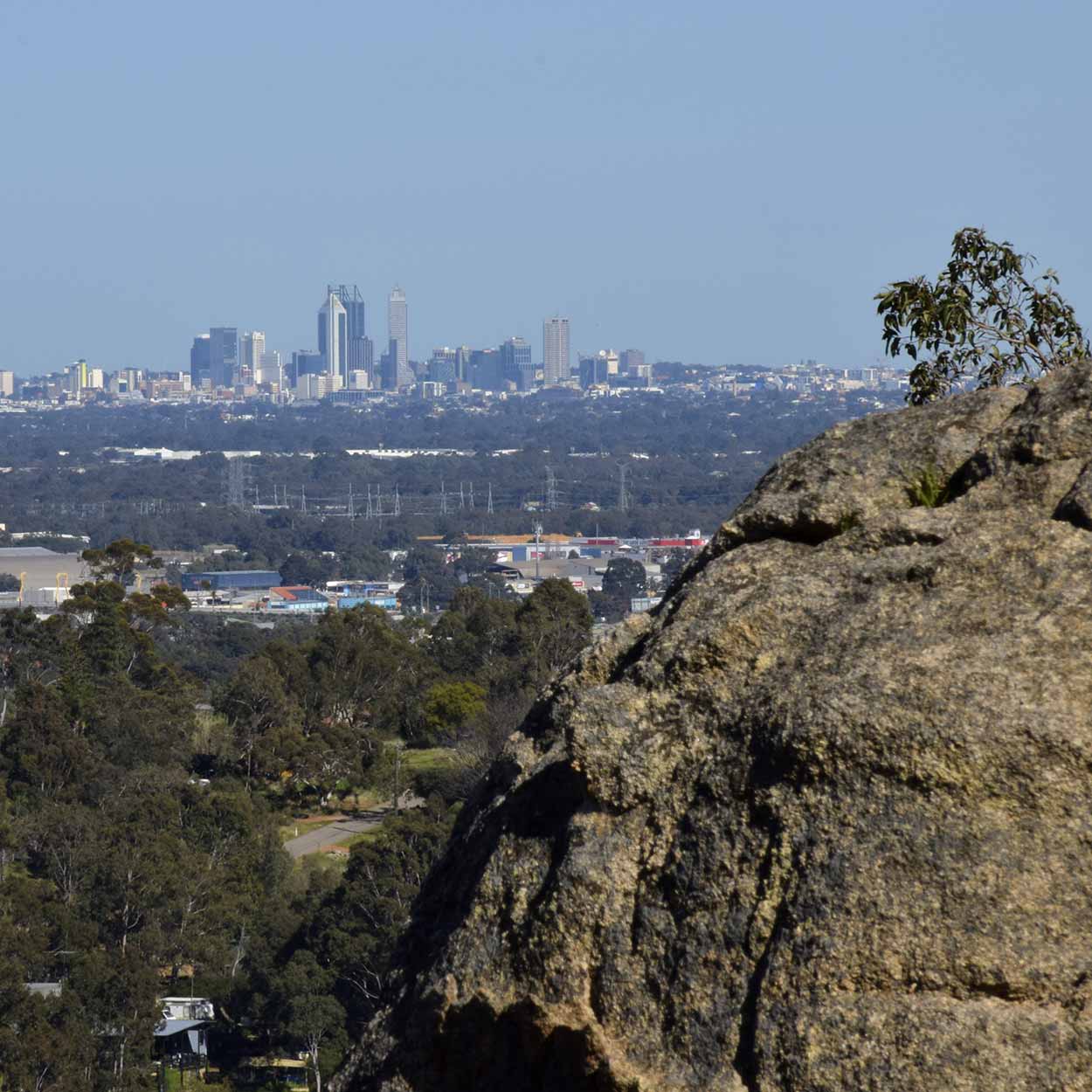
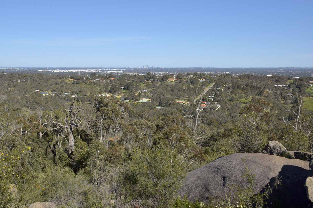
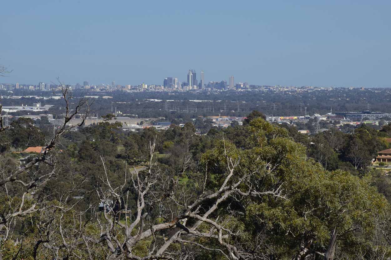
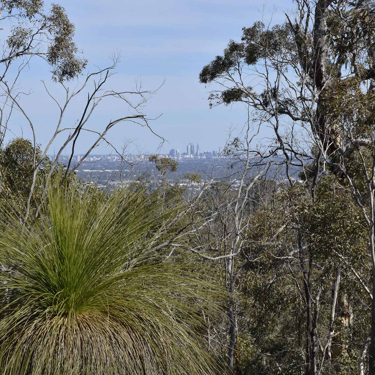
After crossing Christmas Tree Creek and saying hello to a troop of Scouts the path leads uphill onto another ridgeline. The wildflower display is not as prevalent, just the everyday sort of bushland you expect around Perth. However, there are some great views to the west overlooking the Perth metropolitan area.
I continue south towards my final destination of Hovea Falls. The walk is starting to become a little monotonous. Just your general sort of bushwalk. Nothing wrong with the scenery really, I am just starting to get a little tired. I am sure Hovea Falls will lift my spirits.
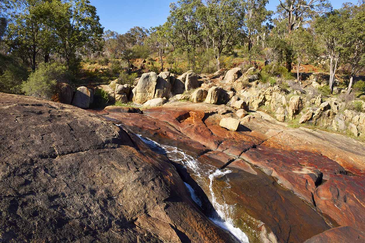
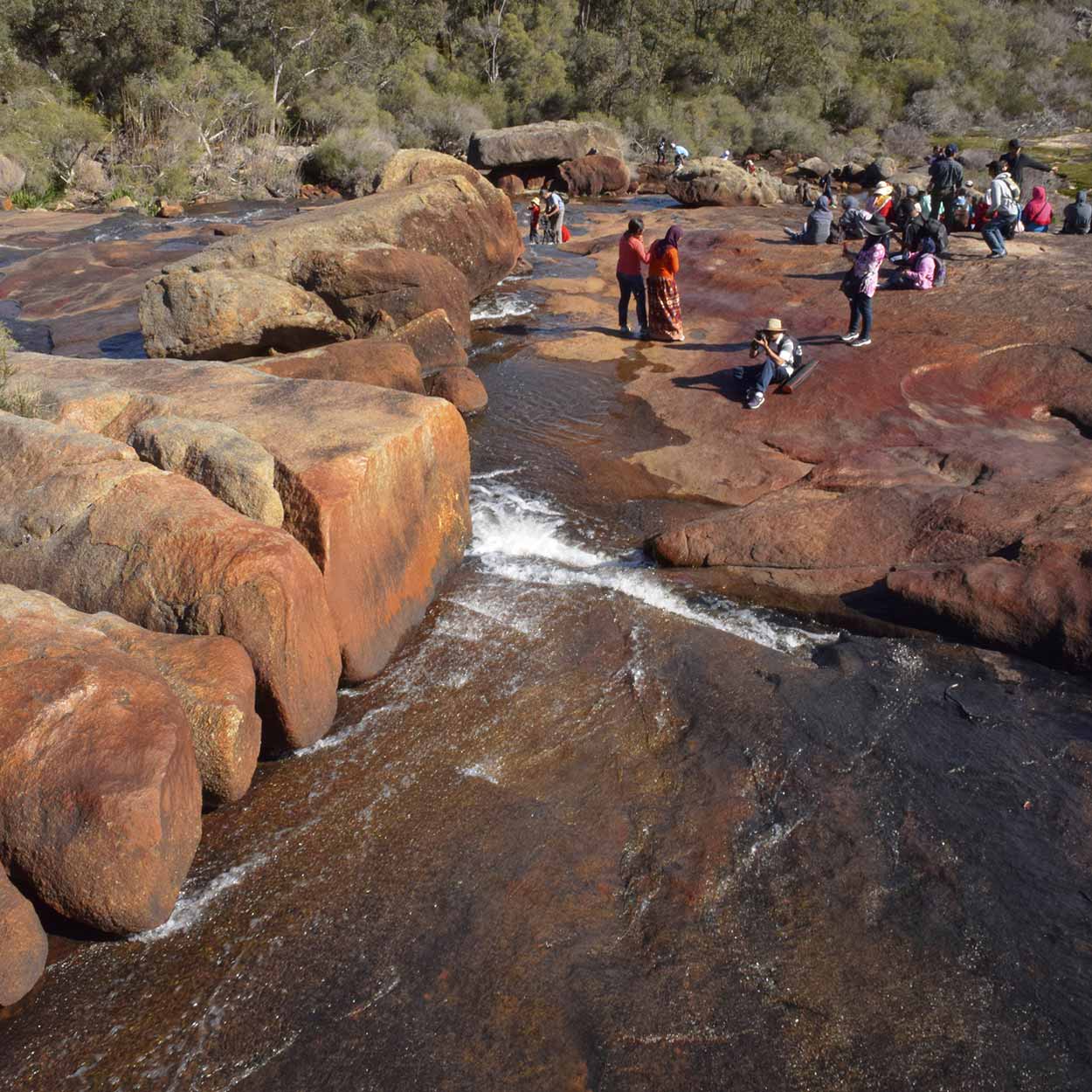
As I approach Hovea Falls I can hear voices (not in my head, I'm not delusional yet). I meander off the main path and climb onto a set of rocks. Thar she blows! That's Hovea Falls in the distance.
I quickly get back on the path and head towards the falls. I spot a sign with a waterfall picture on it pointing into the bushland. It isn't a well-worn path but is probably the quickest route to Hovea Falls. Do I dare not fully complete the Eagle View Walk Trail? I have walked all this way and have almost completed it, there is only a few hundred meters to go. Have I not completed the trail if I miss a few hundred meters? I'm not that OCD am I? Stuff it, I'm heading bush. I emerge to find myself at the bottom of Hovea Falls.
Like National Park Falls there isn't that much water, but there is some. Time to have some fun with my camera.
Hovea Falls are a popular attraction. I spent all day by myself but now there are plenty of people.
When I think of waterfalls I generally also think of danger. I was very careful with my footing and didn't take very big risks to get these photographs. Others were not that scared. For example, parents seemed happy to let their children kick a football around the falls. I really don't think it is the most appropriate spot for a game. Maybe they are playing "extreme football".
Avoiding projectile balls and tourists prancing around the falls I continue taking photographs.
Ahhhhh! Splash! Ahhhh! I look behind me. Someone has slipped and fallen into the falls. I turn around to help but she manages to pull herself out of the water. She is completely soaked, but I think the only major injury is embarrassment. I'm not sure why people aren't being more careful. It's a waterfall people! Water isn't the only thing that can fall around here.
Ok, that is enough for today. Time to head home. My legs are tired and I still have to walk back to the Great Eastern Highway to catch the bus. It is times like this that I wish I had a car. Bus services to this area are not that frequent, so you really need to time your walk well. If I didn't catch the next bus, I would have to wait another 1.5 hours.
All up the walk ended up taking me 5.5 hours, 1 hour longer than I though. I swallow my pride and sign out at the Ranger office, admitting it took me longer than expected. It could have been significantly shorter if the walk wasn't so photogenic. By the end of the walk I had taken over 200 photographs! No wonder it took me so long to walk 15kms. There are a few tricky climbs over rocks at Jane Brook, but apart from that the walk is not that arduous.
I definitely recommend the Eagle View Walk Trail. It is one of the best bushwalks I have taken on in Perth. Probably best visited in winter or spring, especially if there has been plenty of water. I have a feeling it would be unbearable during the summer heat.
As a final note, on the bus ride back home I realised I didn't really see that much animal life. Sure there were a few birds flying about (heaps of crows, a few parrots and finches), plenty of birdsong, but nothing really rustling in the bushes. When I usually go for a bushwalk I am often startled by something moving the undergrowth. But not on this walk. Not sure why? Anyway, take a walk on the Eagle View Walk Trail. Definitely worth a visit.
Click Here To Read More ...
Click Here To Read More ...
Click Here To Read More ...
View Photographs
Hello, I'm Marc and welcome to metrotrekker.
Be it seeing the city sights, exploring parklands and gardens, urban walks or day-hikes in the city outskirts, the metrotrekker website details walking routes and hiking trails accessible by foot and public transport in metropolitan areas.
The metrotrekker website provides you with all the details required for metropolitan exploration:
- a map with geolocation and a selection of map types (street, satellite, topographical)
- navigation formats compatible with common GPS devices, desktop browser/software or mobile apps
- trail length and difficulty
- start and finish options (particularly by public transport)
- photos/videos
- attractions or points of interest along the way
- other walks and hikes nearby
- often a story or detailed description of the trail (I have personally walked every single trail on the website)
- a comments section, so feel free to write about your experiences as well
- and more improvements and resources are continually being added
So let's get outside and explore our great metropolitan areas by foot. Click Here to begin exploring with metrotrekker.
Pleasant Trails,
Marc
Links To Help You Navigate