- Start or End: End of Orange Valley Road, Kalamunda (Google Map Directions)
- Length: 9.2km (5.7mi) in about 4hr
- Grade: Easy to medium. Whistlepipe Gully Walk is flat but still a bush track, while the Lewis Road Walk is steep and rocky in sections.
- Date Walked: 3rd of September 2016
I have heard some great things about Whistlepipe Gully. Time to check it out and continue my conquest of Mundy Regional Park.
It is the first Saturday of spring and the weather is perfect. Blue skies and mild temperatures are going to make for a great bushwalking day. But where to go? Mundy Regional Park is easy to get to and there are still areas I haven't explored. I recently heard about Whistlepipe Gully via The Long Ways Better blog and after some further investigation via the Kalamunda.wa.gov.au website I found a map of the Whistlepipe Gully Walk (page no longer exists on the website though) plus details of the Lewis Road Walk. Just like the Whistlepipe Gully walk, the Lewis Road Walk is a loop, but takes in the hillsides of the gully instead of the creek banks. Both walks are a little short for me, so I decided to combine the two into one larger loop walk.
From Elizabeth Quay Bus Station, I take the 282 bus at 7:41 am and at about 8:30 am get off the bus near the corner of Cotherstone Road and Betti Road, Kalamunda. From the bus stop, it is a short walk down Betti Road and then along Orange Valley Road. The walk starts at the white gate at the end of Orange Valley Road. I decide to walk in a counter-clockwise direction, so I will start the walk on the north side of the creek.
The Whistlepipe Gully Walk starts off on an easy flat gravel road (an extension of Orange Valley Road according to Google maps) under tall trees.
Click Here To Read More ...

In the trees, I spot some noisy Black Cockatoos.

Back on the ground, the Whistlepipe Gully Walk is directed via pink trail markers.

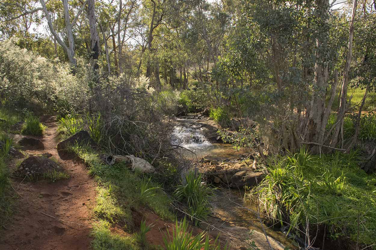
Soon enough I get my first good view of the running water.

With plenty more to come.


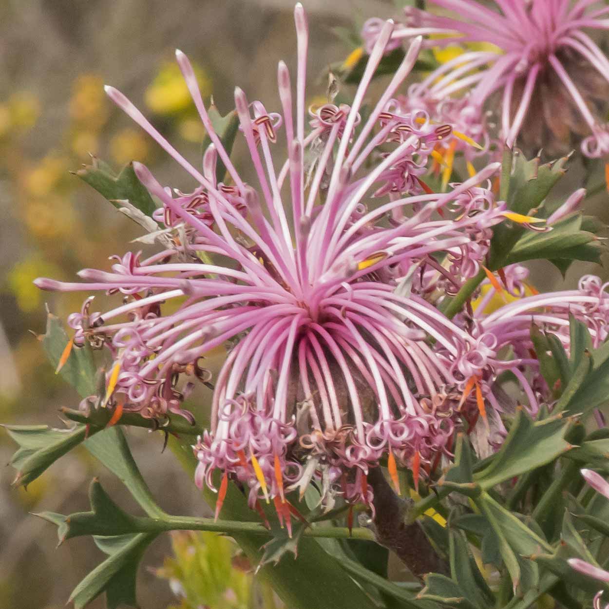
Along with plenty of wildflowers.


A very relaxing walk. My interest is stirred after the water takes a bit of a fall.


Just after this waterfall is the ruins of a house which once spanned the creek in the 1960s.


WAnowandthen.com has a really interesting story on the house and some photos of the original. Would have been such an interesting house to live in.
There aren't much of the ruins from the northern side of the stream. It is possible to cross here, but I didn't want to get my feet wet (and possibly slip and get drenched and humiliated in the process) so I continue along the official Whistlepipe Gully Walk Trail to the nearby bridge.
Just after the bridge, there are good views of a small waterfall from the southern side of the stream.

and another one shortly after.

From here the official Whistlepipe Gully Walk Trail follows a wide gravel trail which connects to Lewis Road. The trail also diverts from the stream. It doesn't look that interesting, so I head back along the southern section of the loop and return to the house ruins.

That looks like the remains of the toilet.

From the ruins, the path heads uphill, where there is a view over the ruins and the stream. What a brilliant place to have lived.

I continue heading east along the stream ...


until I reach a bridge across the stream (which I ignored when I walked along the northern side earlier). The Whistlepipe Gully Walk Trail continues along the stream, but instead, I take a right to the south and head up the gully via the Lewis Road Walk Loop. I will walk the rest of the Whistlepipe Gully Walk Trail from this point when I finish the Lewis Road Walk Loop.

The Lewis Road Walk has red trail markers.

Making my way up the gully I spot a Galah enjoying a flower bed.

Once you reach enough altitude there are good views across the Swan Coastal Plain.


But look down as well, because there are plenty of wildflowers.


After a walk along the top of the gully, the trail heads north and downhill. If you reach some very large concrete tanks you have gone downhill too far. I did, and it is easy to do as the path off the wide gravel road isn't obvious.

Do you see those rocks to the right of the path (near the bottom, right-hand corner)? That's the Lewis Road Walk Trail, so keep an eye out. The south-west section of the Lewis Road Walk loop is not that obvious compared to the rest of the way. Hard to tell where the track is sometimes. This is as clear as it gets.

Another problem is that some of the wildflowers like to call the track home.

So, most of the time I have to tip-toe about the flowers so as not to destroy them. Not sure I took the official path, but I did make it to Lewis Road unscathed. Along the way, I did see a 28 Parrot (Australian Ringneck) sitting in a tree. Seeing plenty of birds today.

From Lewis Road, the trail crosses the stream ...

then heads up-hill on a steep gravel track.

The views along the way are worth it though.

The ascent ends when I reach Ozone Terrace. Taking a right, I walk along the road for about 600m (a rather boring section) until I find a wide gravel trail to the right, which heads downhill back into Mundy Regional Park. There are good views over the gully.


At the bottom, I find the stream and the bridge to access the section of the Whistlepipe Gully Walk Trail I am yet to complete. The Lewis Road Walk is complete.

Time for some walking along the stream.


The further I walk east, the taller the trees become, and the greener the undergrowth.


Feels like I am entering a rainforest. However, the rainforest feel doesn't last long (this is Perth after all) and I am soon back at the end of Orange Valley Road. It is time to call it a day and walk back to the bus stop.
The combination of the Whistlepipe Gully Walk and the Lewis Road Walk (9.2 km) took me about 4 hours to complete. It was a good day out. The highlight would definitely be the Whistlepipe Gully Walk as it is much more scenic and relaxing (probably a good one for the kids). The Lewis Road Walk does have plenty of good views and wildflowers, but the paths are much steeper and rocker (the section along Ozone Terrace is also rather boring, but it doesn't last that long).
Now I can add another two feathers to my Mundy Regional Park hat. Goodbye and happy trails!
Click Here To Read More ...
Click Here To Read More ...
Click Here To Read More ...
View Photographs
Hello, I'm Marc and welcome to metrotrekker.
Be it seeing the city sights, exploring parklands and gardens, urban walks or day-hikes in the city outskirts, the metrotrekker website details walking routes and hiking trails accessible by foot and public transport in metropolitan areas.
The metrotrekker website provides you with all the details required for metropolitan exploration:
- a map with geolocation and a selection of map types (street, satellite, topographical)
- navigation formats compatible with common GPS devices, desktop browser/software or mobile apps
- trail length and difficulty
- start and finish options (particularly by public transport)
- photos/videos
- attractions or points of interest along the way
- other walks and hikes nearby
- often a story or detailed description of the trail (I have personally walked every single trail on the website)
- a comments section, so feel free to write about your experiences as well
- and more improvements and resources are continually being added
So let's get outside and explore our great metropolitan areas by foot. Click Here to begin exploring with metrotrekker.
Pleasant Trails,
Marc
Links To Help You Navigate