- Start or End: Start or end at either Canning Bridge Train Station (Google Map Directions) or bus stops around Beckenham or Lynwood (Google Map Directions) or Beckenham Train Station (Google Map Directions).
- Length: 20.2km (12.6mi) in about 4hr
- Grade: Medium. Paved the whole way and flat, but rather long.
- Date Walked: 15th of February 2014
From mansions with Mercedes out front to front yards full of a hoarders collection. The changing social demographic of the Canning River.
I have pretty much conquered the Swan River after completing the Three Bridges Loop and the Narrows to Heirisson Loop. Ok, I haven't walked much of the upper reaches of the Swan River but if you base "conquering" on the area of the river, not the perimeter, I am sure I have walked 95% of it. Next on the list is the Canning River, a tributary of the Swan River. I have walked the northern bank of the Canning River previously and to be honest I wasn't that impressed - too many dead ends, paths under repair, diversions into the suburbs and snakes. I hope the south bank, which I plan to walk today, is much more enjoyable.
The walk starts at the mouth of the Canning River, the Canning Bridge Train Station, and makes its way across to the southern bank of the Canning River via the Canning Bridge.
Click Here To Read More ...
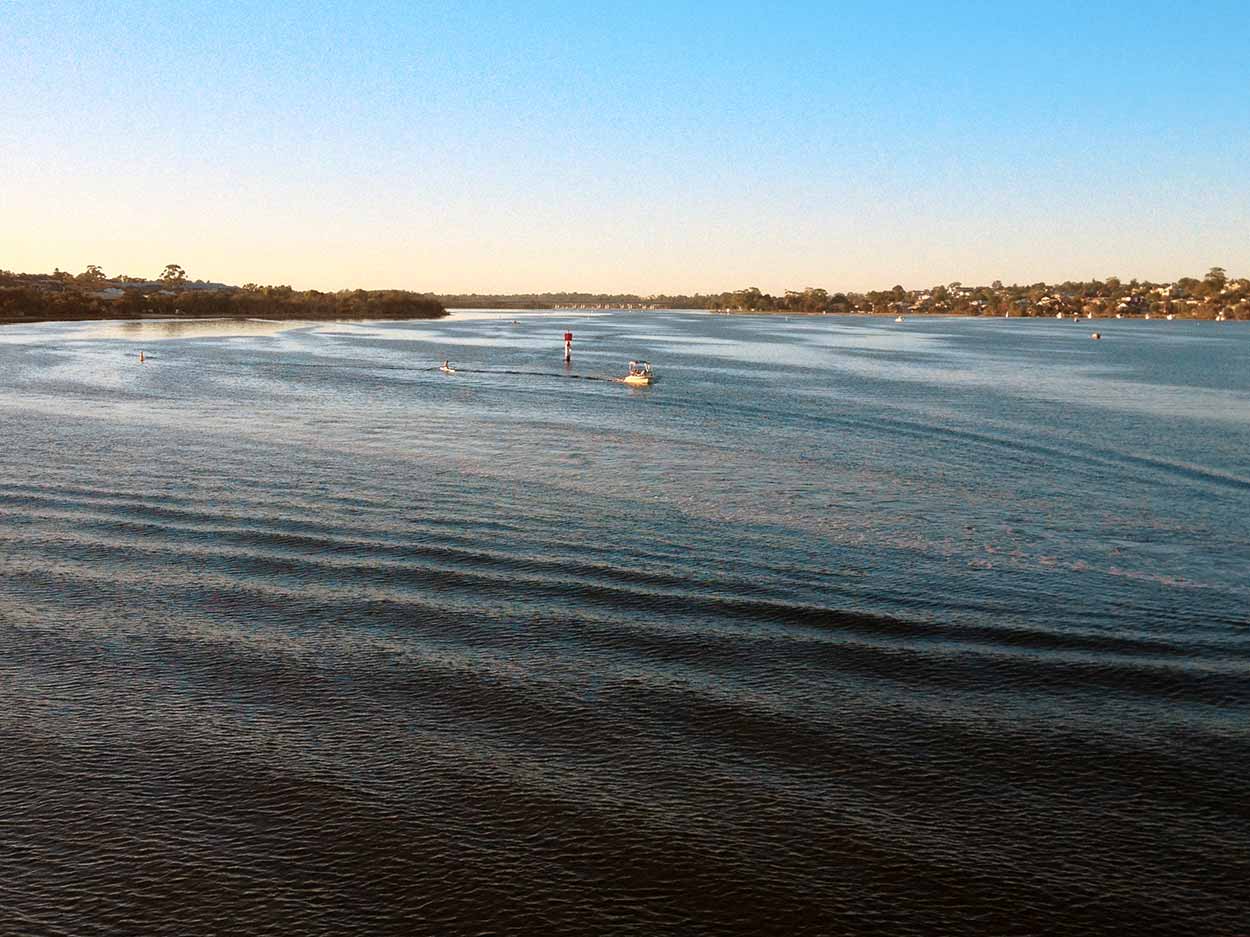
From Canning Bridge the footbath is straddled by the quiet, mansion lined Esplanade and the Canning River. The walk is already outshining the equivalent path along the northern bank of the Canning River, which is right next to the 6-lane Kwinana Freeway and Mandurah train line. Much more peaceful on this side of the river and fewer cyclists to dodge.
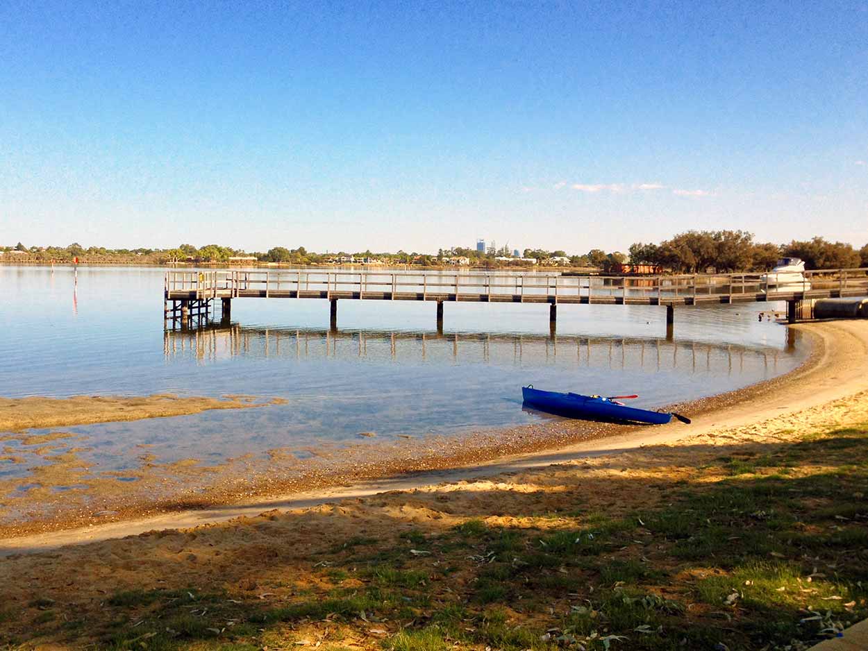
The first point of interest I strike is the Deep Water Point Jetty, which provides some spectacular views of the Canning Rivers calm blue waters and the Perth skyline in the background.
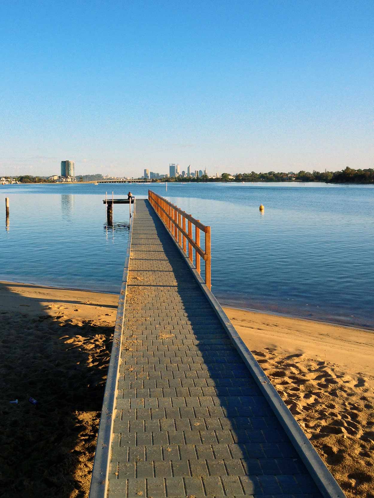
Continuing along The Esplanade I find another jetty next to the Mount Henry Bridge, which also provides some great views.

Even though it is still early morning there are quite a few people getting about. Plenty of walkers and runners on the footpath, families playing in Mount Henry Bridge Reserve, personal trainers being paid to cause pain and an amazing amount of MAMIL (middle aged men in lycra, on bicycles) pelotons causing headaches for the few people driving along The Esplanade. The popularity makes sense as the area from Canning Bridge to the Mount Henry Bridge is a really nice place and a great place to walk, run or cycle.
The path leads under the Mount Henry Bridge and along Bull Creek, a tributary to the Canning River. Saying goodbye to the Canning River I head up stream along Bull Creek towards Bateman and Yangan Parks. It is very quiet around Bull Creek with only the odd walker or runner. After Thomas Middleton Park the foreshore is no longer accessible (some rich people's houses are in the way) so I have to walk the quite streets of Orana Crescent, Spinaway Crescent and Moonlight Cove until I reach the dedicated footpath of Bateman and Yangan Parks. There isn't really anything that exciting in Bateman and Yangan Parks, just a lot of scrubby bush, a few birds flying about, rustling in the bushes from God knows what and no views of Bull Creek.

After Yangan Park the path follows the busy Leach Highway, not the most peaceful section of the walk, and into the suburbs for a while until returning to Bull Creek at the aptly named Creek View Park. Well, there are some views of Bull Creek, but they are mostly obscured by bushes lining the banks. They should call it Obscured Creek View Park.
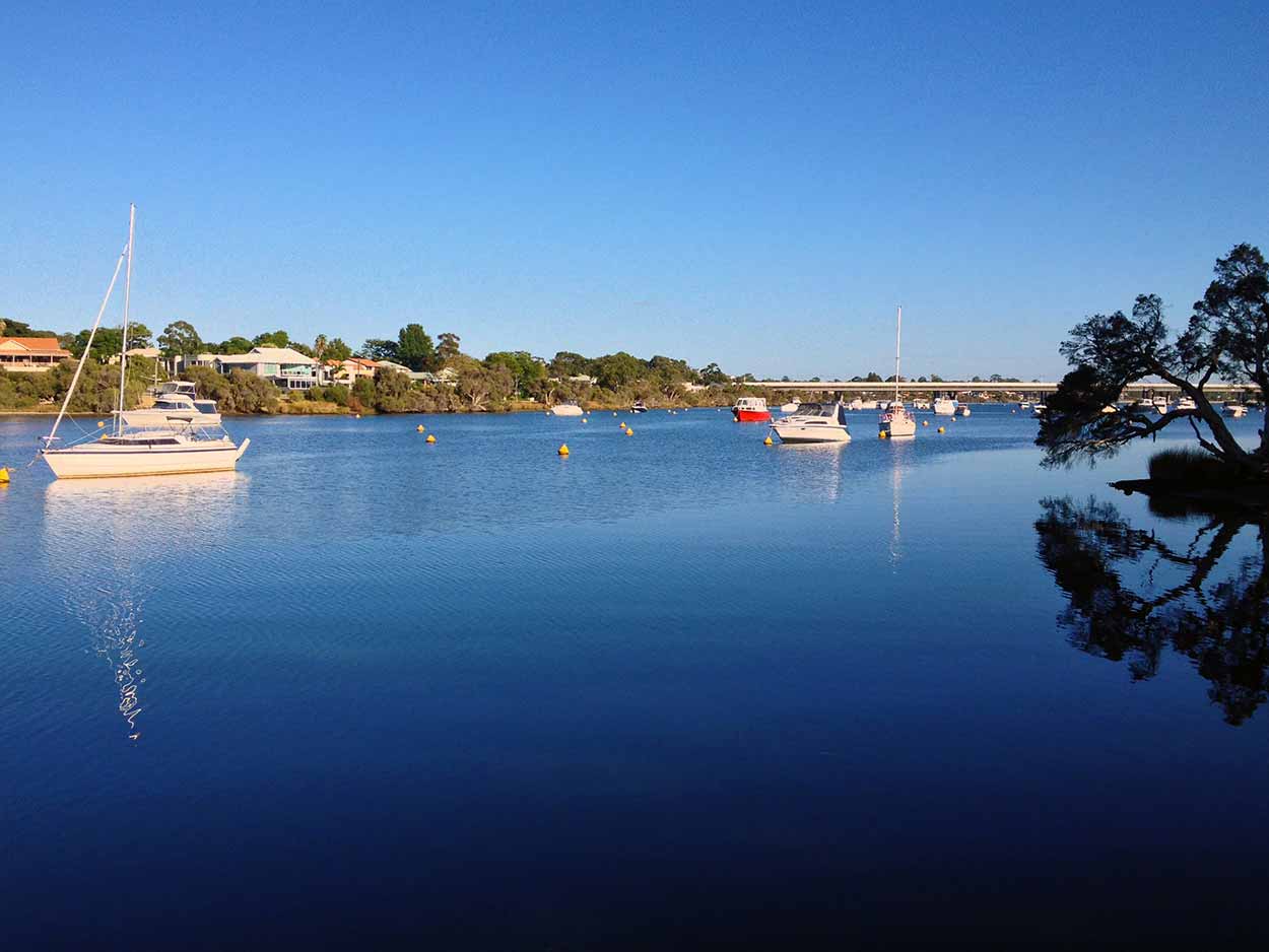
The banks of Bull Creek are heavily dotted with vegetation, however there are a few jetties and viewing areas where you can get clear views of boats moored on the calm waters of Bull Creek.
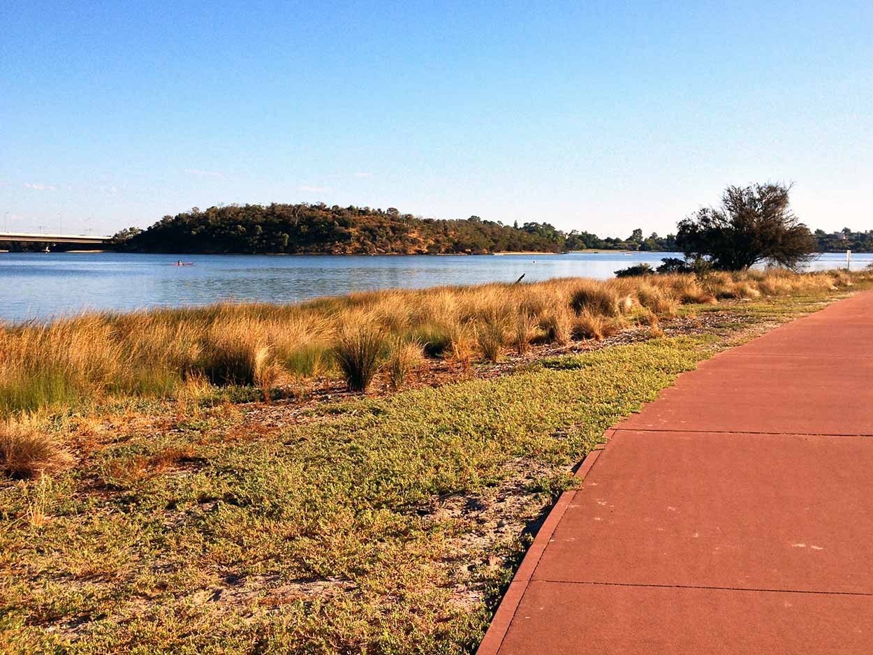
The scrub lining Bull Creek and the Canning River must not be to everyone's liking. At the junction of Bull Creek and the Canning River there are brilliant views of the Mount Henry Bridge and Salter Point. There are also views of signs reminding people that it is illegal to poison trees along the river. I guess the locals don't like their million dollar views interrupted by pesky trees. I can just imagine the local home owners coming out late at night in the cover of darkness to poison trees.
Once again I meet with the Canning River and follow the calm waters upstream along Riverton Drive until I reach Shelley Beach Park where I take a pit stop and admire the views.
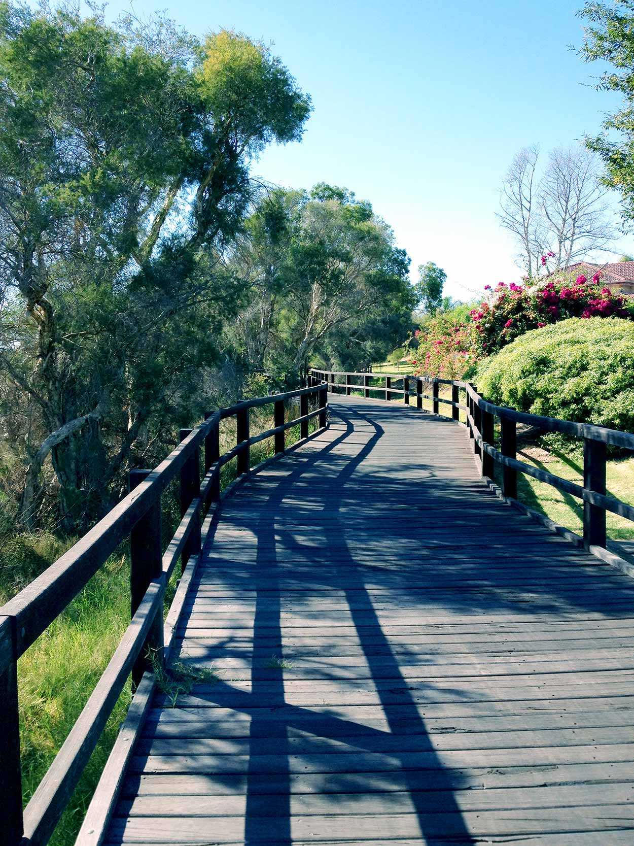
The expansive water views along Riverton Drive are brilliant but start to disappear after the Riverton Bridge, which is where the Canning River Regional Park begins. At the start of the Canning River Regional Park is a brilliant boardwalk suspended above the grasslands of the Canning River. Hope the pathways for the rest of the walk are up to this standard.
After the boardwalk the path turns into a concrete footpath between the suburbs and the thick bush of the Canning River. The pathway then opens up into a cleared grassed parkland next to Rivermoor Loop and Adenia Road where there are a number of shelters with tables and bench seats. I picked one in the shade to apply some sunscreen and fill up on nuts and dried fruit, which seemed to be popular with the local dogs set free in the park. My nuts and dried fruit were quickly saved by shouting dog owners. Spider webs and large aggressive ants were also popular within the shelter. Let's just say, I didn't hang around for long, but it was good to be out of the sun for a while.
Despite the name, you don't see much of the actual river within the Canning River Regional Park. All you basically see is a lot of bushland, that is, on the main path I took. There are a number of dead end paths and circle routes that could be taken, but trudging through the scrub wasn't appealing. The boardwalk at the start of the Canning River Regional Park got my hopes up that this would be a really interesting walk, but so far I am under impressed.
The clear dedicated path follows alongside Adenia Road until it crosses Bannister Creek and then stops at Adenia Road (i.e. Adenia Road is split in two by the Creek). At this point I didn't know what to do, follow the streets or take what appears to be a dirt path behind the houses on Bursaria Crescent? I took the path behind the houses. Bad choice. The path was like quick sand and an absolute pain to walk through. Additionally the resident dogs didn't like me at all and the starring occupants of the houses didn't seem that pleased either. I am within the Canning River Regional Park, so I am not doing anything wrong. I guess no one likes people lurking behind their back fence.
Apart from realising that I will probably only see bushland from this point on, something else was becoming apparent. There has been a noticeable social change as I walk along the Canning River. At first it was mansions and Mercedes, but now I am deep within middle class suburbia.
After finally making my way through the sand pit path I meet a dedicated concrete path alongside Ferndale Crescent. After a short walk along Ferndale Crescent a side path deviates deep into the Canning River Regional Park, the so called Banksia Hill Loop Walk and the Butterflies, Bridges and Birds Walk Trail. As the names suggests there are a number of Banksia trees around as well as plenty of birdlife, even some mechanical ones from the nearby airport. However, I didn't cross any bridges (because I stuck to the lower half of the walk loop) or catch any butterflies.
After diverting from the Butterflies, Bridges and Birds Walk Trail I head along the path following the Canning River upstream. Once again the social demographic is changing. After Bridgeway Park the path heads behind houses where I can hear parents shouting obscenities at children and doors slamming. Sure, children get into trouble and shouted at in all social demographics (maybe the words used could be different) but what I find at the end of Eastfield Court really sets the scene. As I make my way from behind the houses to the cul-de-sac of Eastfield Court I turn my head to the right to find a garbage tip in the middle of suburbia. We have ourselves a hoarder. I quickly turn my head back when I realise there is a rough looking guy amongst it. If you want to see it for yourself Google "18 Eastfield Court Ferndale". The photograph of the house you see on Google Street View is nothing compared to what I came across. From the satellite view on Google Maps you can see that the garbage tip even extends to the backyard.
Think it is time to Google Map App my way out of here. To the Nicholson Road bus stop post-haste! The path heads directly to Nicholson Road and within minutes I am at the "safety" of a main road. If I was more adventurous I could continue along the southern bank of the Canning River by heading to Hester Place Reserve on the other side of Nicholson Road. However, I notice a cleaned out wallet on the side of the path and the sound of sirens. Definitely going home now.
Click Here To Read More ...
Click Here To Read More ...
Click Here To Read More ...
View Photographs
Hello, I'm Marc and welcome to metrotrekker.
Be it seeing the city sights, exploring parklands and gardens, urban walks or day-hikes in the city outskirts, the metrotrekker website details walking routes and hiking trails accessible by foot and public transport in metropolitan areas.
The metrotrekker website provides you with all the details required for metropolitan exploration:
- a map with geolocation and a selection of map types (street, satellite, topographical)
- navigation formats compatible with common GPS devices, desktop browser/software or mobile apps
- trail length and difficulty
- start and finish options (particularly by public transport)
- photos/videos
- attractions or points of interest along the way
- other walks and hikes nearby
- often a story or detailed description of the trail (I have personally walked every single trail on the website)
- a comments section, so feel free to write about your experiences as well
- and more improvements and resources are continually being added
So let's get outside and explore our great metropolitan areas by foot. Click Here to begin exploring with metrotrekker.
Pleasant Trails,
Marc
Links To Help You Navigate